
MyTopo
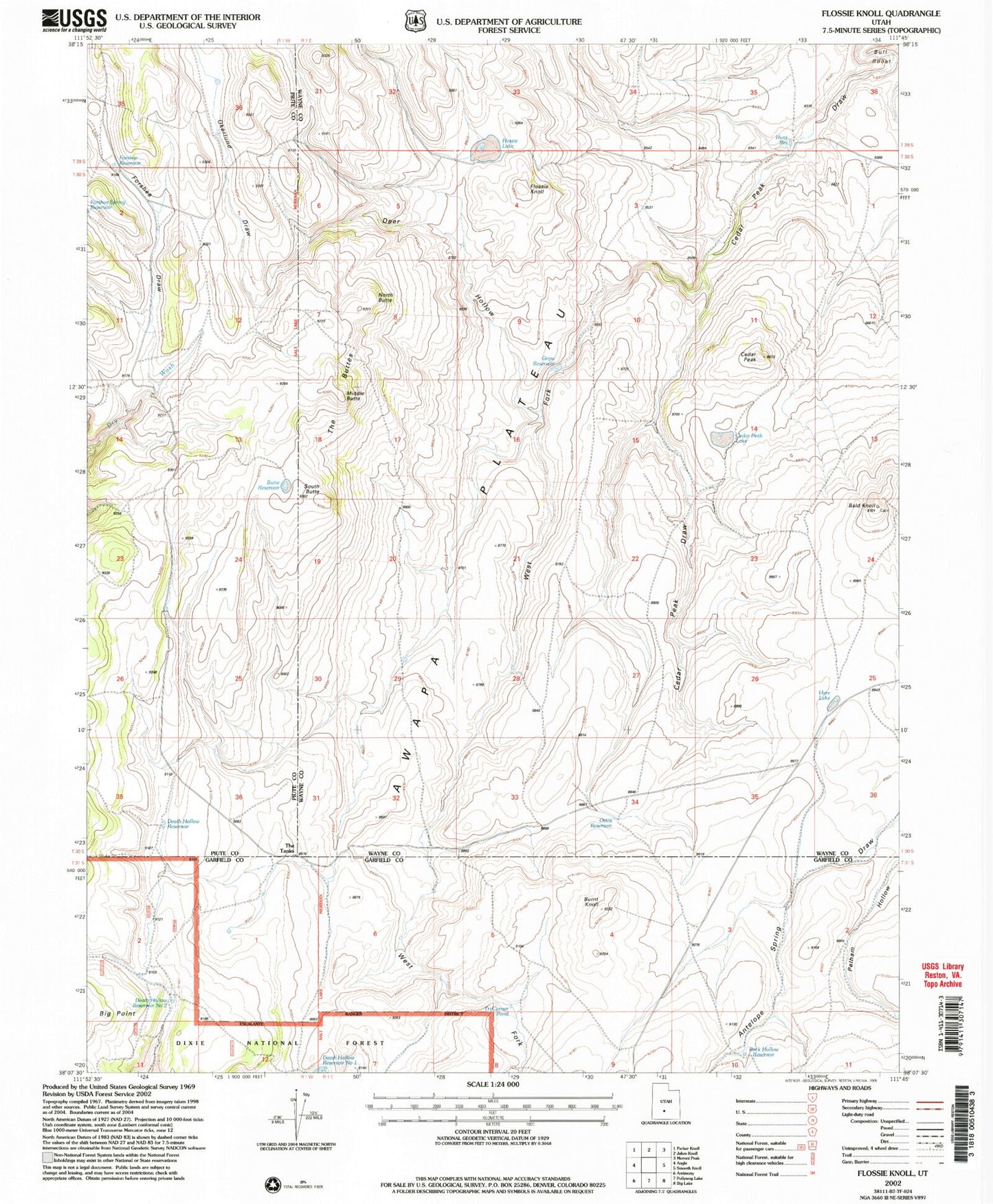
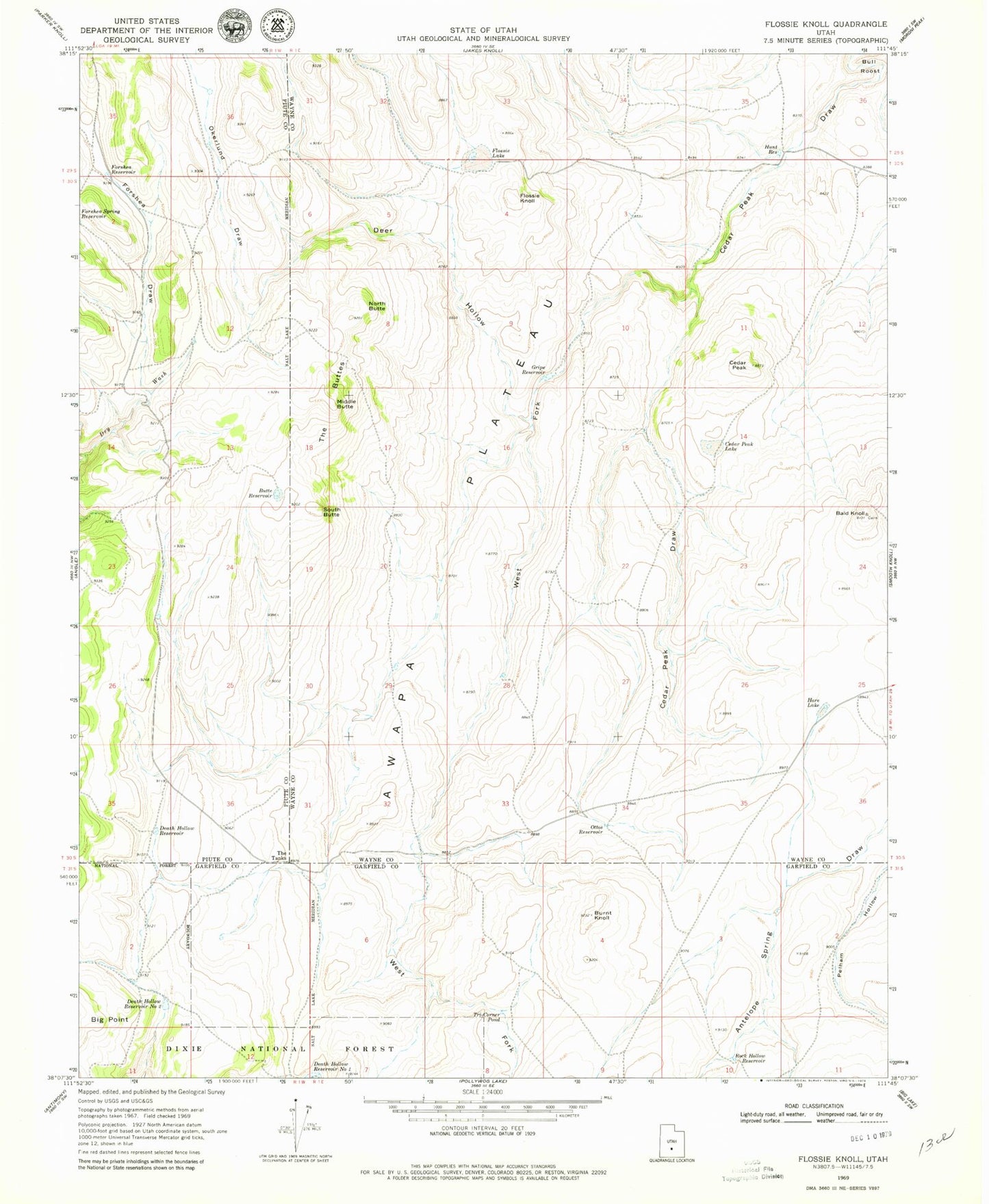
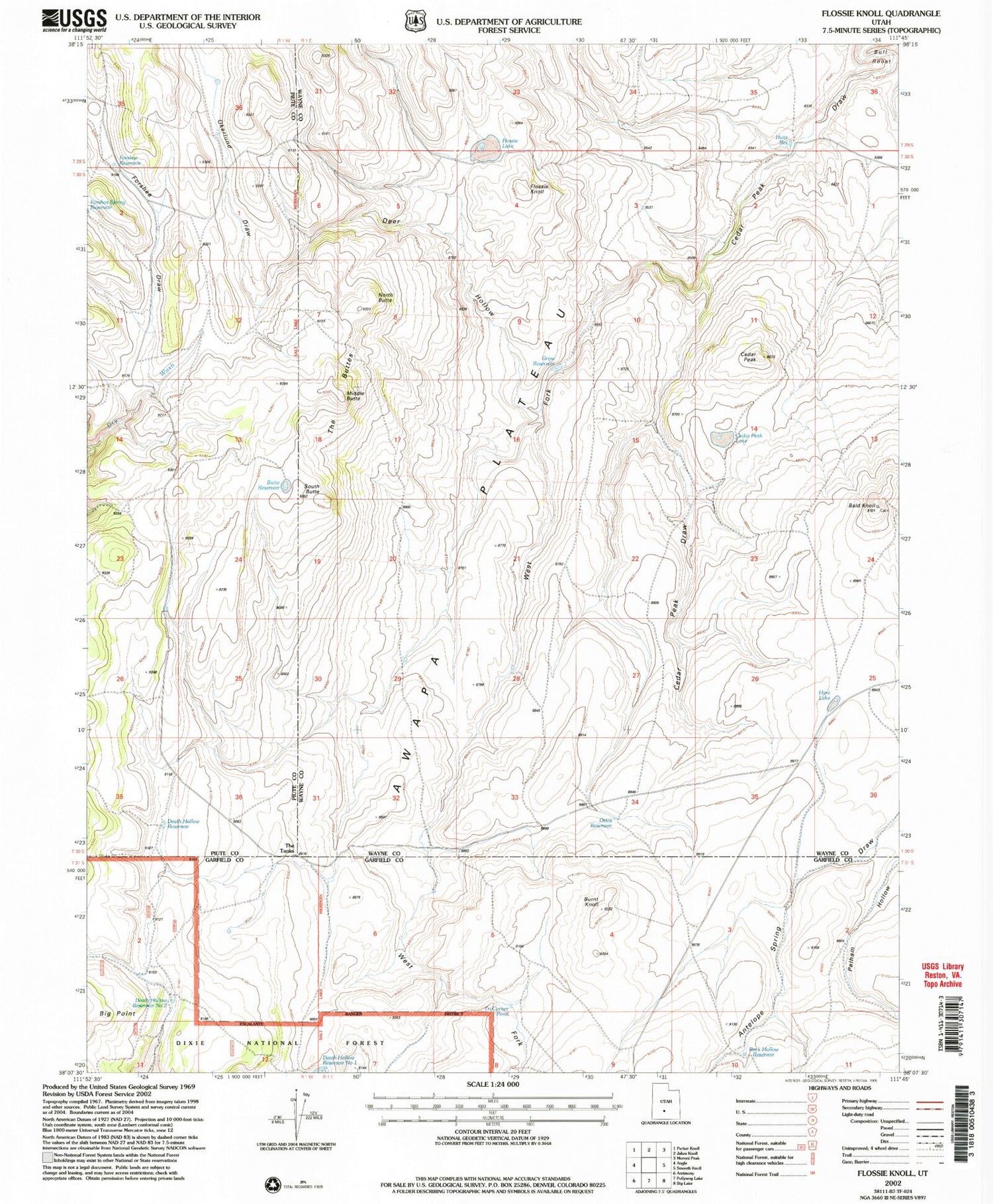
Classic USGS Flossie Knoll Utah 7.5'x7.5' Topo Map
Couldn't load pickup availability
Historical USGS topographic quad map of Flossie Knoll in the state of Utah. Map scale may vary for some years, but is generally around 1:24,000. Print size is approximately 24" x 27"
This quadrangle is in the following counties: Garfield, Piute, Wayne.
The map contains contour lines, roads, rivers, towns, and lakes. Printed on high-quality waterproof paper with UV fade-resistant inks, and shipped rolled.
Contains the following named places: Awapa Plateau, Bald Knoll, Burnt Knoll, Butte Reservoir, Cedar Peak, Cedar Peak Lake, Death Hollow Reservoir, Death Hollow Reservoir Number 1, Death Hollow Reservoir Number 2, Deer Hollow, Flossie Knoll, Flossie Lake, Forshea Draw, Forshea Reservoir, Gripe Reservoir, Hare Lake, Hunt Reservoir, Middle Butte, North Butte, Okerlund Draw, Ottos Reservoir, Rock Hollow Reservoir, South Butte, The Buttes, The Tanks, Tri-Corner Pond, West Fork Cedar Peak Draw