MyTopo
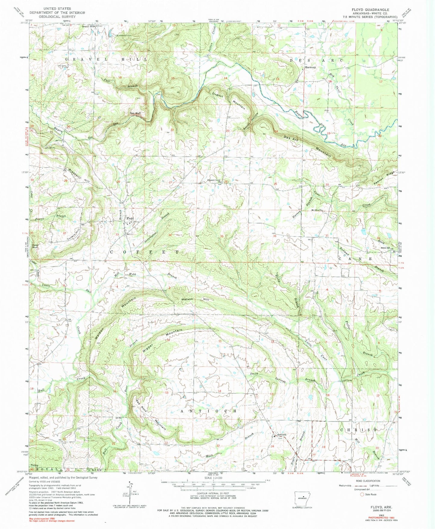
Classic USGS Floyd Arkansas 7.5'x7.5' Topo Map
Couldn't load pickup availability
Historical USGS topographic quad map of Floyd in the state of Arkansas. Map scale may vary for some years, but is generally around 1:24,000. Print size is approximately 24" x 27"
This quadrangle is in the following counties: White.
The map contains contour lines, roads, rivers, towns, and lakes. Printed on high-quality waterproof paper with UV fade-resistant inks, and shipped rolled.
Contains the following named places: Antioch, Antioch Baptist Church, Antioch Volunteer Fire Station, Bear Branch, Bradberry Hill, Brundige, Cedar Bluff, Cedar Creek, Des Arc Mountain, Dugout Mountain, Essex, Fall Branch, Floyd, Floyd Census Designated Place, Floyd Quarry, Floyd Volunteer Fire Department Station 1, Floyd Volunteer Fire Department Station 3, Fuller Branch, Gray Cemetery, Harmony, Harmony United Methodist Church, Harvey Branch, Hog Thief Creek, KPIK-FM (Beebe), Lercher Lake Number Two, Lercher Lake Number Two Dam, Little Bull Creek, Mill Branch, Mount Olive Church, Nipper Mountain, Pleasant Grove Church, Quattlebaum Cemetery, Red Bluff, Red Rock Mountain, Rocky Branch, Sappington Branch, Shiloh Church, Smith Hollow, Smith Springs Branch, Sunrise, Sutton Creek, Township of Antioch, Township of Coffey, Township of Gravel Hill, Turpin Hill, Waldon Mountain, Watson Hill, Webb Branch