
MyTopo
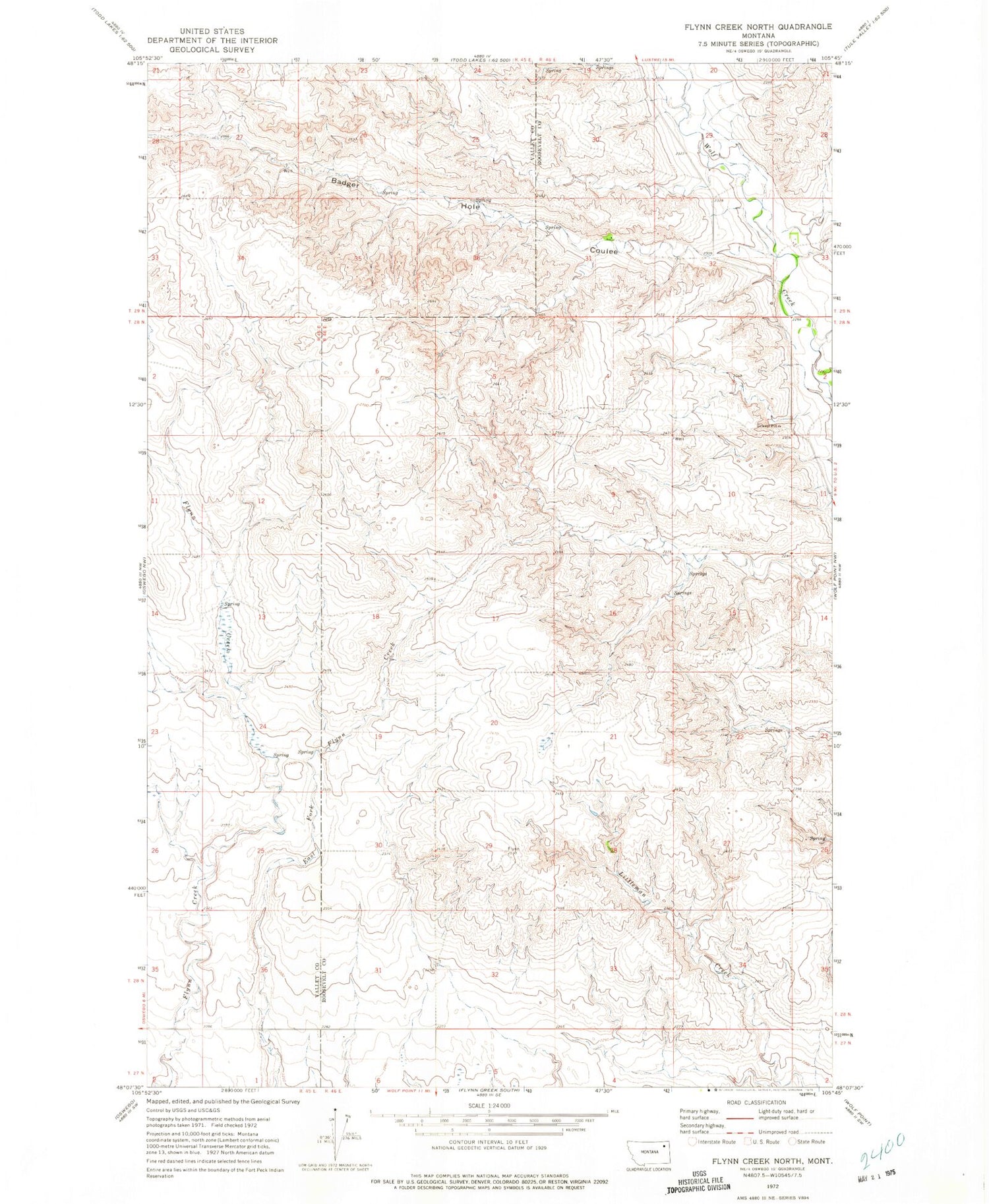
Classic USGS Flynn Creek North Montana 7.5'x7.5' Topo Map
Couldn't load pickup availability
Historical USGS topographic quad map of Flynn Creek North in the state of Montana. Map scale may vary for some years, but is generally around 1:24,000. Print size is approximately 24" x 27"
This quadrangle is in the following counties: Roosevelt, Valley.
The map contains contour lines, roads, rivers, towns, and lakes. Printed on high-quality waterproof paper with UV fade-resistant inks, and shipped rolled.
Contains the following named places: 27N46E06BB__01 Well, 28N46E02BBCB01 Well, 28N46E05CBCA01 Well, 28N46E05DDAD01 Well, 28N46E06BAAC01 Well, 28N46E09ABBC01 Well, 28N46E10BBBB01 Well, 28N46E18AADD01 Well, 28N46E32BCCC01 Well, 29N45E26DCDD01 Spring, 29N45E36BAAA01 Spring, Badger Hole Coulee, Kohl School, Marmon School, Warmbrod School


