
MyTopo
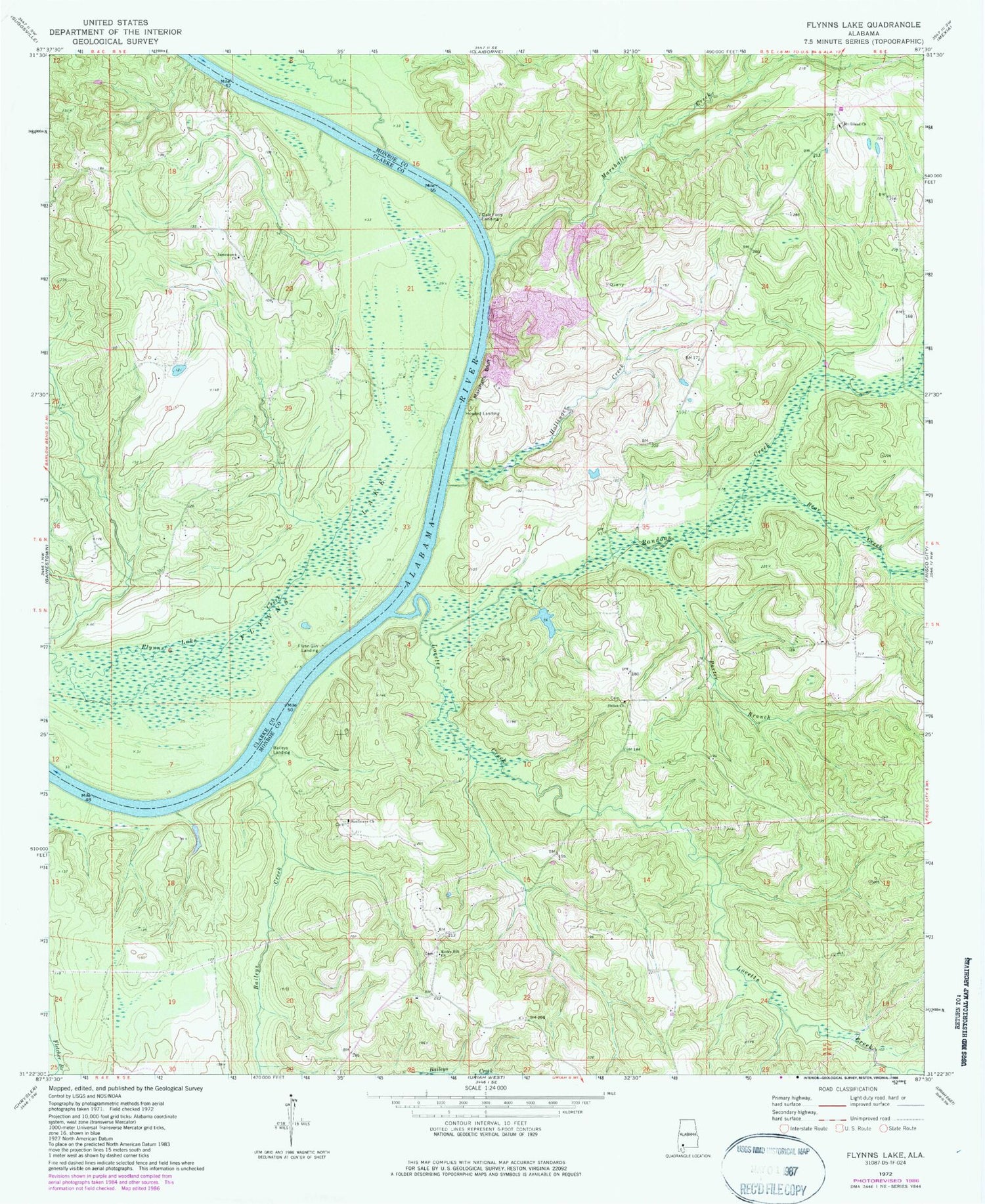
Classic USGS Flynns Lake Alabama 7.5'x7.5' Topo Map
Couldn't load pickup availability
Historical USGS topographic quad map of Flynns Lake in the state of Alabama. Map scale may vary for some years, but is generally around 1:24,000. Print size is approximately 24" x 27"
This quadrangle is in the following counties: Clarke, Monroe.
The map contains contour lines, roads, rivers, towns, and lakes. Printed on high-quality waterproof paper with UV fade-resistant inks, and shipped rolled.
Contains the following named places: Baileys Creek, Baileys Landing, Barlow Bend Oil Field, Bear Creek, Bowdens Landing, Broughton Dam, Broughton Lake, Dale Ferry Landing, English Mill, Flynn Bar, Flynn Gin Landing, Flynns Lake, Herons Landing, Hollinger Creek, Hollingers Landing, Howard Landing, James Landing, Jamestown Church, Linder Cemetery, Lovetts Creek, Lovetts Creek Oil Field, Marriotts Landing, Marshall Ferry Landing, Marshall Gin Landing, Marshalls Bluff, Marshalls Creek, Mount Gilead Church, Mount Gilead School, Olivers Ferry, Peggy Baileys Bluff Lime Works, Porter Branch, Randons Creek, Rocky Hill Church, Rocky Hill Volunteer Fire Department, Shackleford Bar, Shiloh Church, Shiloh School, Sunflower Church


