MyTopo
Classic USGS Folsomville Indiana 7.5'x7.5' Topo Map
Couldn't load pickup availability
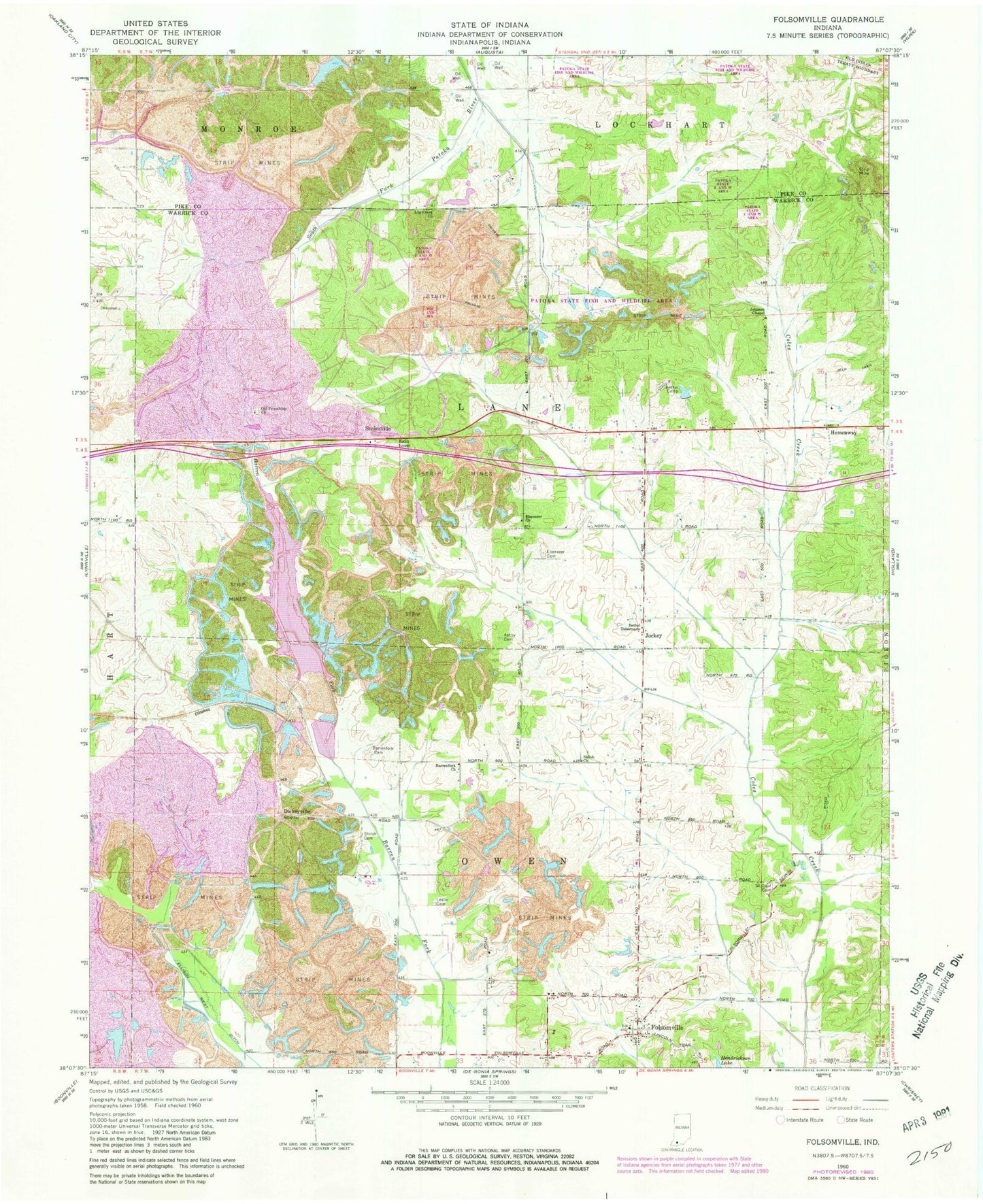
Historical USGS topographic quad map of Folsomville in the state of Indiana. Map scale may vary for some years, but is generally around 1:24,000. Print size is approximately 24" x 27"
This quadrangle is in the following counties: Pike, Warrick.
The map contains contour lines, roads, rivers, towns, and lakes. Printed on high-quality waterproof paper with UV fade-resistant inks, and shipped rolled.
Contains the following named places: Ashby - McClary Cemetery, Barrenfork Cemetery, Barrenfork Church, Bethel Camp, Bethel Tabernacle, Brushy Fork, Crowville Post Office, Dickeyville, Ebenezer Cemetery, Ebenezer Church, Ellison West Ditch, Folsomville, Folsomville Volunteer Fire Department, Hemenway, Hull Cemetery, Jockey, Johnson Chapel, Leslie Cemetery, Log Creek Church, Old Friendship Church, Scalesville, Shiloh Cemetery, Shiloh Church, Tecumseh Mine, Township of Lane, Township of Owen, ZIP Code: 47637