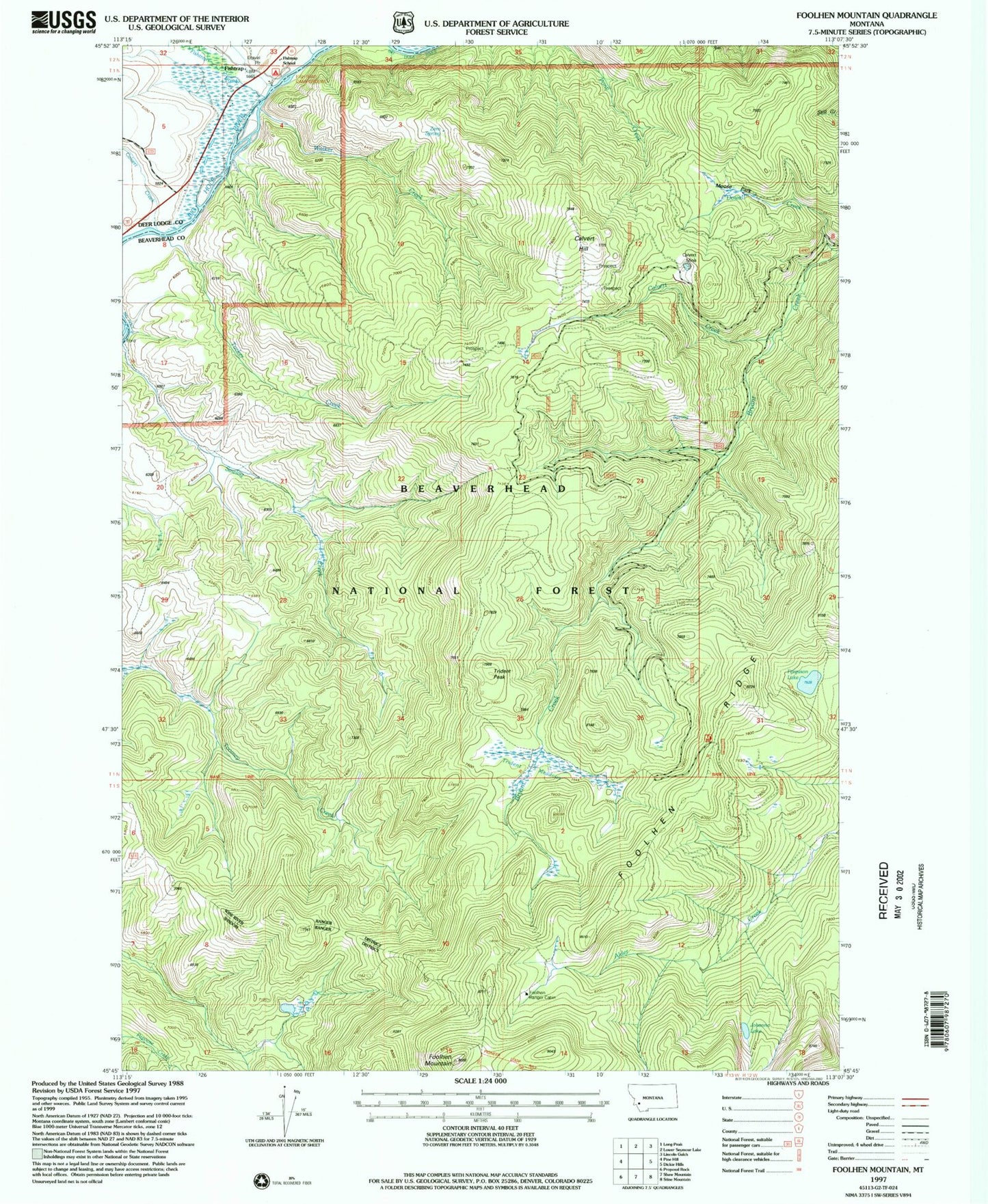
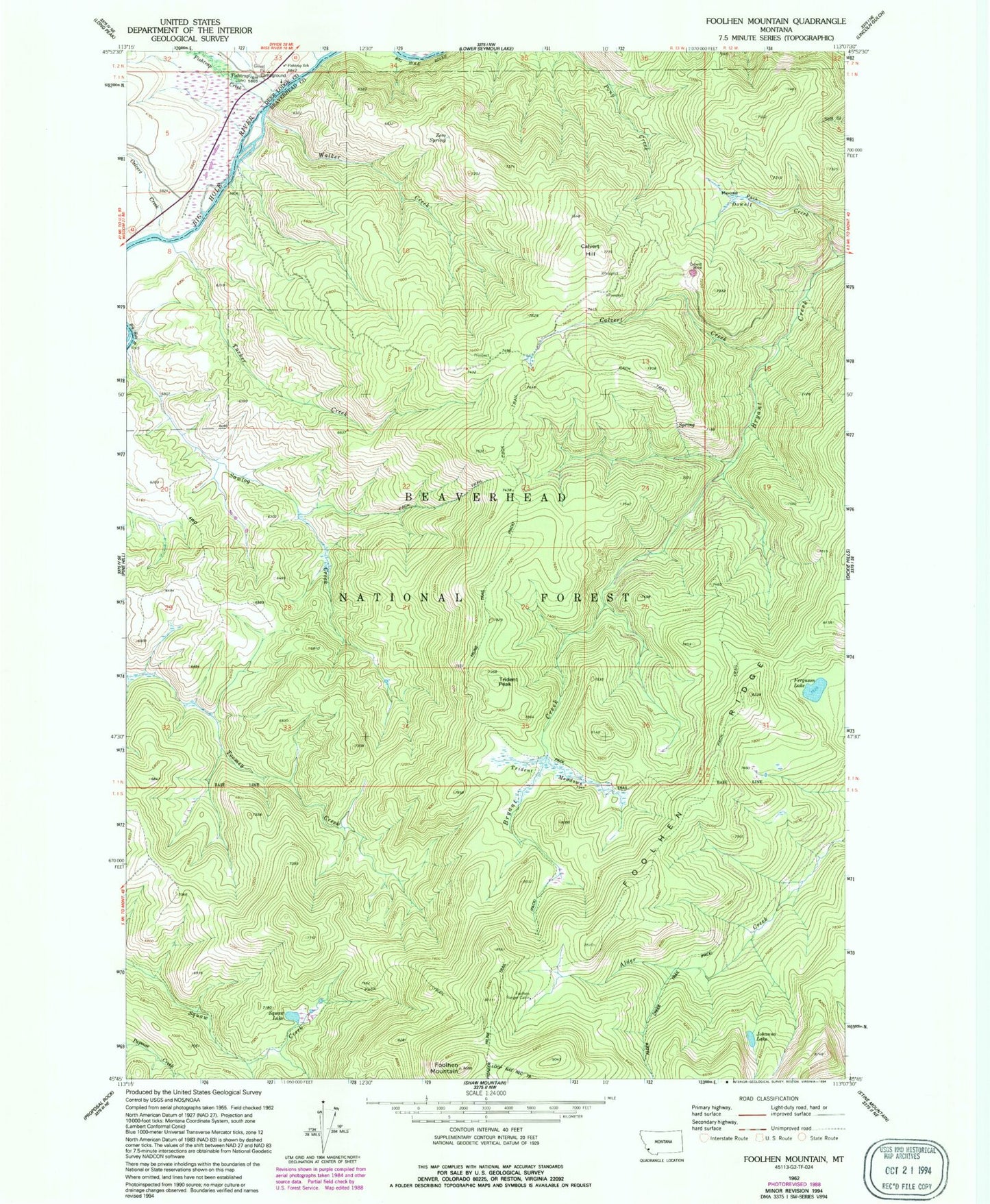
MyTopo
Classic USGS Foolhen Mountain Montana 7.5'x7.5' Topo Map
Couldn't load pickup availability
Historical USGS topographic quad map of Foolhen Mountain in the state of Montana. Typical map scale is 1:24,000, but may vary for certain years, if available. Print size: 24" x 27"
This quadrangle is in the following counties: Beaverhead, Deer Lodge.
The map contains contour lines, roads, rivers, towns, and lakes. Printed on high-quality waterproof paper with UV fade-resistant inks, and shipped rolled.
Contains the following named places: Calvert Creek, Calvert Creek, Calvert Hill, Ferguson Lake, Fishtrap, Fishtrap Creek, Fishtrap School (historical), Foolhen Mountain, Foolhen Ranger Cabin, Foolhen Ridge, Johanna Lake, La Marche Creek, Minnie Creek, Moose Park, Lovell Lake, Trident Meadows, Trident Peak, Tucker Creek, Walker Creek, Zero Spring, Fishtrap Creek Sportmans Access, Fishtrap Campground, Foolhen Forest Service Statin, Calvert Mine, 01N13W04BCBC01 Well, Fishtrap Post Office (historical)