
MyTopo
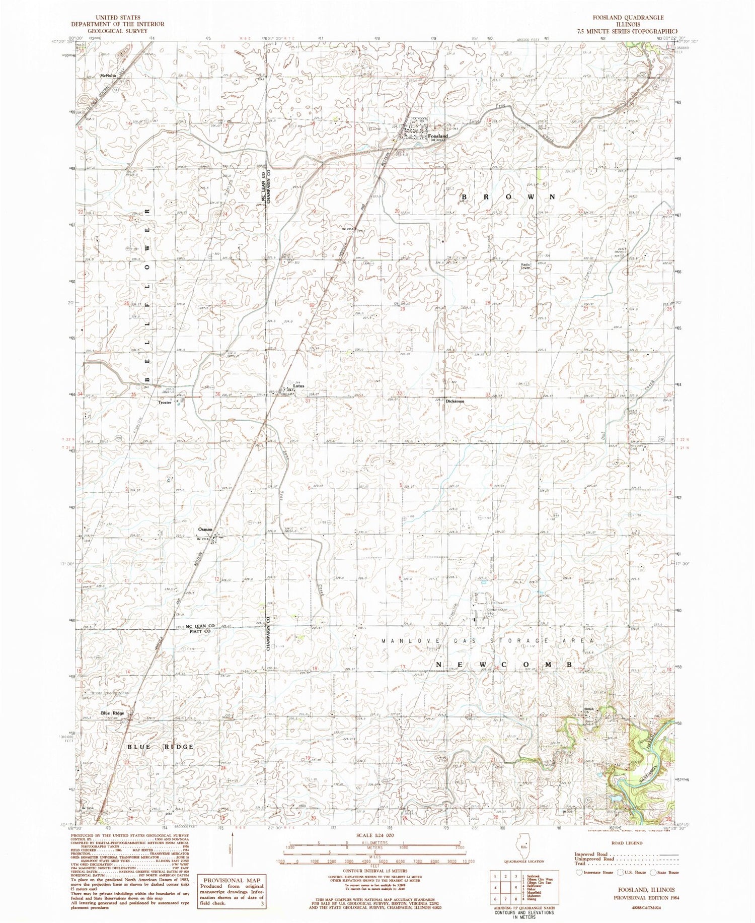
Classic USGS Foosland Illinois 7.5'x7.5' Topo Map
Couldn't load pickup availability
Historical USGS topographic quad map of Foosland in the state of Illinois. Map scale may vary for some years, but is generally around 1:24,000. Print size is approximately 24" x 27"
This quadrangle is in the following counties: Champaign, McLean, Piatt.
The map contains contour lines, roads, rivers, towns, and lakes. Printed on high-quality waterproof paper with UV fade-resistant inks, and shipped rolled.
Contains the following named places: Blue Ridge, Dickerson, Foosland, Foosland Post Office, Lotus, Marvin D Bradd Airport, McNulta, Naylor Cemetery, Osman, Osman Post Office, Sangamon Valley Fire Protection District Station 3, Shiloh Cemetery, Shiloh Center Post Office, Shiloh Church, Township of Brown, Township of Newcomb, Troster, Village of Foosland, Walker Church, ZIP Code: 61845


