MyTopo
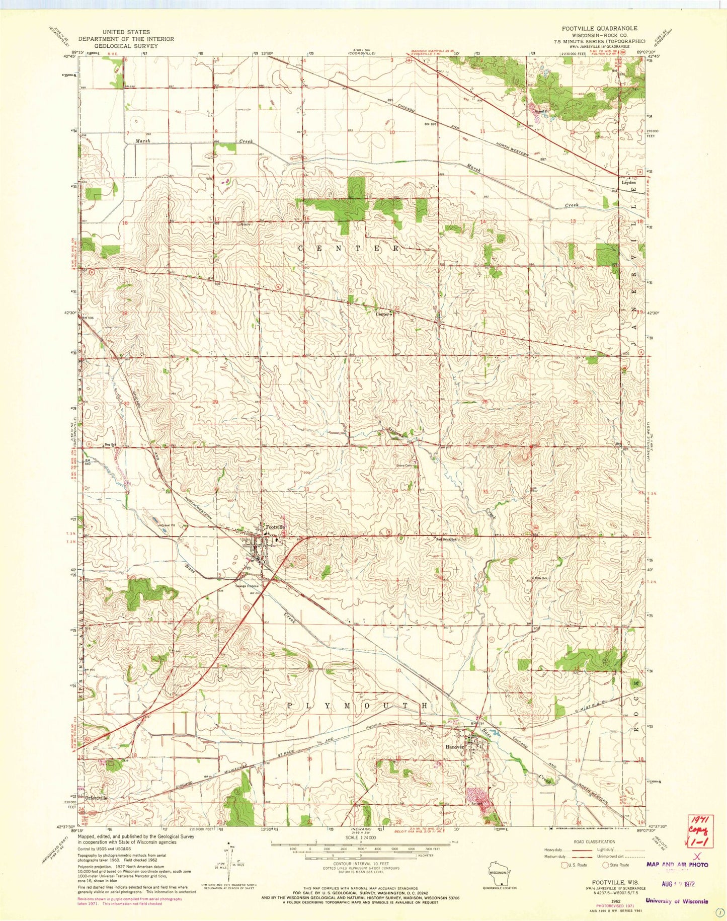
Classic USGS Footville Wisconsin 7.5'x7.5' Topo Map
Couldn't load pickup availability
Historical USGS topographic quad map of Footville in the state of Wisconsin. Map scale may vary for some years, but is generally around 1:24,000. Print size is approximately 24" x 27"
This quadrangle is in the following counties: Rock.
The map contains contour lines, roads, rivers, towns, and lakes. Printed on high-quality waterproof paper with UV fade-resistant inks, and shipped rolled.
Contains the following named places: Apple Acres Ranch, Ayen Farms, Ballmerland Farms, Bog School, Buzzy Field, Center, Ellis School, Fellows, Footville, Footville Community Fire Department and Emergency Medical Services, Footville Elementary School, Footville Post Office, Footville Wastewater Treatment Facility, Grove Cemetery, Hanover, Hanover Census Designated Place, Kessler Railroad Prairie State Natural Area, Leyden, Pineview Farm, Red Brick School, Stevens Creek, Town of Center, Town of Plymouth, Village of Footville, Wilke Way Farm, WJNW-TV (Janesville), WJVL-FM (Janesville), ZIP Codes: 53537, 53576