MyTopo
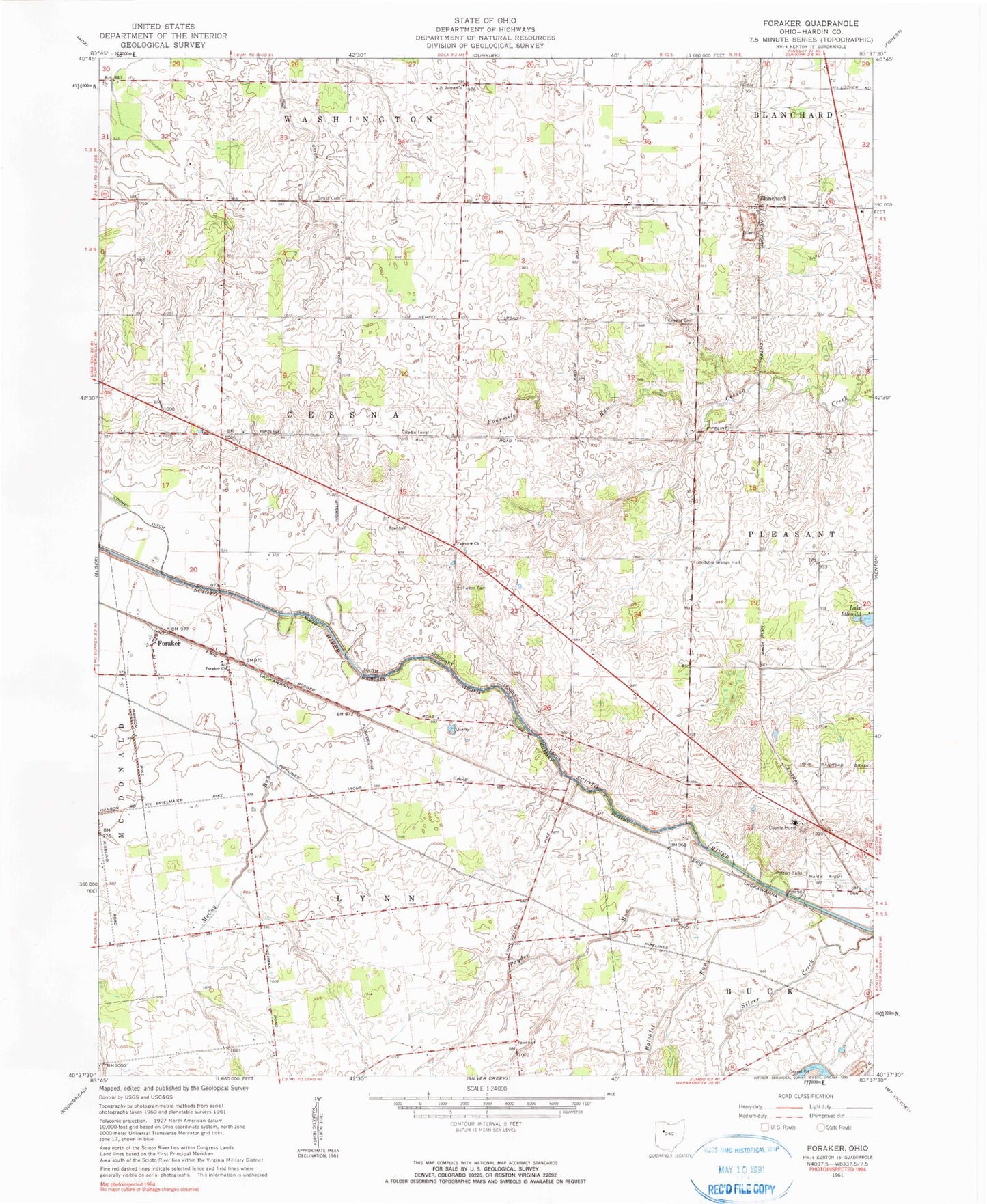
Classic USGS Foraker Ohio 7.5'x7.5' Topo Map
Couldn't load pickup availability
Historical USGS topographic quad map of Foraker in the state of Ohio. Map scale may vary for some years, but is generally around 1:24,000. Print size is approximately 24" x 27"
This quadrangle is in the following counties: Hardin.
The map contains contour lines, roads, rivers, towns, and lakes. Printed on high-quality waterproof paper with UV fade-resistant inks, and shipped rolled.
Contains the following named places: Batchlet Run, Bateson School, Beech Grove School, Blanchard, Blanchard Post Office, Blocktown, Brush College, Buckeye School, Cessna Cemetery, Eagle School, Eibling Circle E Airport, Elmwood School, Fairview Church, Fariview School, Flynn School, Foraker, Foraker Church, Foraker Post Office, Fort McArthur, Fourmile Run, Friendship Grange Hall, Fulton Cemetery, Hardin Airport, Hardin County, Hardin County Home, Hardin Quarry, Lake Idlewild, Liberty School, Lynn Valley School, McCoy Run, Opossum School, Payden Run, Potters Field Cemetery, Saint Johns Church, Salem School, Schingle School, Scioto School, Smith Cemetery, Township of Cessna, Township of Lynn