MyTopo
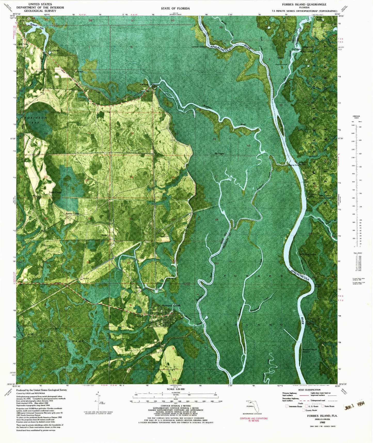
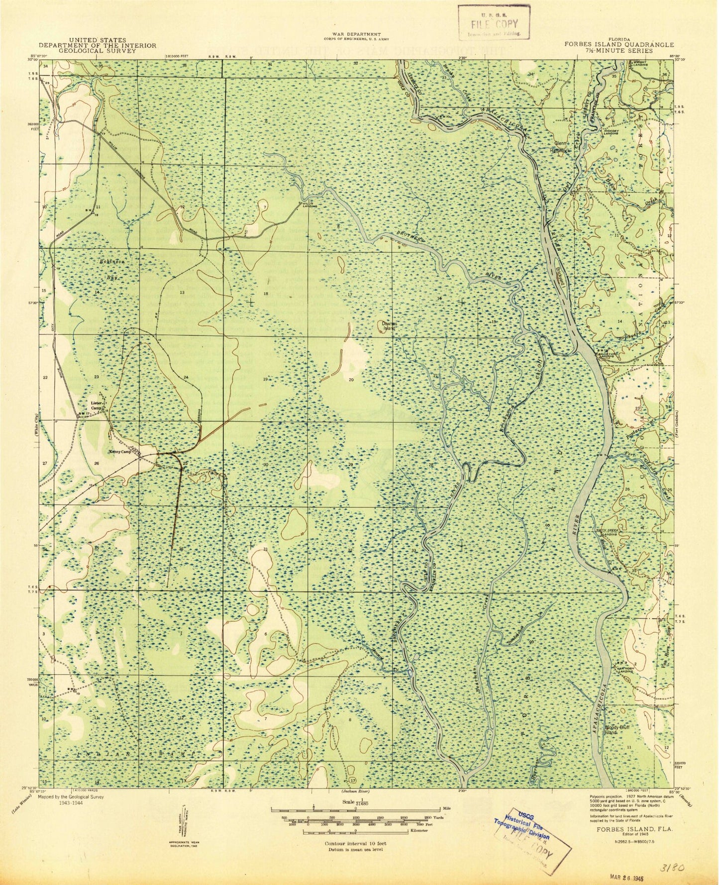
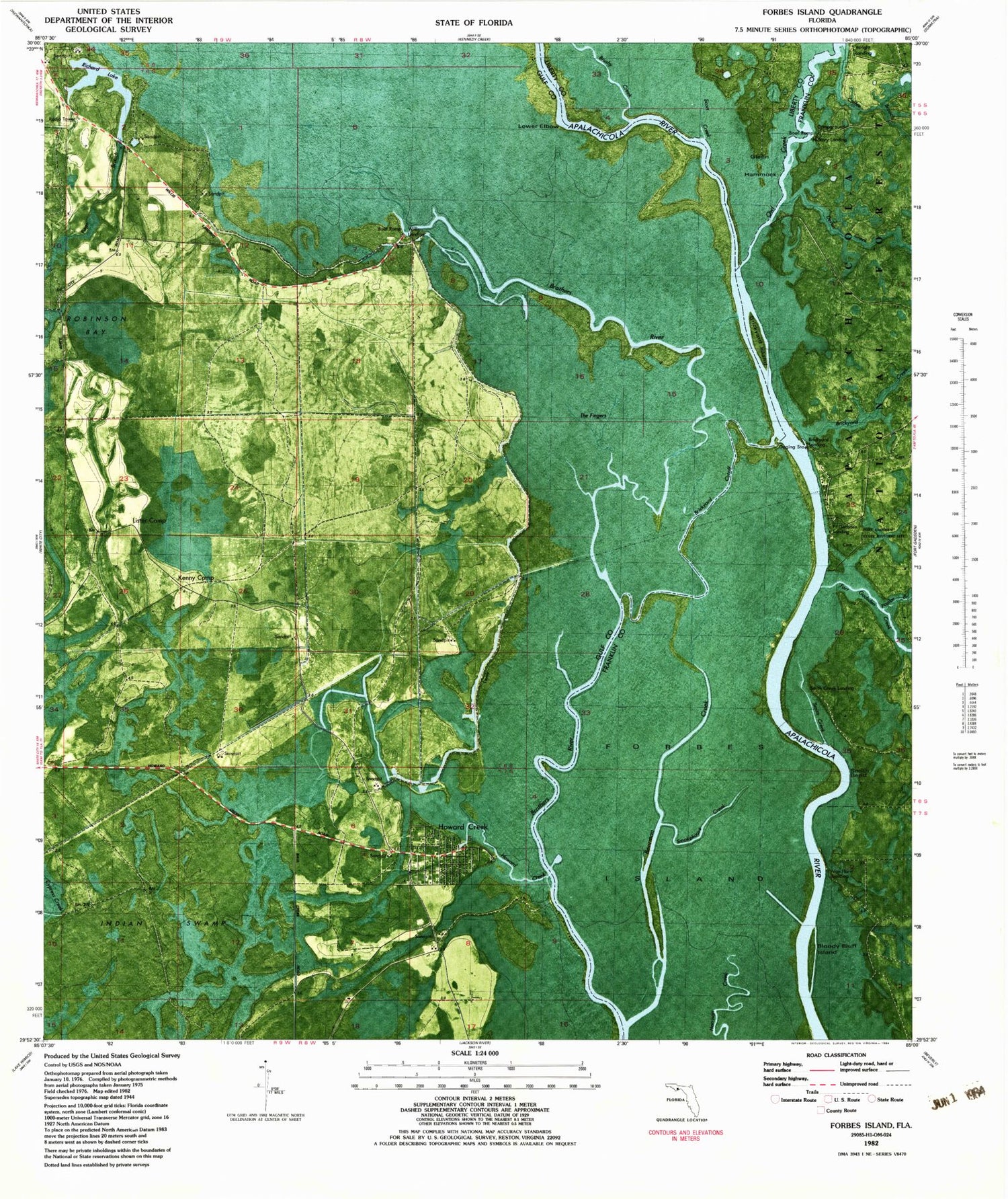
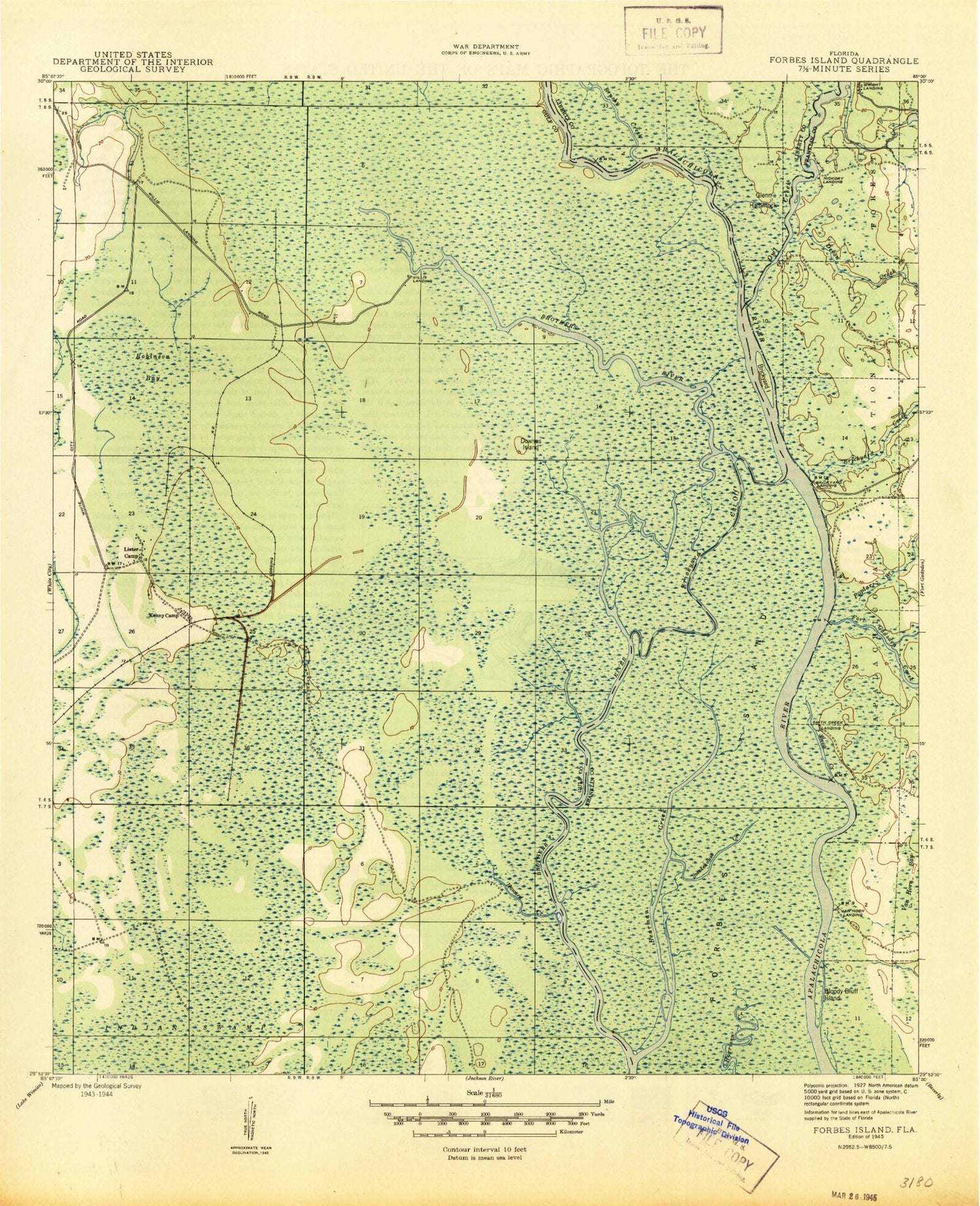
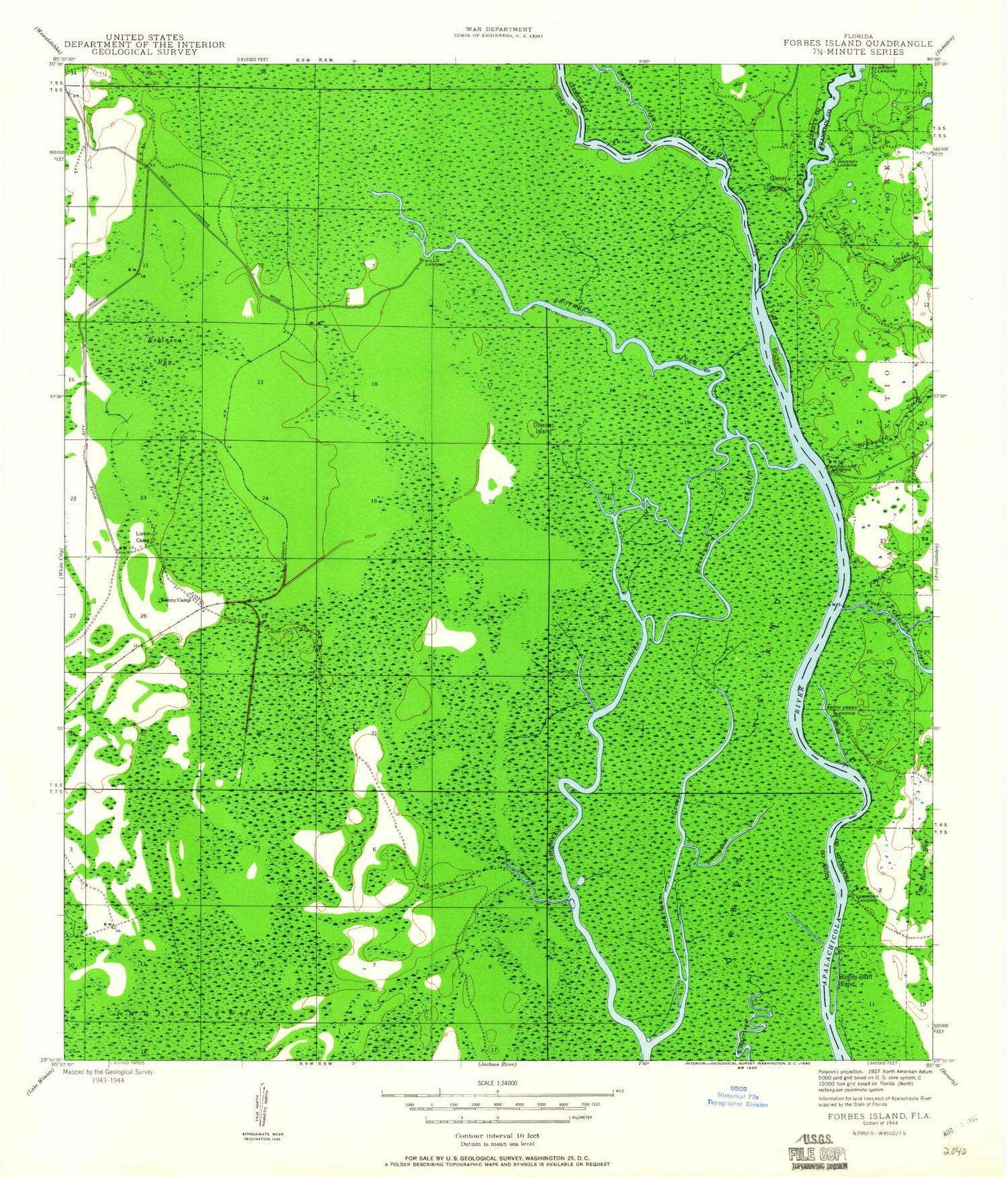
Classic USGS Forbes Island Florida 7.5'x7.5' Topo Map
Couldn't load pickup availability
Historical USGS topographic quad map of Forbes Island in the state of Florida. Typical map scale is 1:24,000, but may vary for certain years, if available. Print size: 24" x 27"
This quadrangle is in the following counties: Franklin, Gulf, Liberty.
The map contains contour lines, roads, rivers, towns, and lakes. Printed on high-quality waterproof paper with UV fade-resistant inks, and shipped rolled.
Contains the following named places: Bearman Creek, Bloody Bluff Island, Brickyard, Brickyard Creek, Brickyard Cut Off, Brickyard Landing, Brushy Creek, Devon Creek, Downes Island, Forbes Island, Fort Gadsden Creek, Glenn Hammock, Hickory Landing, Howard Creek, Kenny Camp, Lister Camp, Owl Creek, Poplar Branch, Robinson Bay, Smith Creek Landing, Smokehouse Creek, Van Horn Landing, Willis Landing, Wright Landing, Brown and Smith Cemetery, Fort Gadsden State Historic Site, Ekanachatte (historical), Hickory Landing Recreaton Site, Fort Gadsden State Park (historical), Howard Creek Fire Department, Prospect Bluff Historic Sites, Bearman Creek, Bloody Bluff Island, Brickyard, Brickyard Creek, Brickyard Cut Off, Brickyard Landing, Brushy Creek, Devon Creek, Downes Island, Forbes Island, Fort Gadsden Creek, Glenn Hammock, Hickory Landing, Howard Creek, Kenny Camp, Lister Camp, Owl Creek, Poplar Branch, Robinson Bay, Smith Creek Landing, Smokehouse Creek, Van Horn Landing, Willis Landing, Wright Landing, Brown and Smith Cemetery, Fort Gadsden State Historic Site, Ekanachatte (historical), Hickory Landing Recreaton Site, Fort Gadsden State Park (historical), Howard Creek Fire Department, Prospect Bluff Historic Sites