MyTopo
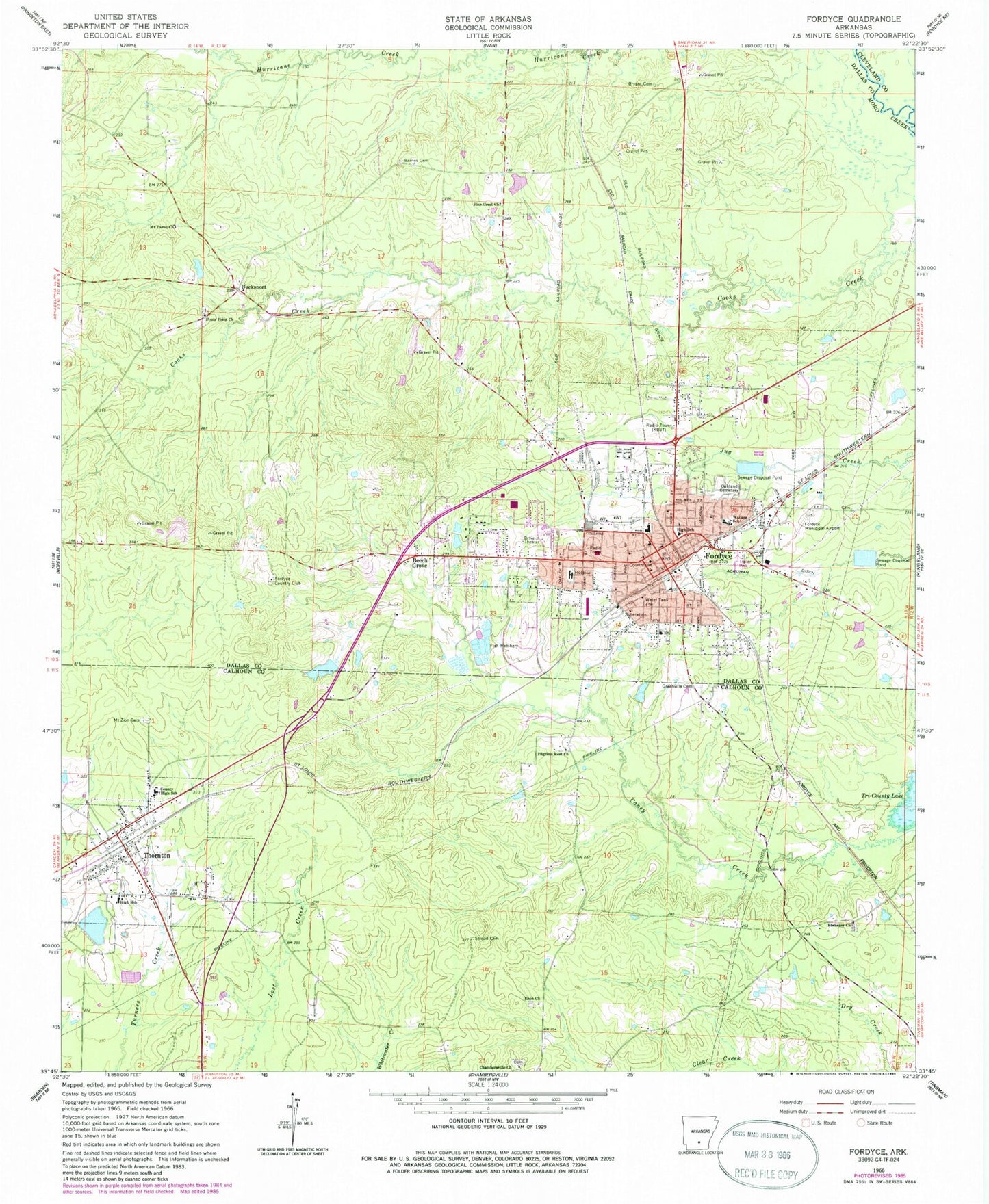
Classic USGS Fordyce Arkansas 7.5'x7.5' Topo Map
Couldn't load pickup availability
Historical USGS topographic quad map of Fordyce in the state of Arkansas. Map scale may vary for some years, but is generally around 1:24,000. Print size is approximately 24" x 27"
This quadrangle is in the following counties: Calhoun, Cleveland, Dallas.
The map contains contour lines, roads, rivers, towns, and lakes. Printed on high-quality waterproof paper with UV fade-resistant inks, and shipped rolled.
Contains the following named places: Barnes Cemetery, Beech Grove, Bryant Cemetery, Bucksnort, Chambersville Church, Charlotte Street Historic District, City of Fordyce, City of Thornton, Dallas County Courthouse, Dallas County Hospital Heliport, Dallas County Medical Center, Dallas County Sheriff's Office, Ebenezer, Ebenezer Church, Emergency Ambulance Service Fordyce, Enon Church, First Baptist Church, First Presbyterian Church, First United Methodist Church, Fordyce, Fordyce Country Club, Fordyce Elementary School, Fordyce Fire Department, Fordyce High School, Fordyce Middle School, Fordyce Police Department, Fordyce Post Office, Greenville Cemetery, J E Wallace Elementary School, Jacobs Lake, Jacobs Lake Dam, KBJT-AM (Fordyce), Kervin Lake Dam Number One Dam, Kervin Lake Number One, KQEW-FM (Fordyce), Lake Cathay, Lake Cathay Dam, Lake Lansdale, Lake Lansdale Dam, Mount Paron Church, Mount Zion Cemetery, North Fordyce, Oakland Cemetery, Patterson Grammar School, Pilgrims Rest Church, Pine Crest Church, Stony Point Church, Stroud Cemetery, The Mall Shopping Center, Thornton, Thornton Fire Station, Thornton Post Office, Township of Fordyce, Township of Moro, ZIP Code: 71742