MyTopo
Classic USGS Forepaugh Peak Arizona 7.5'x7.5' Topo Map
Couldn't load pickup availability
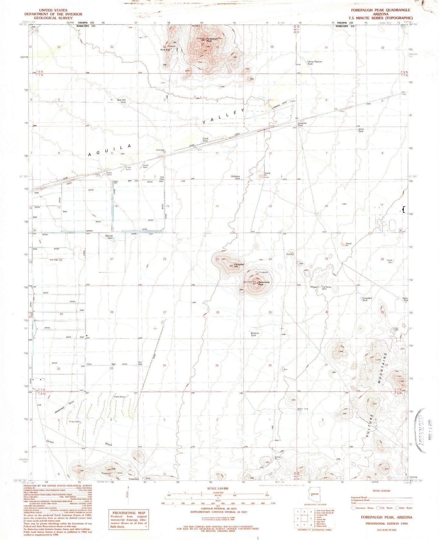
Historical USGS topographic quad map of Forepaugh Peak in the state of Arizona. Map scale may vary for some years, but is generally around 1:24,000. Print size is approximately 24" x 27"
This quadrangle is in the following counties: Maricopa, Yavapai.
The map contains contour lines, roads, rivers, towns, and lakes. Printed on high-quality waterproof paper with UV fade-resistant inks, and shipped rolled.
Contains the following named places: Big Pimberton Tanks, Brahma Tank, Campbell Hill, Campbell Tank, Clark Tank, Daniels Tank, Engle Well, Forepaugh, Forepaugh Peak, Forepaugh Railroad Station, Forepaugh Tank, Horse Pasture Tank, Hultman Tank, J O Dandy Mine, Janie Tank, Joanette Tank, Red Hill Tank, Sevenmile Peak, Torrance Well