MyTopo
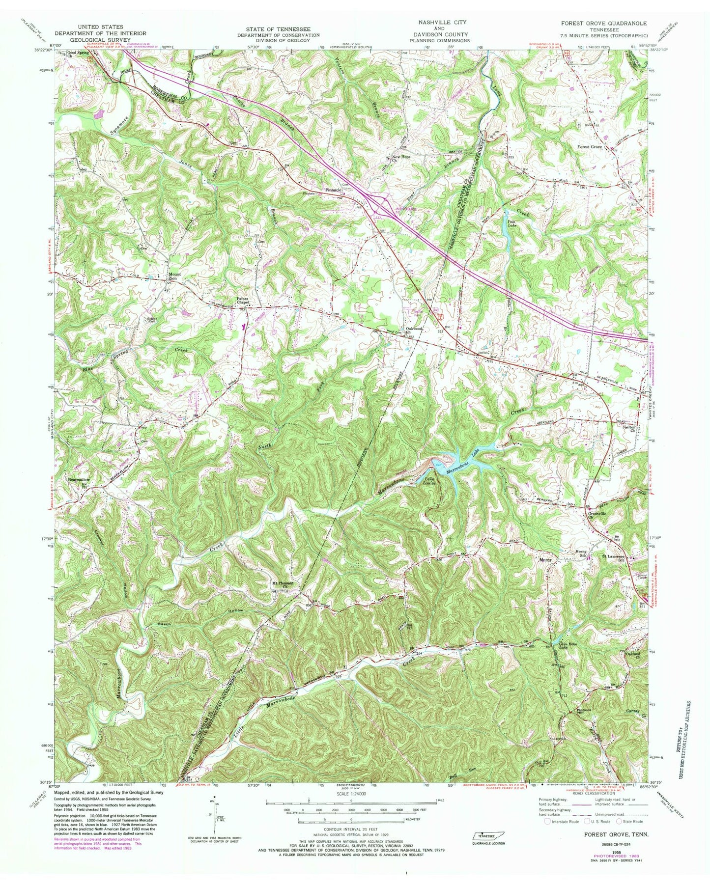
Classic USGS Forest Grove Tennessee 7.5'x7.5' Topo Map
Couldn't load pickup availability
Historical USGS topographic quad map of Forest Grove in the state of Tennessee. Typical map scale is 1:24,000, but may vary for certain years, if available. Print size: 24" x 27"
This quadrangle is in the following counties: Cheatham, Davidson, Robertson.
The map contains contour lines, roads, rivers, towns, and lakes. Printed on high-quality waterproof paper with UV fade-resistant inks, and shipped rolled.
Contains the following named places: Bear Branch, Bearwallow, Beech Hollow, Crocker Hollow, Forest Grove, Glen Echo Lake, Good Spring Church, Gupton Cemetery, Hollis Creek, Jones Branch, Long Branch, Lake Louise, Morny, Mount Pleasant Church, Mount Zion, New Hope Freewill Baptist Church, North Fork Marrowbone Creek, Oakland Church, Oakwood Church, Paines Chapel, Pals Lake, Pinhook Hill, Pinnacle, Procks Branch, Saint Lawrence School, Evans Airport (historical), Marrowbone Lake, Marrowbone Dam, Greenville Church, Joelton Church, Pals Lake Dam, Rest (historical), Hoffasville (historical), Westeria (historical), Mudlick Creek, Paradise Ridge, Setters Lake, West, Mount Zion Freewill Baptist Church, Mount Pleasant School (historical), Bearwallow School (historical), Bearwallow Church, East Cheatham Elementary School, Mount Zion School (historical), Pinnacle School (historical), Forest Grove School (historical), Fosters Store (historical), Pinedale Church (historical), Setters School (historical), WZEZ-FM (Nashville), Forest Grove Cemetery, Greenville Cemetery, Oakland Cemetery, Saint Lawrence Catholic Church, Greenville, Morny Elementary School, Commissioner District 2, Commissioner District 1, Pleasant View Volunteer Fire Department Station 2, Nashville Fire Department Station 30


