MyTopo
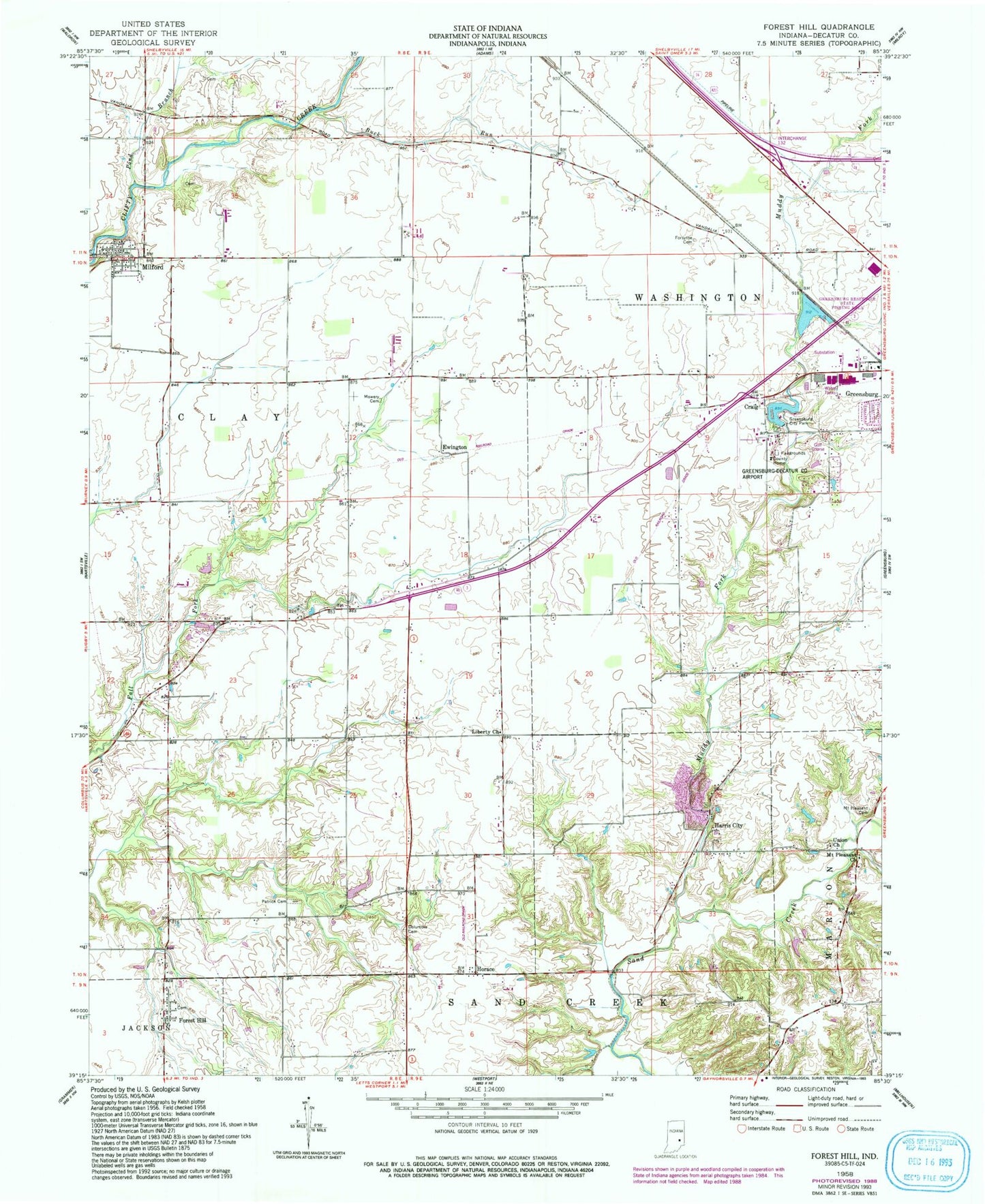
Classic USGS Forest Hill Indiana 7.5'x7.5' Topo Map
Couldn't load pickup availability
Historical USGS topographic quad map of Forest Hill in the state of Indiana. Map scale may vary for some years, but is generally around 1:24,000. Print size is approximately 24" x 27"
This quadrangle is in the following counties: Decatur.
The map contains contour lines, roads, rivers, towns, and lakes. Printed on high-quality waterproof paper with UV fade-resistant inks, and shipped rolled.
Contains the following named places: Buck Run, City of Greensburg, Columbia Cemetery, Craig, Decatur County, Ewington, Forest Hill, Forsythe Cemetery, Greenburg Reservoir, Greenburg Reservoir Dam, Greenburg Reservoir State Fishing Area, Greensburg City Park, Greensburg Municipal Airport, Greersburg City Park Lake, Greersburg City Park Lake Dam, Harris City, Harris City Cemetery, Harris City Quarry, Horace, Liberty Church, Milford, Milford Cemetery, Mount Pleasant Cemetery, Mount Pleasant Church, Mowery Cemetery, Muddy Fork Sand Creek, Patrick Cemetery, Pond Branch, Schoettmer Farm Airport, Town of Milford, Township of Clay, Union Church, WTRE-AM (Evansville), WTRE-FM (Greensburg)