MyTopo
Classic USGS Forest Home Alabama 7.5'x7.5' Topo Map
Couldn't load pickup availability
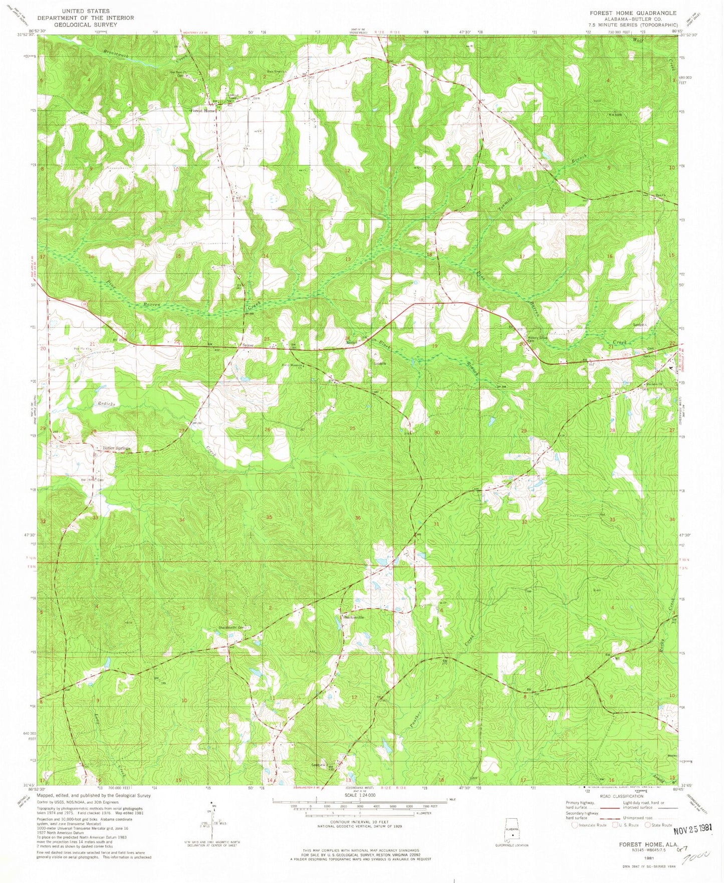
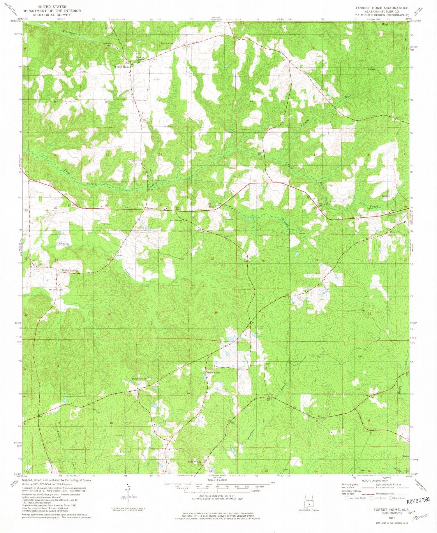
Historical USGS topographic quad map of Forest Home in the state of Alabama. Map scale may vary for some years, but is generally around 1:24,000. Print size is approximately 24" x 27"
This quadrangle is in the following counties: Butler.
The map contains contour lines, roads, rivers, towns, and lakes. Printed on high-quality waterproof paper with UV fade-resistant inks, and shipped rolled.
Contains the following named places: Black Branch, Buckaloo Church, Butler County State Wildlife Management Area, Butler Springs, Butler Springs Baptist Church, Butler Springs Cemetery, English Pond, Forest Home, Forest Home Cemetery, Forest Home Church, Forest Home Post Office, Forest Home School, Forest Home Volunteer Fire Department, Herbert, Hickory Grove Cemetery, Pine Flat Church, Pine Flat School, Providence - Mount Pisgah Volunteer Fire Department, Rock Rest Church, Rocky Mountain Church, Salem Church, Saucer, Shacklesville, Shacklesville Cemetery, Shacklesville Church, Shackleville Volunteer Fire Department, Tenmile Branch, The Independent Holiness Church, Watts Cemetery, Zion Church, Zion Rest Church