
MyTopo
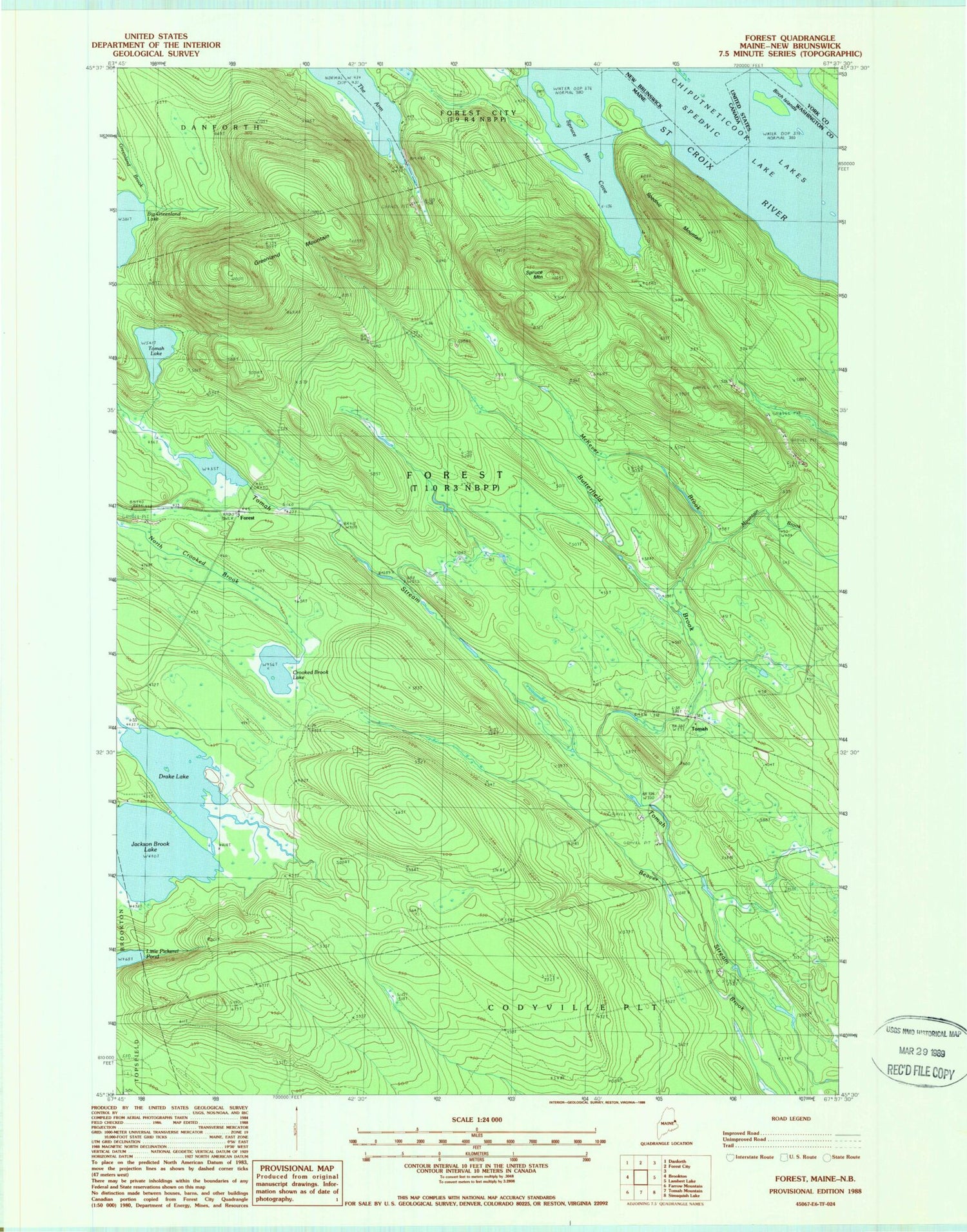
Classic USGS Forest Maine 7.5'x7.5' Topo Map
Couldn't load pickup availability
Historical USGS topographic quad map of Forest in the state of Maine. Map scale may vary for some years, but is generally around 1:24,000. Print size is approximately 24" x 27"
This quadrangle is in the following counties: Washington.
The map contains contour lines, roads, rivers, towns, and lakes. Printed on high-quality waterproof paper with UV fade-resistant inks, and shipped rolled.
Contains the following named places: Big Greenland Lake, Birch Islands, Butterfield Brook, Cowboys Air Ranch, Crooked Brook Lake, Drake Lake, Forest, Forest Township, Greenland Mountain, Jackson Brook Lake, Little Pickerel Pond, McKever Brook, Mountain Brook, Spednic Mountain, Spruce Mountain, Spruce Mountain Cove, The Basin, Tomah, Tomah Lake


