
MyTopo
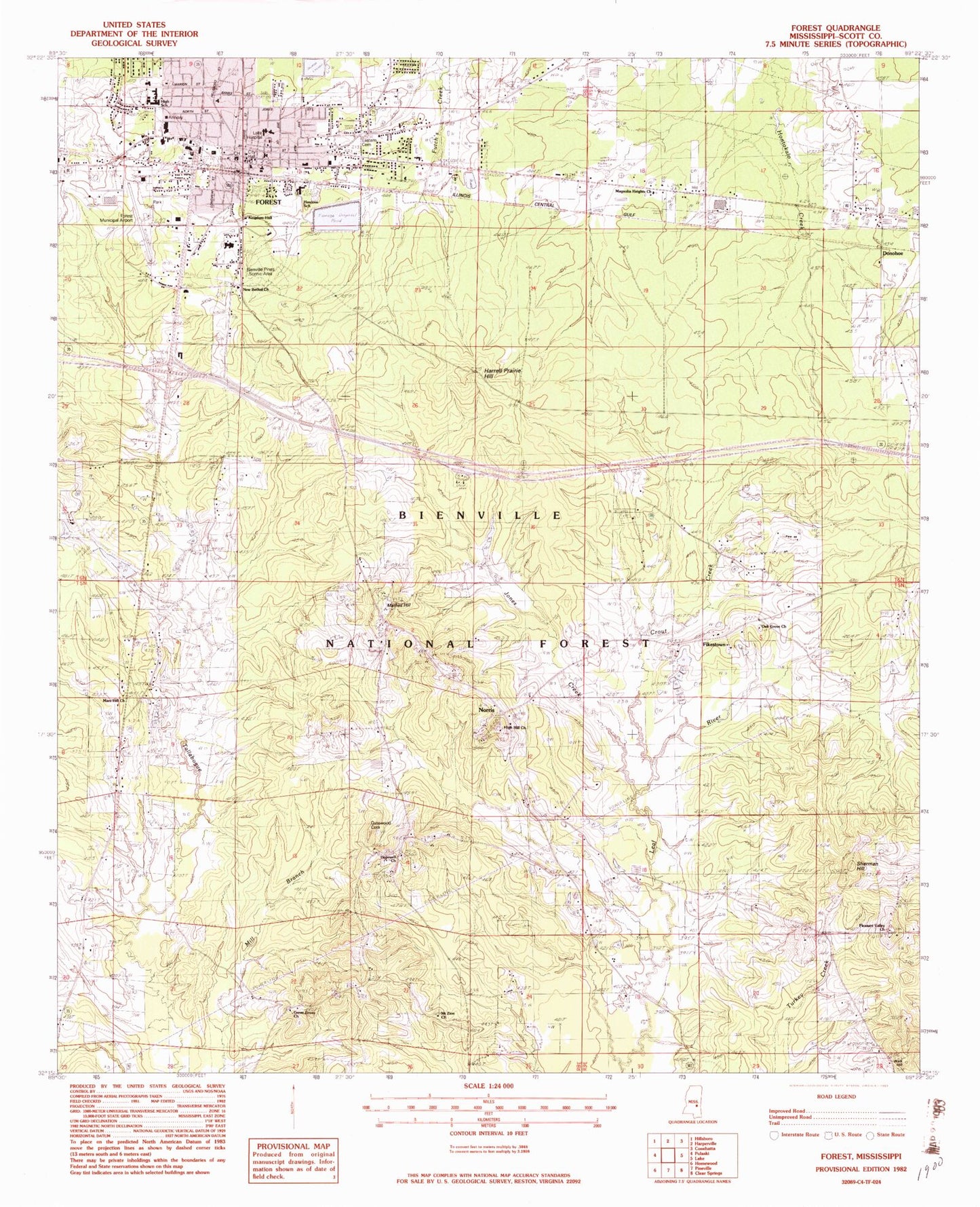
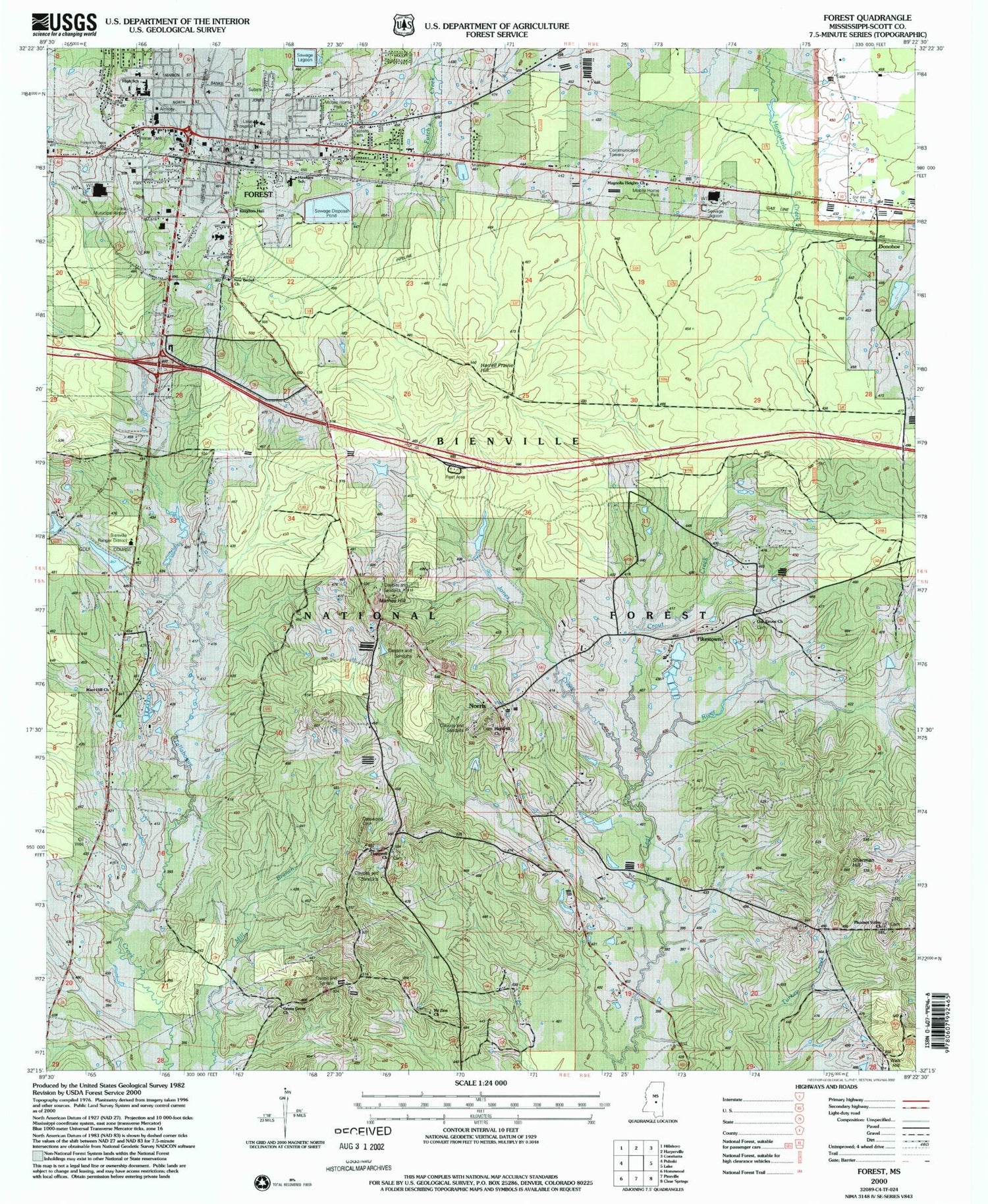
Classic USGS Forest Mississippi 7.5'x7.5' Topo Map
Couldn't load pickup availability
Historical USGS topographic quad map of Forest in the state of Mississippi. Typical map scale is 1:24,000, but may vary for certain years, if available. Print size: 24" x 27"
This quadrangle is in the following counties: Scott.
The map contains contour lines, roads, rivers, towns, and lakes. Printed on high-quality waterproof paper with UV fade-resistant inks, and shipped rolled.
Contains the following named places: Forest Baptist Church, Magnolia Heights Church, Crout Creek, Donohoe, Fikestown, Forest, Forest School, Green Grove Church, Harrell Prairie Hill, High Hill Church, Hopewell Church, Jones Chapel, Jones Creek, New Bethel Church, Mathes Hill, Moore School, Mars Hill Church, Mount Zion School, Norris, Oak Grove Church, Pinkston Hill, Sherman Hill, Sherman Hill School, Walk Hill, WJYV-AM (Forest), WQST-FM (Forest), G V Montgomery Airport, George Gatewood Catfish Pond Dam, Forest Country Club Lake Dam, Forest Sewage Lagoon Dam, Whiteway Farms Lake Dam, Forest Sewage Lagoon Dam, Assembly of God Church, Bienville Pines Scenic Area, Calvary Baptist Church, Caney Creek State Wildlife Management Area, Covenant Presbyterian Church, Eastern Cemetery, Forest City Hall, Forest Methodist Church, Forest Presbyterian Church, Gatewood Cemetery, Hawkins Middle School, Kingdom Hall, Lackey Memorial Hospital, Scott County Courthouse, Mount Zion Church, New Bethal Church, Pleasant Valley Church, Forest Elementary School, Forest High School, Bienville District Ranger Office, Bienville Work Center, Harrell Prairie Botanical Area, Supervisor District 2, Forest Post Office, City of Forest, Forest Fire Department, Scott County Sheriff's Office, Forest City Police Department