MyTopo
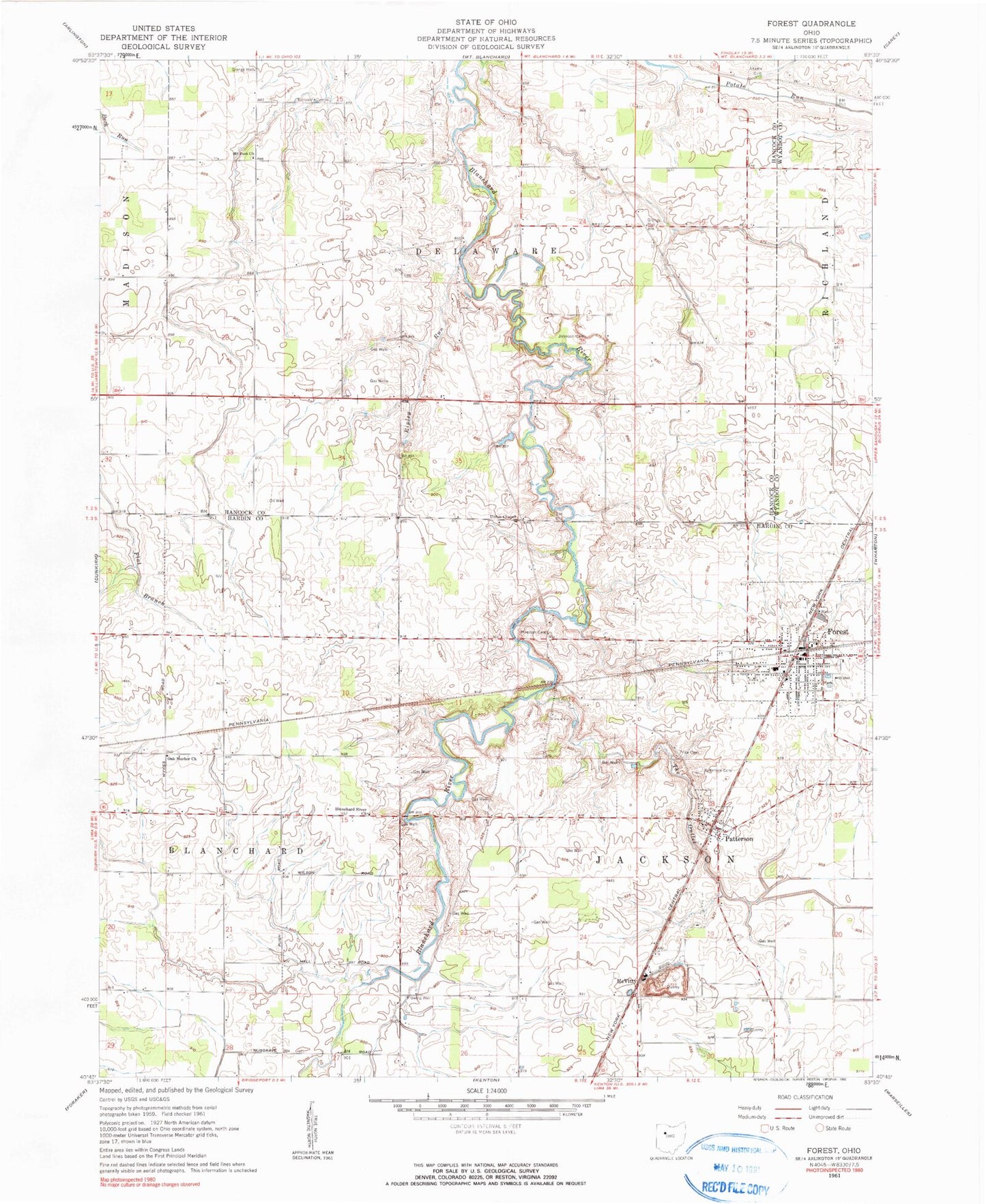
Classic USGS Forest Ohio 7.5'x7.5' Topo Map
Couldn't load pickup availability
Historical USGS topographic quad map of Forest in the state of Ohio. Map scale may vary for some years, but is generally around 1:24,000. Print size is approximately 24" x 27"
This quadrangle is in the following counties: Hancock, Hardin, Wyandot.
The map contains contour lines, roads, rivers, towns, and lakes. Printed on high-quality waterproof paper with UV fade-resistant inks, and shipped rolled.
Contains the following named places: Adams Cemetery, Blanchard River Church, Earlywine Cemetery, First Baptist Church, First Presbyterian Church, Forest, Forest Christian Pre-School, Forest Elementary School, Forest Field, Forest Fire Department, Forest Police Department, Forest Post Office, Forest United Methodist Church, Herzog Quarry, Hope Church, Hueston Cemetery, Jackson - Forest Joint Ambulance District, Johnson Cemetery, Maplegrove Church, McVitty, Mount Zion Church, Oak Harbor Church, Oak Harbor School, Patterson, Patterson Cemetery, Patterson Post Office, Price Cemetery, Ripley Run, Rushville School, The Outlet, Township of Blanchard, Township of Delaware, Township of Jackson, Union Chapel, Village of Forest, Village of Patterson, ZIP Code: 45843