MyTopo
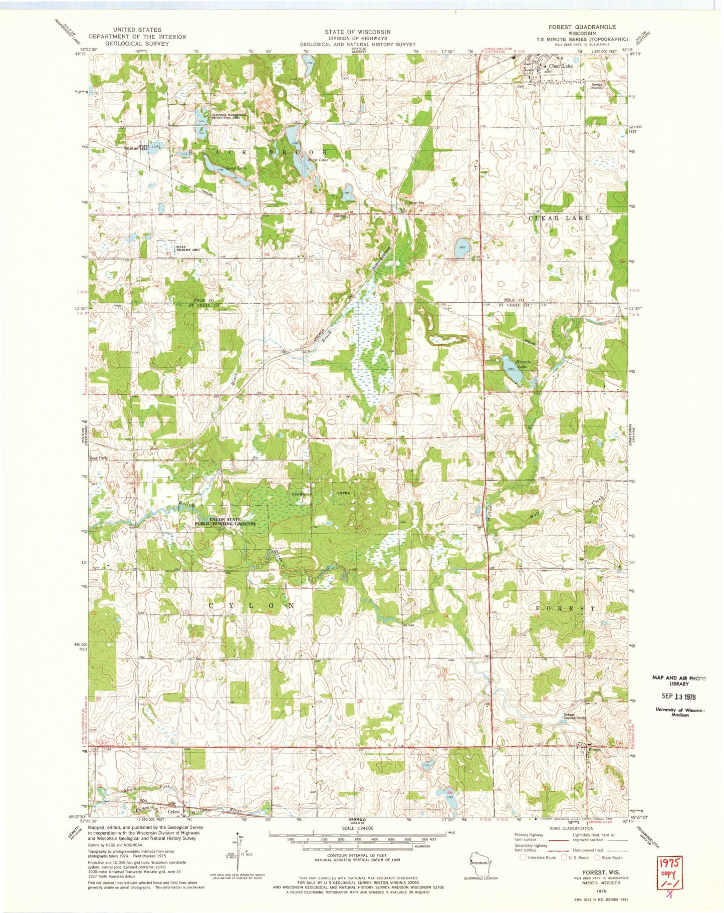
Classic USGS Forest Wisconsin 7.5'x7.5' Topo Map
Couldn't load pickup availability
Historical USGS topographic quad map of Forest in the state of Wisconsin. Map scale may vary for some years, but is generally around 1:24,000. Print size is approximately 24" x 27"
This quadrangle is in the following counties: Polk, St. Croix.
The map contains contour lines, roads, rivers, towns, and lakes. Printed on high-quality waterproof paper with UV fade-resistant inks, and shipped rolled.
Contains the following named places: Black Brook, Black Brook Townhall, Bone Lake, Clear Lake Junior - Senior High School, Clear Lake Junior High School, Cylon School, Cylon State Public Hunting Grounds, Diamond K Farm, Don Dosch Wildlife Flowage Dam, Edgewood School, Forest, Gaylord A Nelson Education Center, Green Creek School, Harmin Lake, High Landing School, Hutton Creek, Jack Green Creek, Kuhn Farm, Liberty School, Long Lake, Oakland School, Town of Cylon, Village of Clear Lake, Wolf Creek, ZIP Code: 54007