MyTopo
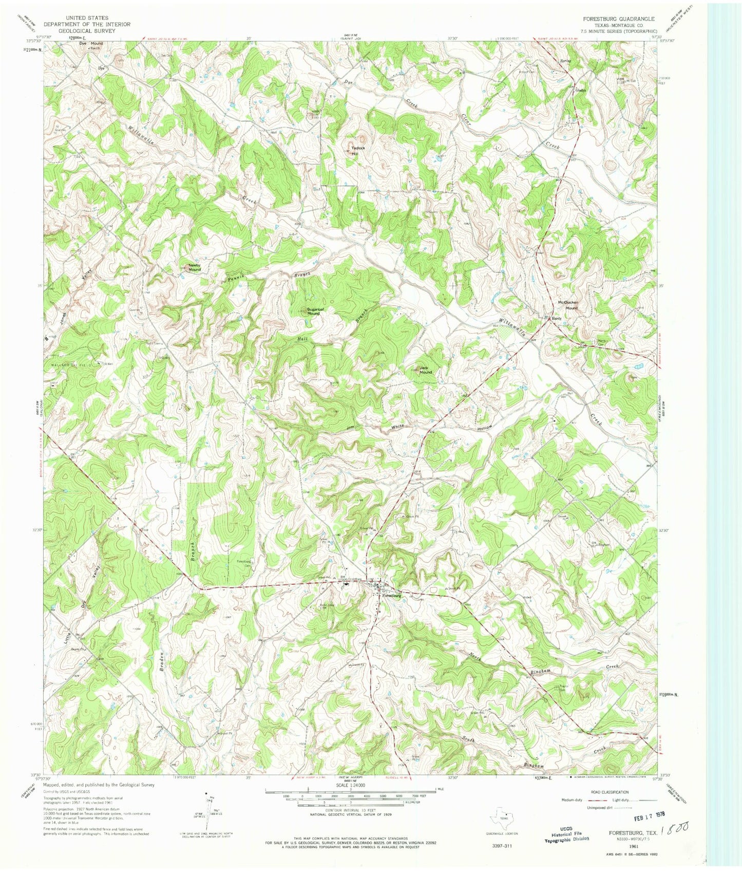
Classic USGS Forestburg Texas 7.5'x7.5' Topo Map
Couldn't load pickup availability
Historical USGS topographic quad map of Forestburg in the state of Texas. Map scale may vary for some years, but is generally around 1:24,000. Print size is approximately 24" x 27"
This quadrangle is in the following counties: Montague.
The map contains contour lines, roads, rivers, towns, and lakes. Printed on high-quality waterproof paper with UV fade-resistant inks, and shipped rolled.
Contains the following named places: Antioch Cemetery, Bird Dog Landing, Dewey Church, Dye, Dye Cemetery, Dye Church, Dye Creek, Dye Mound, Fannin Branch, Forestburg, Forestburg Cemetery, Forestburg Post Office, Forestburg Volunteer Fire Department, Gaylord Lake Number 1, Gaylord Lake Number 1 Dam, Gaylord Lake Number 2, Gaylord Lake Number 2 Dam, Gladys, Hall Branch, Hardy, Hardy Cemetery, Jack Mound, Jim White Hollow, McCracken Mound, Newby Mound, Sediment Control Structure 112 Reservoir, Sediment Control Structure 7-6 Reservoir, Soil Conservation Service Sediment Control Structure 103, Soil Conservation Service Sediment Control Structure 104, Soil Conservation Service Sediment Control Structure 104 Reservoir, Soil Conservation Service Sediment Control Structure 105, Soil Conservation Service Sediment Control Structure 105 Reservoir, Soil Conservation Service Sediment Control Structure 106, Soil Conservation Service Sediment Control Structure 106 Reservoir, Soil Conservation Service Sediment Control Structure 107, Soil Conservation Service Sediment Control Structure 107 Reservoir, Soil Conservation Service Sediment Control Structure 109, Soil Conservation Service Sediment Control Structure 109 Reservoir, Soil Conservation Service Sediment Control Structure 111, Soil Conservation Service Sediment Control Structure 111 Reservoir, Soil Conservation Service Sediment Control Structure 112, Soil Conservation Service Sediment Control Structure 113, Soil Conservation Service Sediment Control Structure 113 Reservoir, Soil Conservation Service Sediment Control Structure 16-1, Soil Conservation Service Sediment Control Structure 16-1 Reservoir, Soil Conservation Service Sediment Control Structure 16-2, Soil Conservation Service Sediment Control Structure 16-2 Reservoir, Soil Conservation Service Sediment Control Structure 7-6, Soil Conservation Service Site 12 Dam, Soil Conservation Service Site 12 Reservoir, Soil Conservation Service Site 13 Dam, Soil Conservation Service Site 13 Reservoir, Soil Conservation Service Site 14 Dam, Soil Conservation Service Site 14 Reservoir, Soil Conservation Service Site 22 Dam, Soil Conservation Service Site 22 Reservoir, Soil Conservation Service Site 23 Dam, Soil Conservation Service Site 23 Reservoir, Soil Conservation Service Site 24 Dam, Soil Conservation Service Site 24 Reservoir, Soil Conservation Service Site 25 Dam, Soil Conservation Service Site 25 Reservoir, Soil Conservation Service Site 26 Dam, Soil Conservation Service Site 26 Reservoir, Soil Conservation Service Site 27 Dam, Soil Conservation Service Site 27 Reservoir, Soil Conservation Service Site 28 Dam, Soil Conservation Service Site 28 Reservoir, Soil Conservation Service Site 29 Dam, Soil Conservation Service Site 29 Reservoir, Soil Conservation Service Site 30 Dam, Soil Conservation Service Site 30 Reservoir, Soil Conservation Service Site 7b Dam, Soil Conservation Service Site 7b Reservoir, Soil Conservation Service Site 7d Dam, Soil Conservation Service Site 7d Reservoir, Soil Conservation Service Site 9a Dam, Soil Conservation Service Site 9a Reservoir, Soil Conservation Service Site 9b Dam, Soil Conservation Service Site 9b Reservoir, Soil Conservation Service Site 9c Dam, Soil Conservation Service Site 9c Reservoir, Soil Conservation Service Site 9d Dam, Soil Conservation Service Site 9d Reservoir, Sugarloaf Mound, Tadlock Hill, Traylor Cemetery, ZIP Code: 76239


