
MyTopo
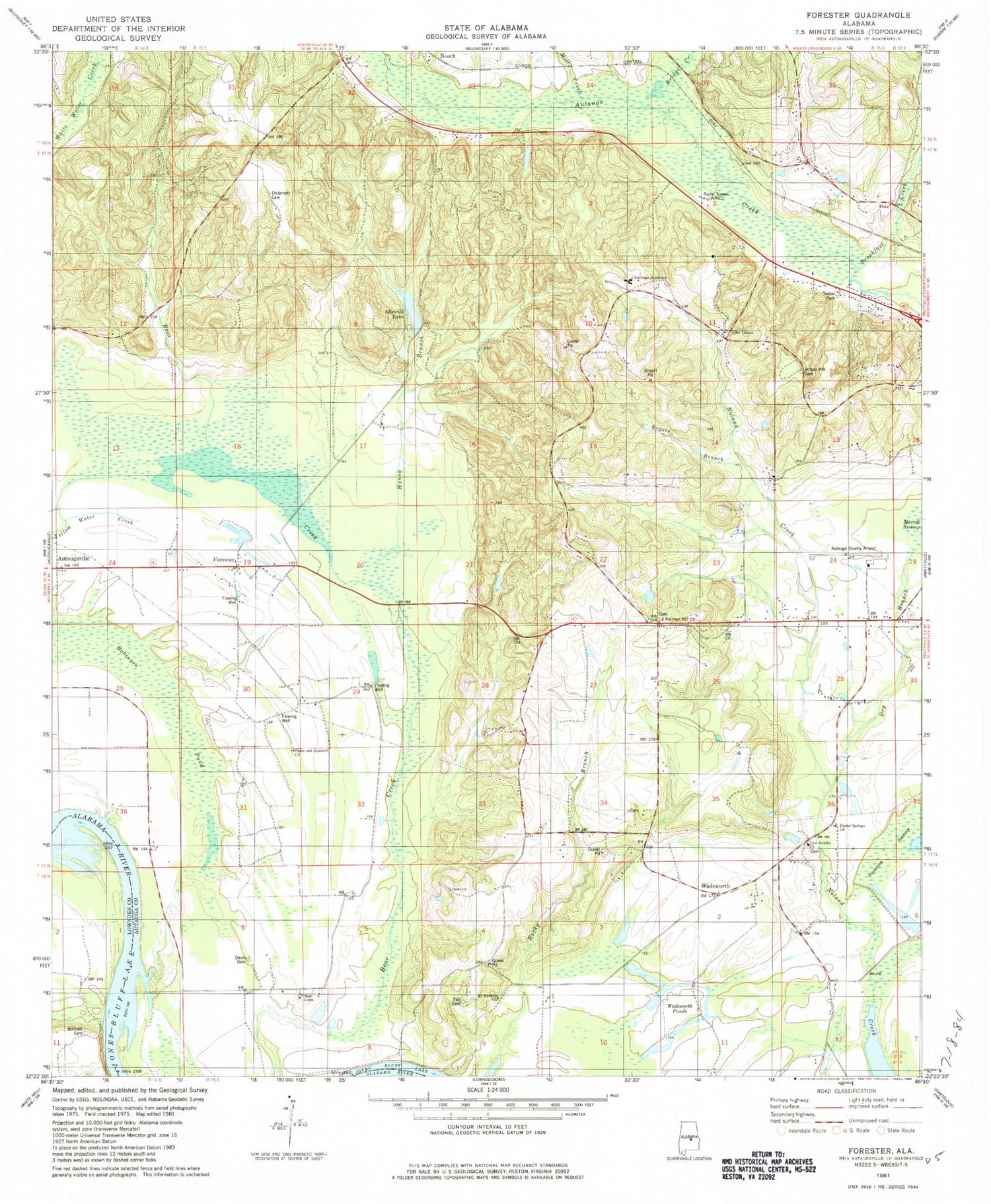
Classic USGS Forester Alabama 7.5'x7.5' Topo Map
Couldn't load pickup availability
Historical USGS topographic quad map of Forester in the state of Alabama. Map scale may vary for some years, but is generally around 1:24,000. Print size is approximately 24" x 27"
This quadrangle is in the following counties: Autauga, Lowndes.
The map contains contour lines, roads, rivers, towns, and lakes. Printed on high-quality waterproof paper with UV fade-resistant inks, and shipped rolled.
Contains the following named places: Allen Chapel, Autauga Academy, Autauga Hill African Methodist Episcopal Zion Church, Autauga Hill School, Bear Creek Swamp, Bear Swamp, Booth Cemetery, Booth United Methodist Church, Breakfast Creek, Bridge Creek, Davis Cemetery, Davis Chapel, DeJarnett Cemetery, Dry Branch, Fair Cemetery, Forester, Greenwood Baptist Church, Gum Cypress Lake, Haney Branch, Idlewild Lake, Idlewood Lake Dam, Indian Hill Cemetery, Indian Springs Post Office, Kingdom Hall of Jehovahs Witnesses, Mill Creek, Mount Ramoth Church, New Jerico Baptist Church, Newport Ferry, Old Vernon, Pate, Peace and Goodwill Church, Poplar Springs Church, Popular Spring African Methodist Episcopal Zion Church, Prattville - Grouby Field, Prattville Church, Prattville Division, Robinson Pond, Rogers Branch, Savanna Swamp, Wadsworth, Wadsworth Ponds, WIQR-AM (Prattville)