MyTopo
Classic USGS Forestport New York 7.5'x7.5' Topo Map
Couldn't load pickup availability
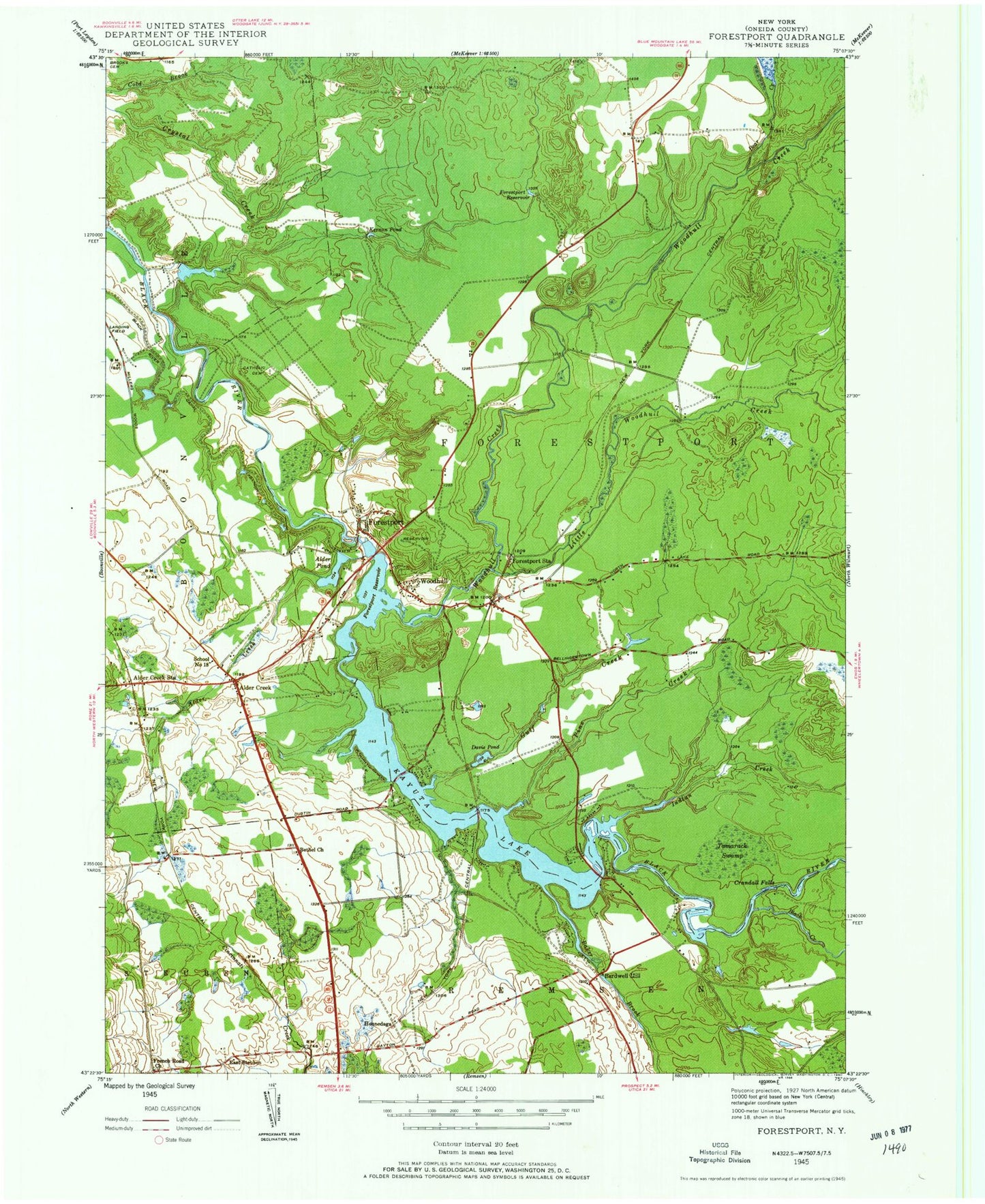
Historical USGS topographic quad map of Forestport in the state of New York. Typical map scale is 1:24,000, but may vary for certain years, if available. Print size: 24" x 27"
This quadrangle is in the following counties: Oneida.
The map contains contour lines, roads, rivers, towns, and lakes. Printed on high-quality waterproof paper with UV fade-resistant inks, and shipped rolled.
Contains the following named places: Alder Creek, Alder Creek, Alder Creek Station, Alder Pond, Baker Brook, Bardwell Mill, Bear Creek, Bethel Church, Catholic Cemetery, Crandall Falls, Davis Pond, Forestport, Forestport Reservoir, Forestport Reservoir, Forestport Station, French Road Church, Gulf Creek, Indian Creek, Kayuta Lake, Kernan Pond, Little Black Creek, Little Woodhull Creek, Pine Creek, Tamarack Swamp, Woodhull, Woodhull Creek, East Steuben, Honnedaga, School Number 18 (historical), Town of Forestport, Forestport Elementary School, French Road Church Cemetery, Bethel Cemetery, Alder Creek Cemetery, Beechwood Cemetery, Muskrat Creek, Muskrat Lake, Kayuta Lake Campground, Alder Creek Golf Course, Bear Creek Lodge Golf Course, Forestport Town Wastewater Treatment Plant, Forestport Fire Department, Alder Creek Post Office, Forestport Post Office