MyTopo
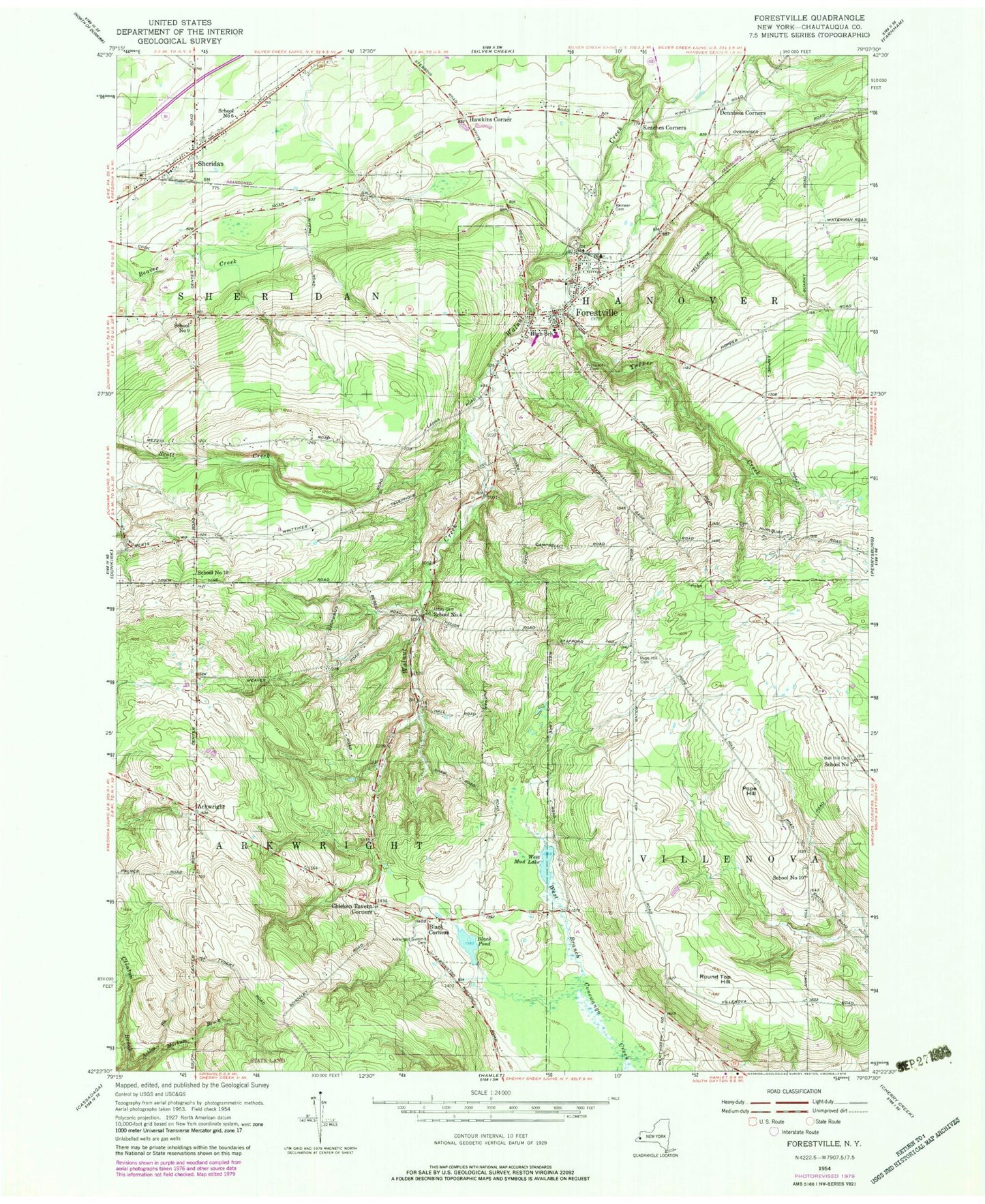
Classic USGS Forestville New York 7.5'x7.5' Topo Map
Couldn't load pickup availability
Historical USGS topographic quad map of Forestville in the state of New York. Map scale may vary for some years, but is generally around 1:24,000. Print size is approximately 24" x 27"
This quadrangle is in the following counties: Chautauqua.
The map contains contour lines, roads, rivers, towns, and lakes. Printed on high-quality waterproof paper with UV fade-resistant inks, and shipped rolled.
Contains the following named places: Abbey Cemetery, Ackles Brook, Arkwright, Arkwright Summit Cemetery, Ball Hill Cemetery, Black Corners, Black Pond, Chicken Tavern Corners, Dennison Corners, Fairdawn Farms, Falcone Farms, Forestville, Forestville Baptist Church, Forestville Cemetery, Forestville Census Designated Place, Forestville Central High School, Forestville Elementary School, Forestville Fire Department, Forestville Post Office, Forestville United Methodist Church, Hamlet Farm, Hawkins Corner, Hubbards Park, Keaches Corners, Killdeer Farms, Merritt Estate Winery, Pioneer Cemetery, Pope Hill, Pope Hill Cemetery, Round Top Hill, School Number 10, School Number 4, School Number 6, School Number 7, School Number 9, Sheridan, Sheridan Fire Department, Sheridan Pioneer Cemetery, Sheridan Post Office, Sheridan United Methodist Church, Town of Arkwright, Town of Hanover, Town of Sheridan, Town of Sheridan Municipal Complex, Tupper Creek, Village of Forestville, Wesleyan Church, West Mud Lake, ZIP Codes: 14062, 14135