MyTopo
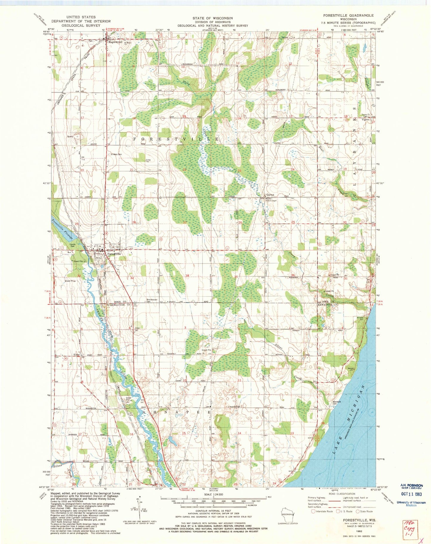
Classic USGS Forestville Wisconsin 7.5'x7.5' Topo Map
Couldn't load pickup availability
Historical USGS topographic quad map of Forestville in the state of Wisconsin. Map scale may vary for some years, but is generally around 1:24,000. Print size is approximately 24" x 27"
This quadrangle is in the following counties: Door, Kewaunee.
The map contains contour lines, roads, rivers, towns, and lakes. Printed on high-quality waterproof paper with UV fade-resistant inks, and shipped rolled.
Contains the following named places: Brockhausen Cemetery, Carnot, Carnot Field, Cherry Lane Orchards, Clark Farms, Door County Library Forestville Branch, Door County Park, Door Quarry South, East Maplewood School, Forest Chapel, Forestville, Forestville 1885C70 Dam, Forestville Post Office, Forestville Wastewater Treatment Plant, Foscoro Airport, Gigstad Farms, Harmann Farms, Jorgensen - Stoller Airport, Kirchman Farms, Kodan, Kodan School, Krause G5896 1 Dam, Lakeview School, Maplewood, Mathison Farms, Olson Farm, Peninsula Dairy, Saint Mary Cemetery, Saint Marys Church, Silver Creek, Southern Door Volunteer Fire Department, Steiner Farm, Stony Creek, Stony Creek Vineyards, Tanum Church, Town of Ahnapee, Town of Forestville, Vignes, Village of Forestville, Vistren Farms, Woodside Cemetery, Woodside School