MyTopo
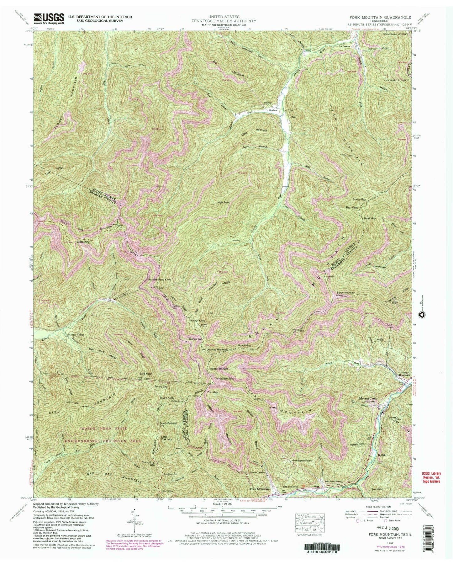
USGS Classic Fork Mountain Tennessee 7.5'x7.5' Topo Map
Couldn't load pickup availability
Historical USGS topographic quad map of Fork Mountain in the state of Tennessee. Scale: 1:24000. Print size: 24" x 27"
This quadrangle is in the following counties: Anderson, Campbell, Morgan, Scott.
The map contains contour lines, roads, rivers, towns, lakes, and grids including latitude / longitude and UTM / MGRS. Printed on high-quality waterproof paper with UV fade-resistant inks.
Contains the following named places: Old Mac Mountain, Smoky Mountain, Snake Den Branch, Squire Knob, Stallion Branch, Stallion Mountain, Straight Fork, Sugarcamp Branch, Sugarcamp Branch, The Garden Spot, Tub Spring, Walnut Knob, Y Hollow, Zeek Ridge, Alex Branch, Arch Mountain, Asher Fork, Bald Knob, Bald Knob Hollow, Barley Mouth Branch, Bear Knob, Beech Grove Cemetery, Beech Grove Church, Big Cove Branch, Big Mountain, Bird Mountain, Buffalo, Bunch Gap, Burge Mountain, Cherry Log Gap, Coffin Spring, Cold Gap, Dry Creek, Emory Gap, Emory Gap Branch, Flower Mountain, Fork Mountain, Fork Mountain, Fork Ridge, Grassy Gap, Green Branch, Guinea Gap, Guinea Hill Knob, Gum Branch, Hawk Gap, High Point, High Point Mountain, Indian Fork, Indian Fork Gap, Joe Branch, Jury Ridge, Laurel Fork, Lick Branch, Ligias Ridge, Linlog Branch, Little Brimstone Creek, Little Fork Mountain, Little Mountain, Loudon Creek, Low Cemetery, Lowe Branch, Lowe Cemetery, Mahan Village, Moores Camp, Morgan State Forest, Norman Pond Knob, Ova Branch, Panther Branch, Panther Gap, Patterson Cemetery, Peach Orchard Gap, Rayder Creek, Reeves - Daugherty Cemetery, Sandy Gap Mountan, Second Laurel Branch, Shack Creek, Bills Branch, Cave Branch, Coon Pool Branch, Darty Mine, Fork Mountain-Peewee Mountain Mine, Sagamine Mine, Thompson Number 1 Mine, Thompson Number 2 Mine, Trimore Mine, Brushy Mountain Number 4 Mine, Brushy Mountain Number 5 Mine, Brushy Mountain Number 6 Mine, Frozen Head State Environmental Education Area, Newland (historical), Tioga, Hembree, Fork Mountain School (historical), Chambers Mine, Hembree School (historical), Leonard Mine, Lindsay Mine, Mahan-Ellison Mine, Pemberton and Hibble Number One Mine, Braytown Cemetery, Buffalo School (historical), Mooretown School (historical), Devonia Post Office, Moore Mine