MyTopo
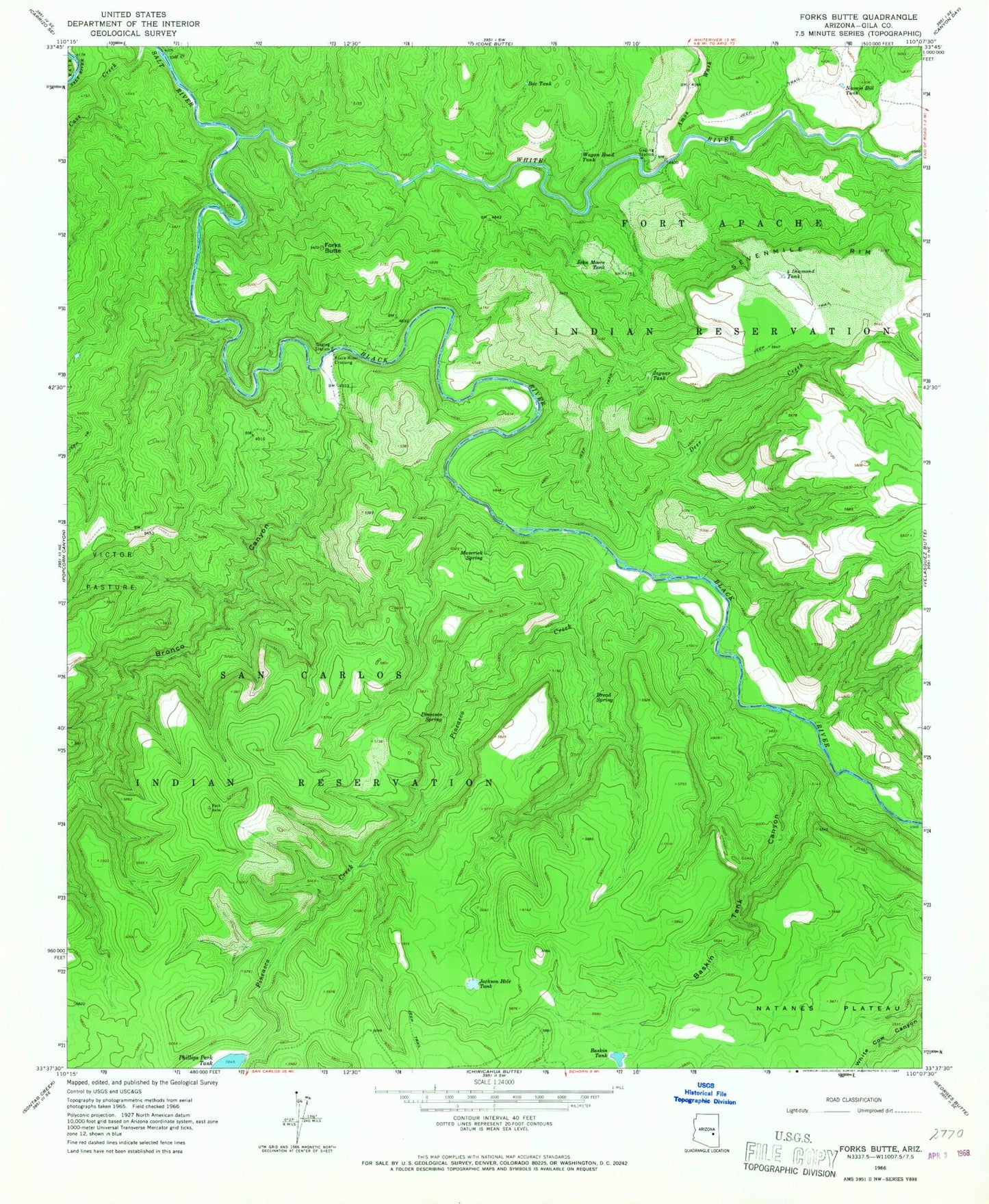
Classic USGS Forks Butte Arizona 7.5'x7.5' Topo Map
Couldn't load pickup availability
Historical USGS topographic quad map of Forks Butte in the state of Arizona. Map scale may vary for some years, but is generally around 1:24,000. Print size is approximately 24" x 27"
This quadrangle is in the following counties: Gila.
The map contains contour lines, roads, rivers, towns, and lakes. Printed on high-quality waterproof paper with UV fade-resistant inks, and shipped rolled.
Contains the following named places: Amos Wash, Baskin Tank, Baskin Tank Canyon, Black River, Black River Crossing, Box Tank, Bread Spring, Bronco Canyon, Calf Creek, Deer Creek, Forks Butte, Four Diamond Tank, Jackson Hole Tank, Jaquar Tank, John Moore Tank, Maverick Spring, Navajo Bill Tank, Packing Horse Creek, Phillips Park Dam, Phillips Park Tank, Pineasco Creek, Pineasco Spring, Wagon Road Tank, Warm Spring, White River