MyTopo
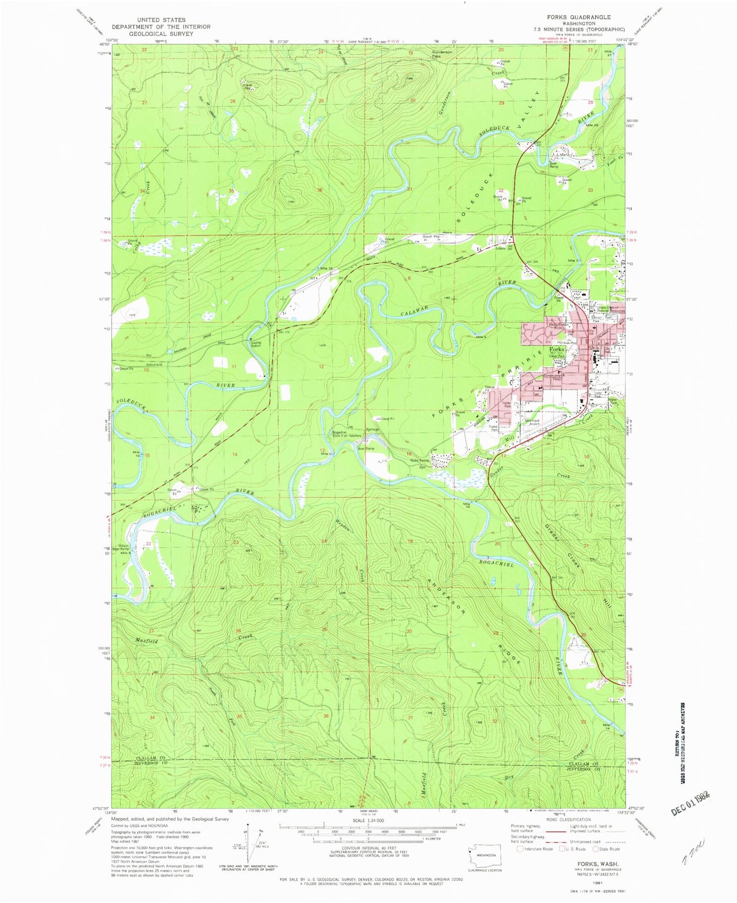
Classic USGS Forks Washington 7.5'x7.5' Topo Map
Couldn't load pickup availability
Historical USGS topographic quad map of Forks in the state of Washington. Map scale may vary for some years, but is generally around 1:24,000. Print size is approximately 24" x 27"
This quadrangle is in the following counties: Clallam, Jefferson.
The map contains contour lines, roads, rivers, towns, and lakes. Printed on high-quality waterproof paper with UV fade-resistant inks, and shipped rolled.
Contains the following named places: Anderson Ridge, Assembly of God Church, Calawah River, Calawah River Bridge, Calvary Chapel Forks, Campbell Quarry, Church of the Nazarene, City of Forks, Congregational Church, Department of Natural Resources Heliport, District Run Home School, Dry Creek, First Baptist Church, First Congregational Church, Forks, Forks Airport, Forks Alternative School, Forks Ambulance Service, Forks Bible Church, Forks City Hall, Forks Community Hospital, Forks Dam, Forks Elementary School, Forks High School, Forks Junior High School, Forks Library, Forks Middle School, Forks Mobile Home Park, Forks Police Department, Forks Post Office, Forks Prairie, Forks Timber Museum, Forks Transit Center, Forks Wastewater Treatment Plant, Fossil Creek, Grader Creek, Grader Creek Hill, Gunderson Creek, Gunderson Pass, Kingdom Hall of Jehovahs Witnesses, KLLM-FM (Forks), KVAC-AM (Forks), Marietta Mobile Home Court, Mill Creek, Muralts Mobile Home Park, Old Smokey Pit, Pacific Ranger District - Forks Office, Prince of Peace Lutheran Church, Quillayute Valley School District 402 Office, Rain Forest Mobile Home Park, Ripple Creek, Saint Anne's Church, Sol Duc Valley, South Fork Maxfield Creek, Tassel Creek, Tilicum Park, Wasankaris Mobile Home Park, Weeden Creek, Whitcomb Dimmel Pit, Willow Place Mobile Home Park, Wilson Ranch