MyTopo
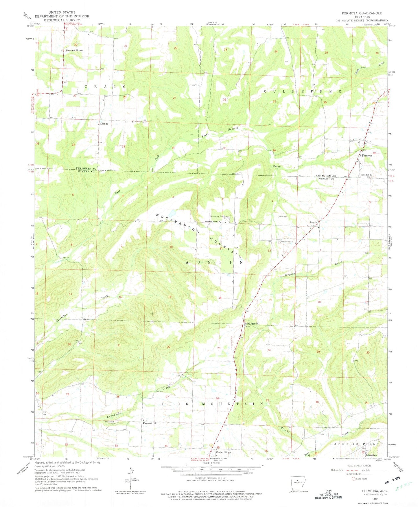
Classic USGS Formosa Arkansas 7.5'x7.5' Topo Map
Couldn't load pickup availability
Historical USGS topographic quad map of Formosa in the state of Arkansas. Map scale may vary for some years, but is generally around 1:24,000. Print size is approximately 24" x 27"
This quadrangle is in the following counties: Conway, Van Buren.
The map contains contour lines, roads, rivers, towns, and lakes. Printed on high-quality waterproof paper with UV fade-resistant inks, and shipped rolled.
Contains the following named places: Austin, Buck Branch, Center Ridge Baptist Church, Center Ridge Census Designated Place, Claude, East Fork Point Remove Site One Dam, East Fork Point Remove Site One Reservoir, East Fork Point Remove Site Two Dam, East Fork Point Remove Site Two Reservoir, Formosa, Formosa Church of Christ, Friendship, Halbrooks Cemetery, Hogans Creek, Mountain View Church, Pleasant Grove, Pleasant Hill, Pleasant Hill Cemetery, Scotland Area Fire and Emergency Medical Services, Sweet Home Church, Township of Austin, Township of Formosa, Township of Lick Mountain, Woolverton, Woolverton Mountain, Woolverton Mountain Cemetery