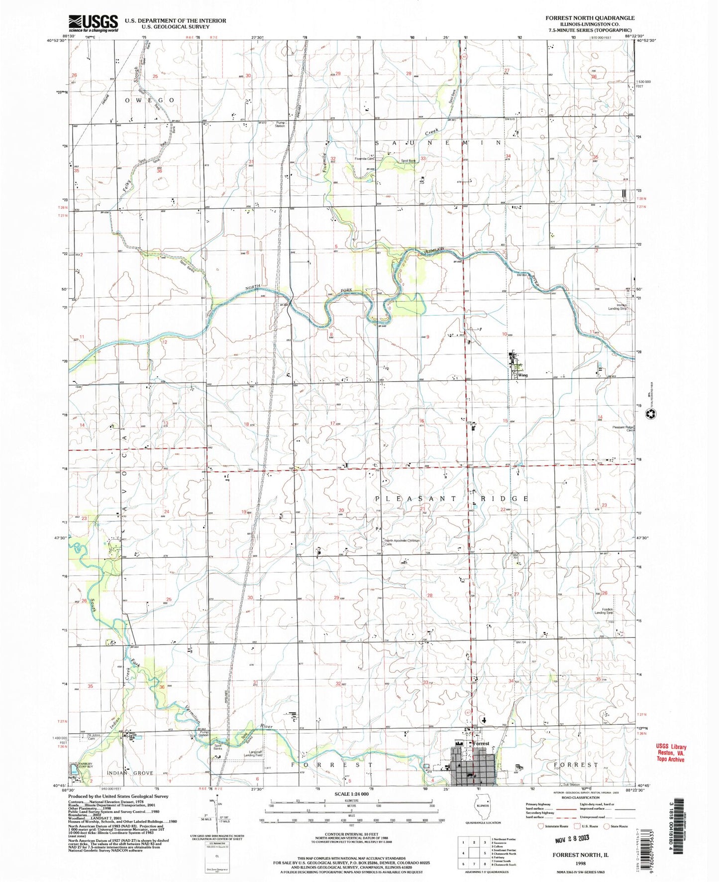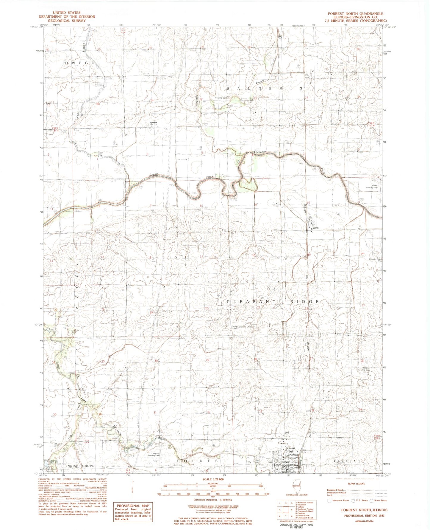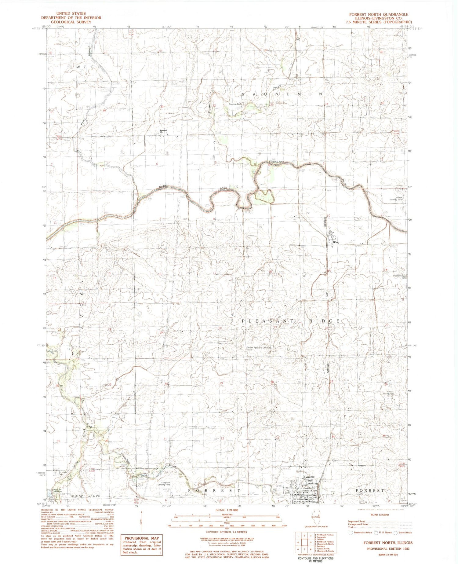
MyTopo
Classic USGS Forrest North Illinois 7.5'x7.5' Topo Map
Couldn't load pickup availability
Historical USGS topographic quad map of Forrest North in the state of Illinois. Map scale may vary for some years, but is generally around 1:24,000. Print size is approximately 24" x 27"
This quadrangle is in the following counties: Livingston.
The map contains contour lines, roads, rivers, towns, and lakes. Printed on high-quality waterproof paper with UV fade-resistant inks, and shipped rolled.
Contains the following named places: Banner School, Bell Top School, Carter School, Emmanuel United Methodist Church, Felky Slough, Five Mile Cemetery, Five Mile Grove, Fivemile Creek, Forrest, Forrest - Strawn - Wing Fire Protection District, Fosdick Airport, Fugate School, Gaines School, Immke Airport, Indian Creek, Langstaff Landing Field, Meadowbrook Elementary School, Metz School, Miller School, North Apostolic Christian Cemetery, North Church, Pearson School, Prairie Central Junior High School, Saint Johns Cemetery, Township of Pleasant Ridge, Vieley Branch Gaging Station, Vieley Bridge, Village of Forrest, Wing, ZIP Code: 61741