
MyTopo
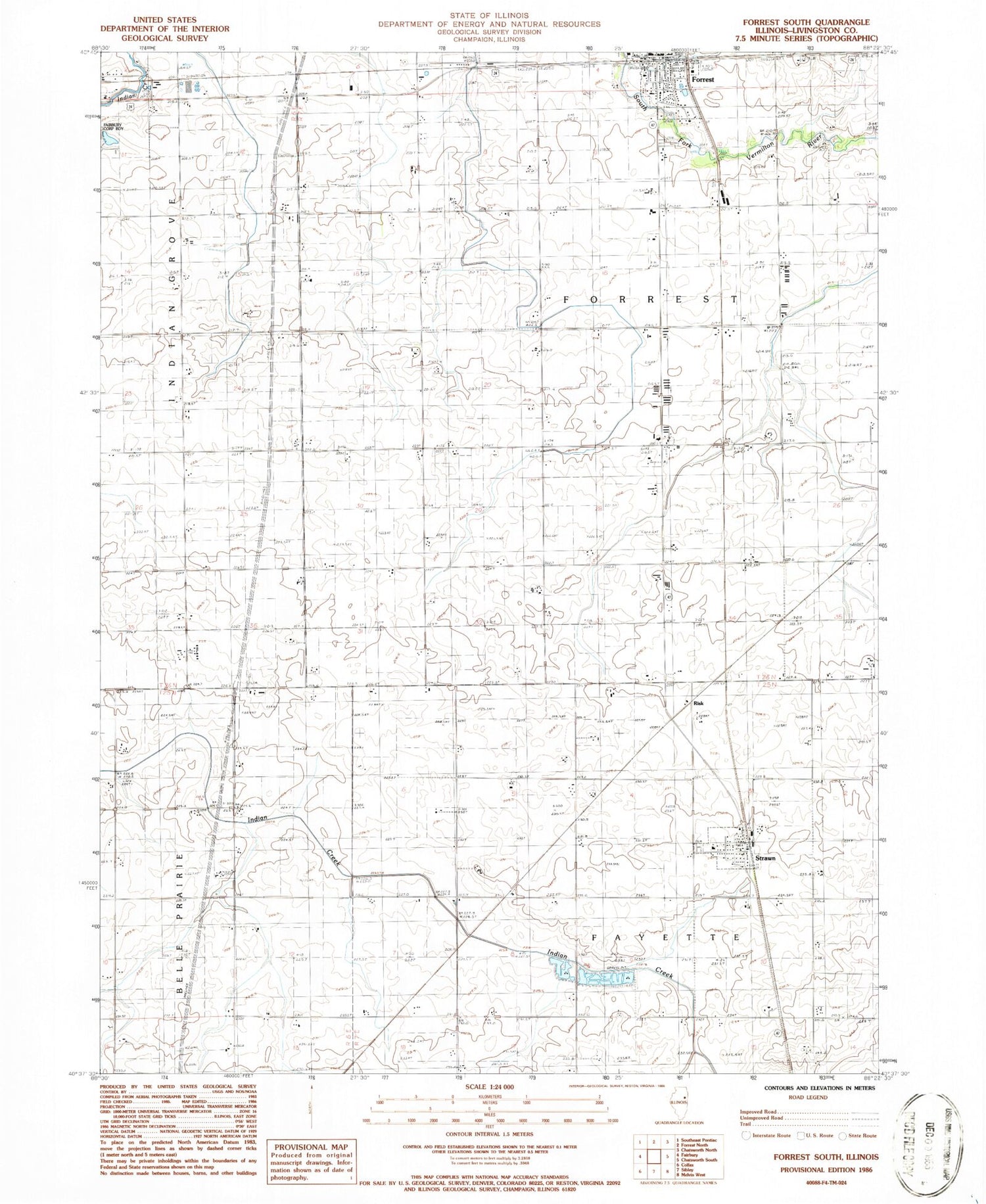
Classic USGS Forrest South Illinois 7.5'x7.5' Topo Map
Couldn't load pickup availability
Historical USGS topographic quad map of Forrest South in the state of Illinois. Map scale may vary for some years, but is generally around 1:24,000. Print size is approximately 24" x 27"
This quadrangle is in the following counties: Livingston.
The map contains contour lines, roads, rivers, towns, and lakes. Printed on high-quality waterproof paper with UV fade-resistant inks, and shipped rolled.
Contains the following named places: Bee Hive School, Broadhead School, Center School, Five Mile Cemetery, Forrest - Strawn - Wing Fire Protection District, Forrest Post Office, Forrest Township Cemetery, Frye School, Keeley School, Knaur School, Murphy Station, Potter School, Risk, Rudd School, Saint Rose Catholic Church, South Apostolic Christian Cemetery, South Church, Strawn, Strawn Cemetery, Strawn High School, Strawn Post Office, Strawn United Methodist Church, Township of Fayette, Township of Forrest, Village of Strawn, Village Park, Weeks School, ZIP Code: 61775


