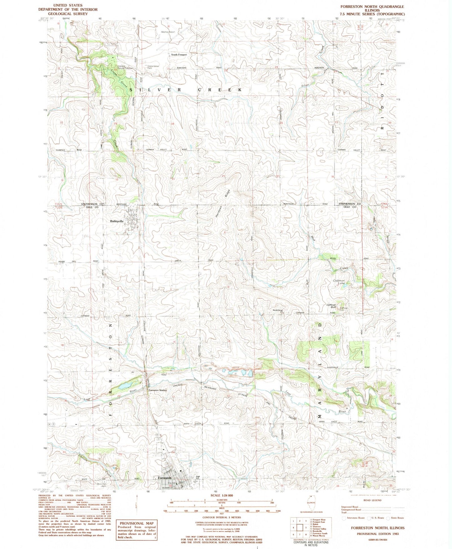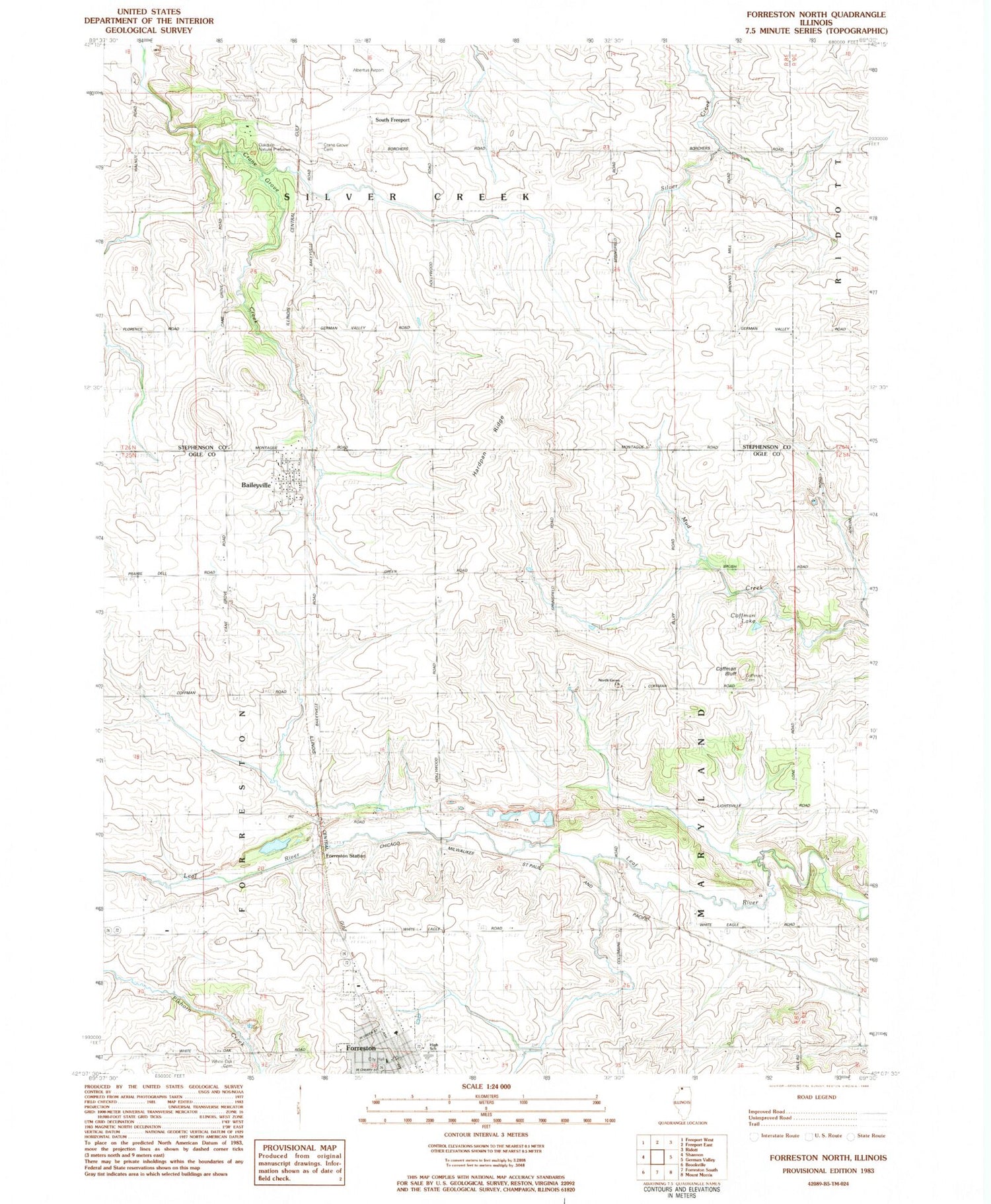
MyTopo
Classic USGS Forreston North Illinois 7.5'x7.5' Topo Map
Couldn't load pickup availability
Historical USGS topographic quad map of Forreston North in the state of Illinois. Map scale may vary for some years, but is generally around 1:24,000. Print size is approximately 24" x 27"
This quadrangle is in the following counties: Ogle, Stephenson.
The map contains contour lines, roads, rivers, towns, and lakes. Printed on high-quality waterproof paper with UV fade-resistant inks, and shipped rolled.
Contains the following named places: Albertus Airport, Baileyville, Baileyville Baptist Church, Baileyville Census Designated Place, Baileyville Post Office, Baileyville Reformed Church, Coffman Bluff, Coffman Cemetery, Coffman Lake, Collman School, Crane School, Cranes Grove Cemetery, Cyclone Heights School, Forreston, Forreston City Hall, Forreston Fire Protection District, Forreston High School, Forreston Post Office, Forreston Station, Gravel Pit School, Green Prairie School, Hardpan Ridge, Kutz Quarry, Maple Hill School, Myers Quarry, North Grove Church, North Grove Zion Reformed Cemetery, Oakdale Nature Preserve, Pleasant Hill School, Prairie Hill School, Rummel RLA Airport, Silver Creek Center School, South Freeport, Sunnyside School, Timber Ridge Mobile Home Park, Township of Maryland, Township of Silver Creek, Village of Forreston, White Oak Cemetery, White Oak School, ZIP Code: 61007