MyTopo
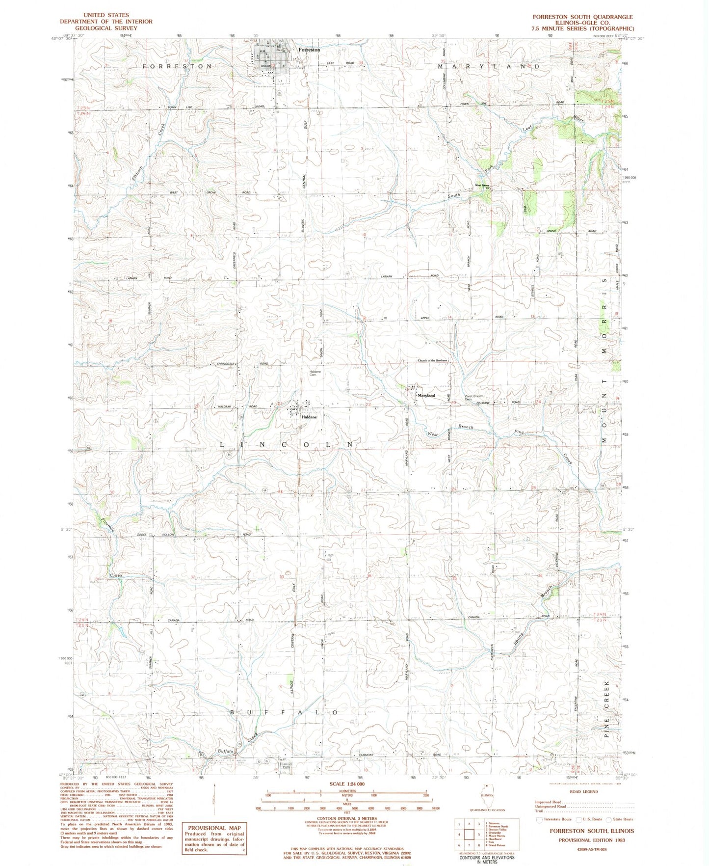
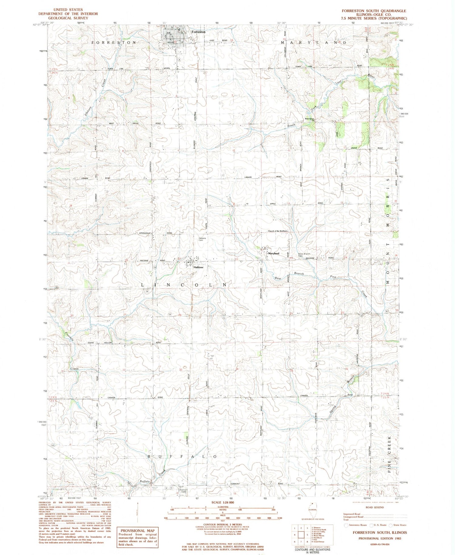
Classic USGS Forreston South Illinois 7.5'x7.5' Topo Map
Couldn't load pickup availability
Historical USGS topographic quad map of Forreston South in the state of Illinois. Map scale may vary for some years, but is generally around 1:24,000. Print size is approximately 24" x 27"
This quadrangle is in the following counties: Ogle.
The map contains contour lines, roads, rivers, towns, and lakes. Printed on high-quality waterproof paper with UV fade-resistant inks, and shipped rolled.
Contains the following named places: B and E Farm, Brand School, Brick School, Church of the Brethren, Eldorado School, Eureka School, Excelsior School, Forreston Grade and Junior High School, Gratatum School, Haldane, Haldane Cemetery, Haldane Post Office, Haldane School, Marr School, Maryland, Oakwood Farm, Springdale School, Summer Hill School, Township of Lincoln, West Branch Cemetery, West Branch School, West Grove Cemetery, West Grove Church, ZIP Code: 61030