
MyTopo
Classic USGS Forsyth Reservoir Utah 7.5'x7.5' Topo Map
Couldn't load pickup availability
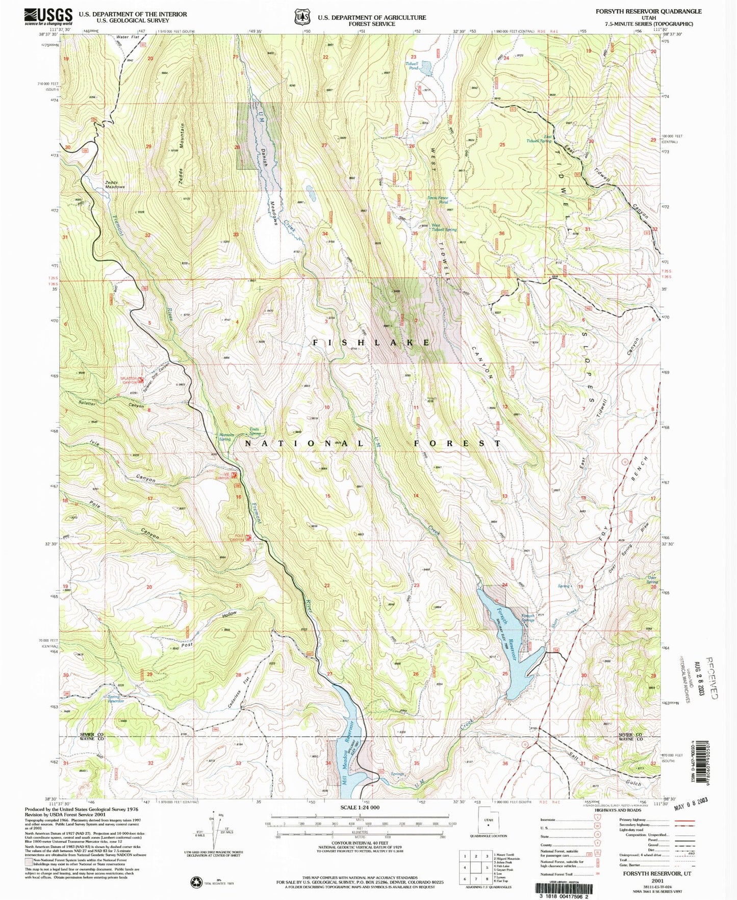
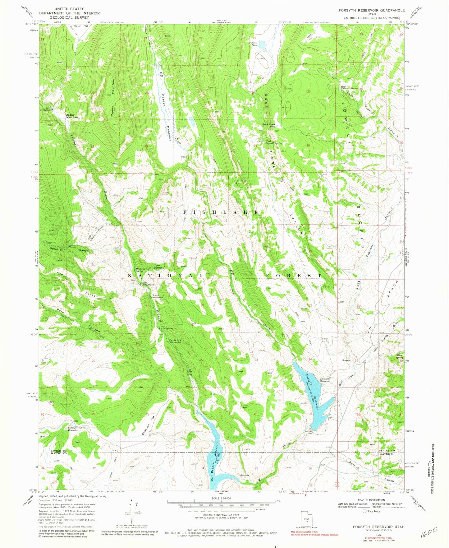
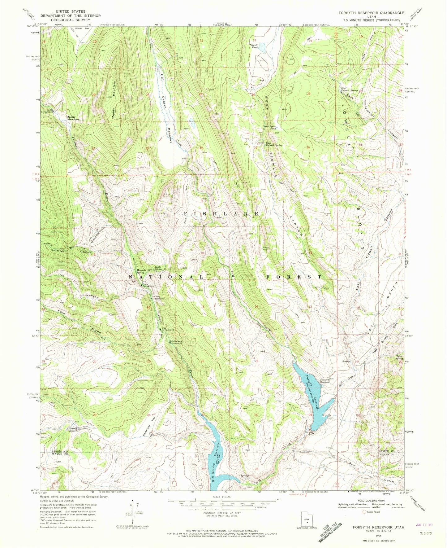
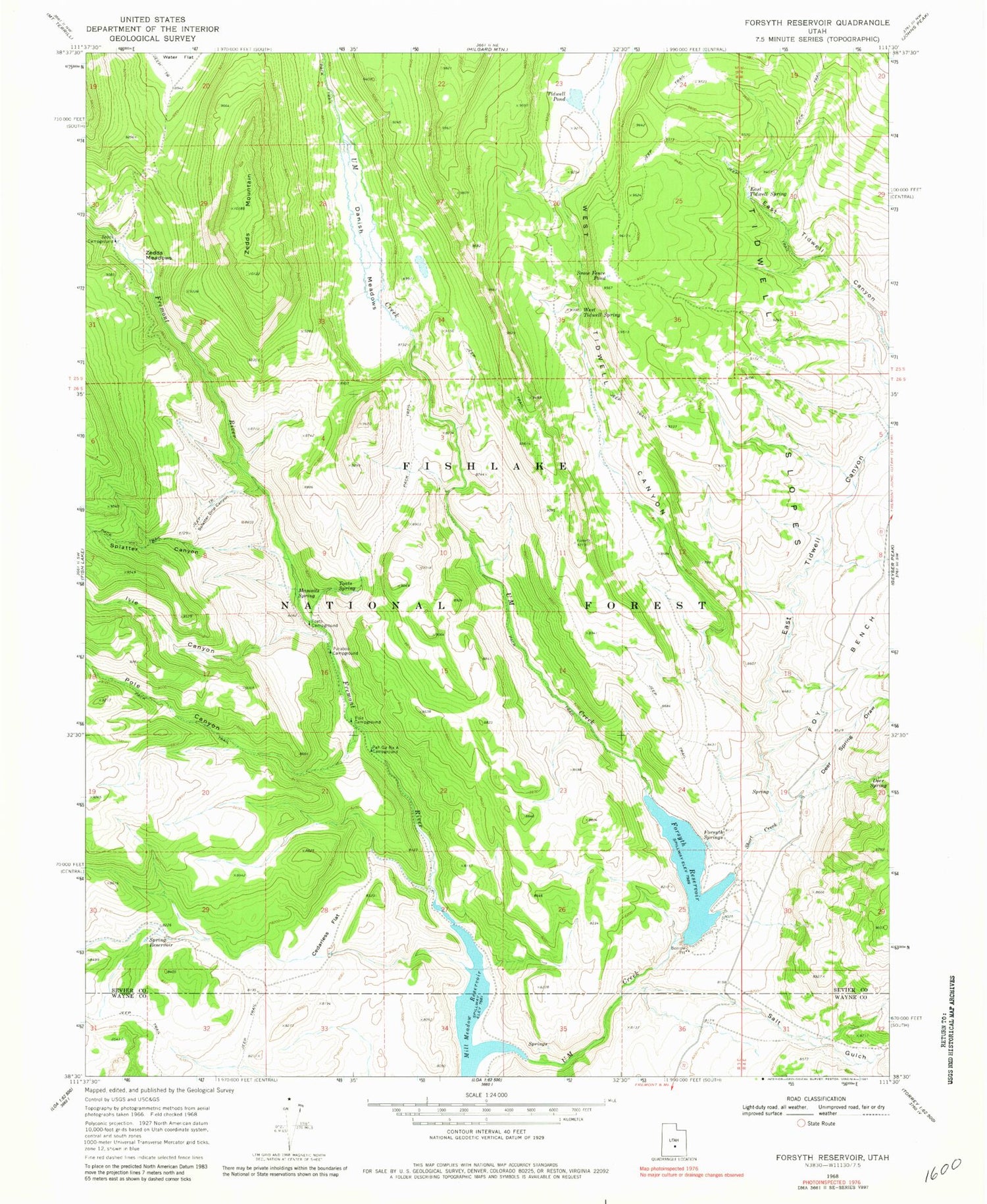
Historical USGS topographic quad map of Forsyth Reservoir in the state of Utah. Typical map scale is 1:24,000, but may vary for certain years, if available. Print size: 24" x 27"
This quadrangle is in the following counties: Sevier, Wayne.
The map contains contour lines, roads, rivers, towns, and lakes. Printed on high-quality waterproof paper with UV fade-resistant inks, and shipped rolled.
Contains the following named places: Cedarless Flat, Danish Meadows, Deer Spring, Deer Spring Draw, East Tidwell Canyon, East Tidwell Spring, Forsyth Reservoir, Forsyth Springs, Foy Bench, Ivie Canyon, Mamoits Spring, Pah Ga Ne A Campground, Paraboo Campground, Pole Campground, Pole Canyon, Salt Gulch, Short Creek, Snow Fence Pond, Splatter Canyon, Splatter Drip Canyon, Spring Reservoir, Tidwell Pond, Tidwell Slopes, Toats Campground, Toats Spring, U M Creek, West Tidwell Canyon, West Tidwell Spring, Zedds Campground, Zedds Meadows, Zedds Mountain, Mill Meadow Reservoir, Forsyth Dam, Post Hollow, Cedarless Flat, Danish Meadows, Deer Spring, Deer Spring Draw, East Tidwell Canyon, East Tidwell Spring, Forsyth Reservoir, Forsyth Springs, Foy Bench, Ivie Canyon, Mamoits Spring, Pah Ga Ne A Campground, Paraboo Campground, Pole Campground, Pole Canyon, Salt Gulch, Short Creek, Snow Fence Pond, Splatter Canyon, Splatter Drip Canyon, Spring Reservoir, Tidwell Pond, Tidwell Slopes, Toats Campground, Toats Spring, U M Creek, West Tidwell Canyon, West Tidwell Spring, Zedds Campground, Zedds Meadows, Zedds Mountain, Mill Meadow Reservoir, Forsyth Dam, Post Hollow