MyTopo
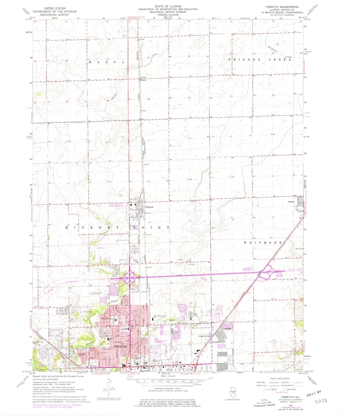
Classic USGS Forsyth Illinois 7.5'x7.5' Topo Map
Couldn't load pickup availability
Historical USGS topographic quad map of Forsyth in the state of Illinois. Map scale may vary for some years, but is generally around 1:24,000. Print size is approximately 24" x 27"
This quadrangle is in the following counties: Macon.
The map contains contour lines, roads, rivers, towns, and lakes. Printed on high-quality waterproof paper with UV fade-resistant inks, and shipped rolled.
Contains the following named places: Belle Prairie School, Boiling Springs Cemetery, Boiling Springs Park, Boiling Springs School, Brettwood Village Shopping Center, Brush College Industrial Park, Cresthaven Country Club, Cresthaven Park, Decatur Ambulance Service Post 2, Decatur Correctional Center, Decatur Fire Department Station 5, East Mound Park, Emery, Fair Play School, Flood School, Forsyth, Forsyth Baptist Church, Forsyth Grade School, Forsyth Post Office, Forsyth Public Library, Forsyth Recreation Center, Forsyth United Methodist Church, Forsyth Village Hall, Greendell Park, Greens Switch, Hickory Point Fire Protection District, Hickory Point Golf Course, Hickory Point Mall Shopping Center, Independence School, Larkdale, Macon County Fairgrounds, Macon County Poor Farm, Magee School, Memorial Post Office, Meyer Clinic, Miller School, Model School, Mound Middle School, Moundford Plaza Shopping Center, Northland Shopping Center, Our Lady of Lourdes School, Parsons Elementary School, Pleasant Valley School, Progress School, Renshaw School, Richland Community College, Spring Creek Plaza Shopping Center, Stephen Decatur High School, Stevenson Elementary School, Township of Hickory Point, Village of Forsyth, Village Park, White School, WSOY-AM (Decatur), WSOY-FM (Decatur), ZIP Codes: 62526, 62535, 62554