MyTopo
Classic USGS Fort Ann New York 7.5'x7.5' Topo Map
Couldn't load pickup availability
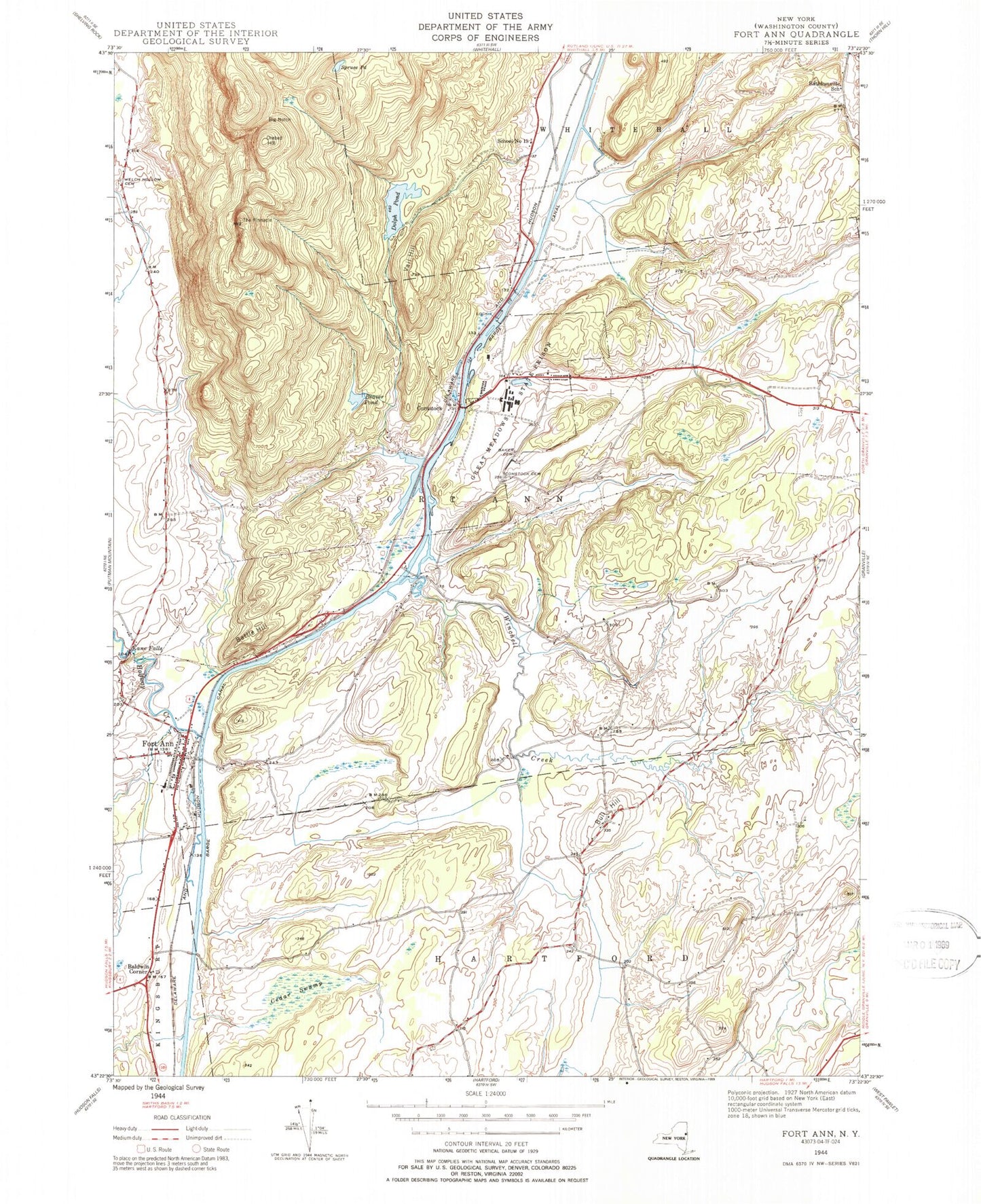
Historical USGS topographic quad map of Fort Ann in the state of New York. Map scale may vary for some years, but is generally around 1:24,000. Print size is approximately 24" x 27"
This quadrangle is in the following counties: Washington.
The map contains contour lines, roads, rivers, towns, and lakes. Printed on high-quality waterproof paper with UV fade-resistant inks, and shipped rolled.
Contains the following named places: B and C Farms, Baker Cemetery, Baldwin Corner, Baldwin Corners Road Bridge, Battle Hill, Beaver Pond, Big Notch, Brookefield Farm, Bull Hill, Cedar Swamp, Champlain Canal, Clay Hill Road Bridge, Comstock, Comstock Cemetery, Comstock Post Office, Deweys Bridge Quarry, Deweys Bridge Road Bridge, Dolph Pond, Fort Ann, Fort Ann Cemetery, Fort Ann Central School, Fort Ann Post Office, Fort Ann Quarry, Fort Ann Volunteer Fire Company, Great Meadow Correctional Facility, Green Thumb Nursery, Halfway Brook, Hartford Quarry, Holstein Heaven Farm, Kane Falls, Milton Farms, Orebed Hill, Rathbunville School, Saint Ann's Catholic Church, School Number 13, Spruce Pond, The Pinnacle, United Protestant Church, Vail Hill, Village of Fort Ann, Washington Correctional Facility, Welch Hollow Cemetery, Whitehall Drive-In, Winchell Creek, WNYV-FM (Whitehall), ZIP Code: 12821