MyTopo
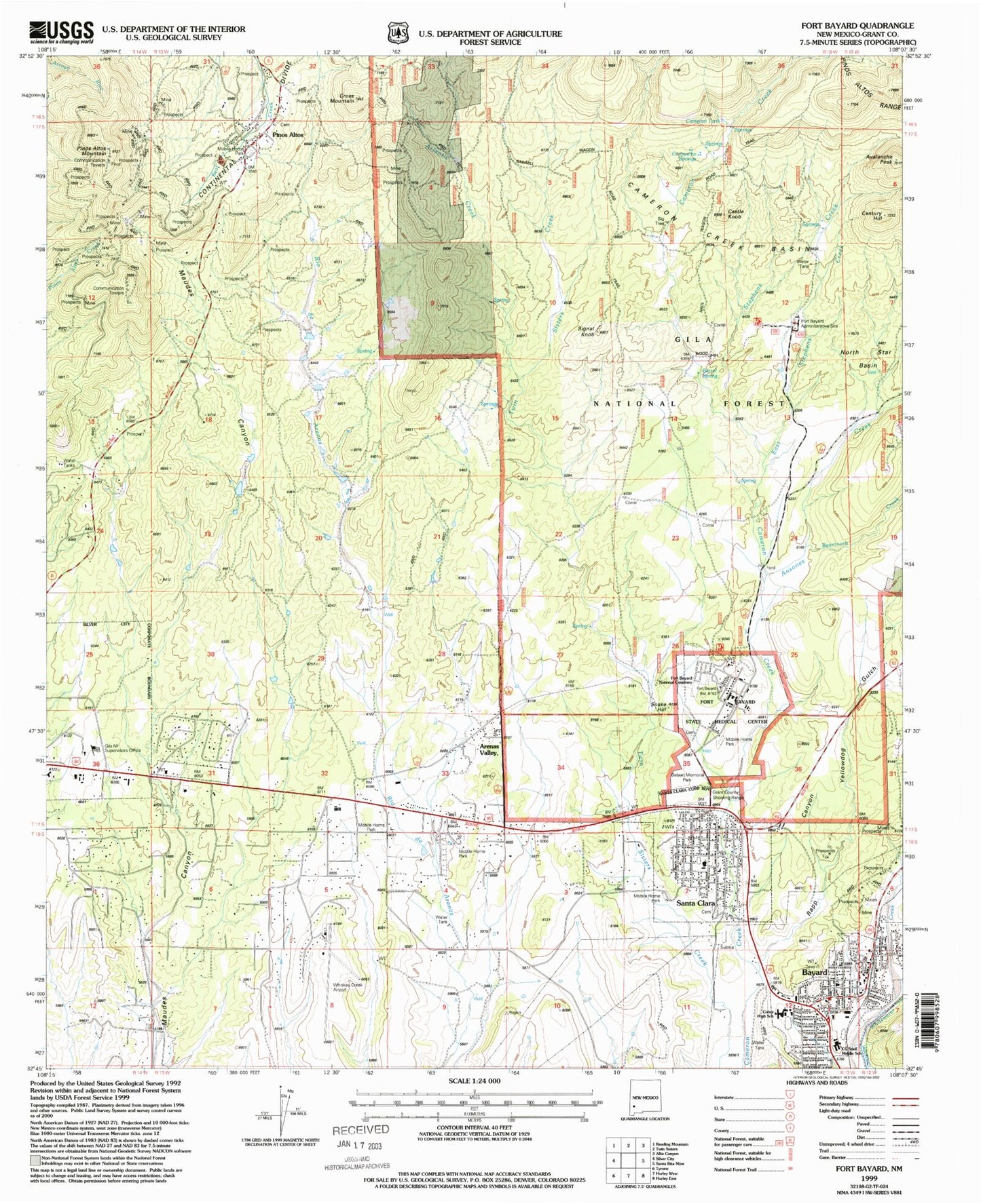
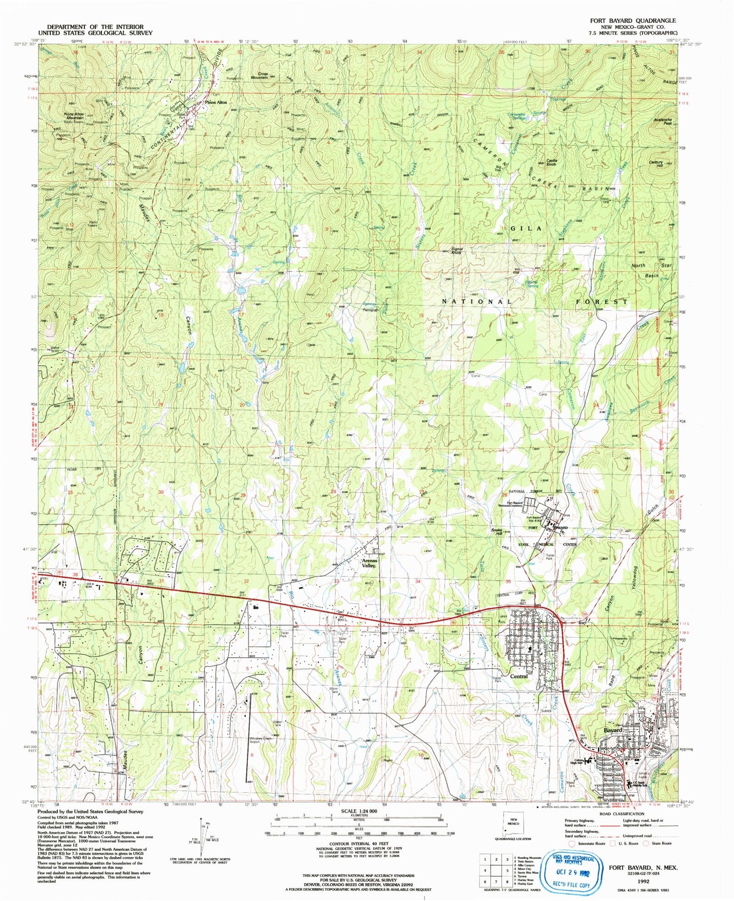
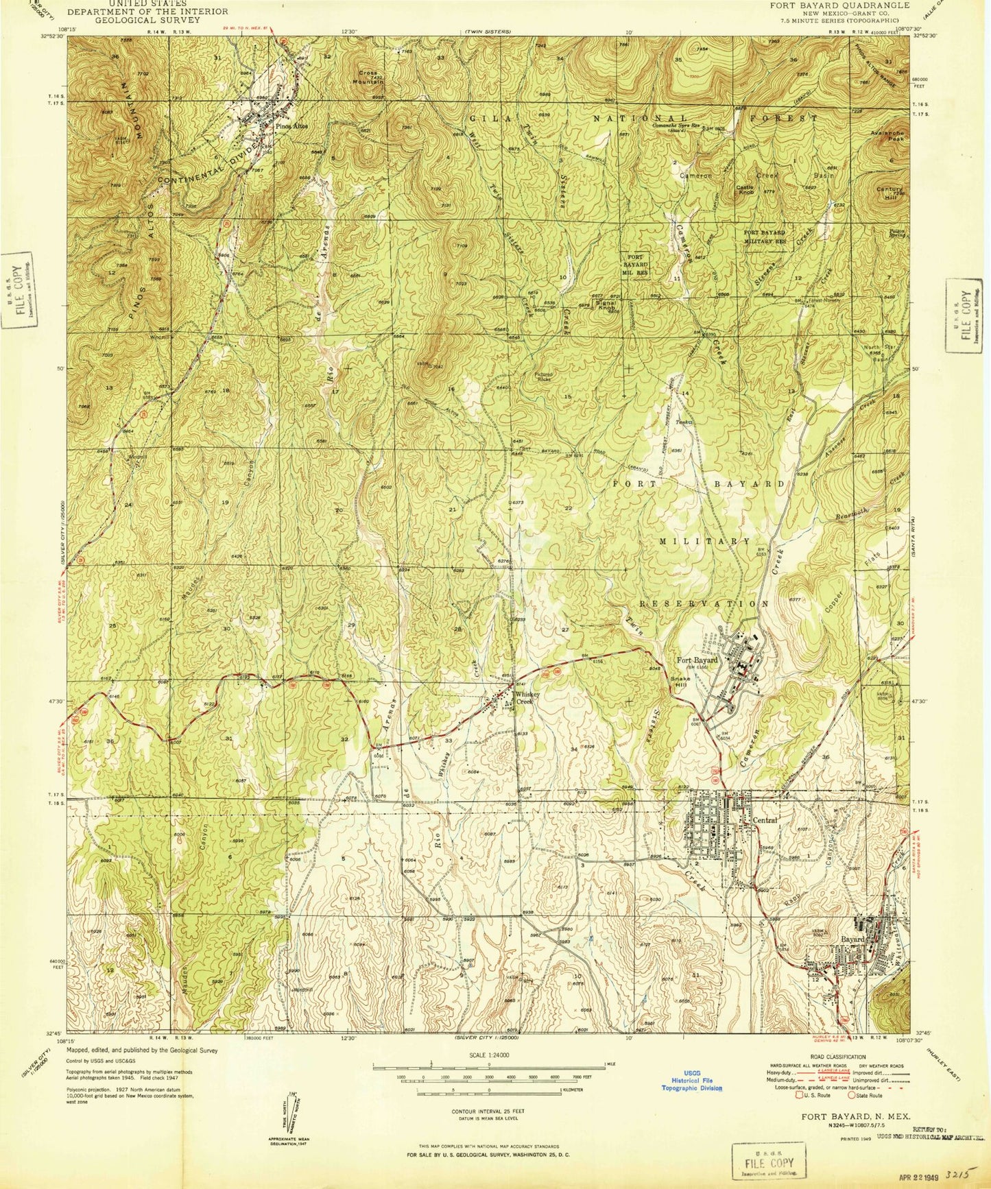
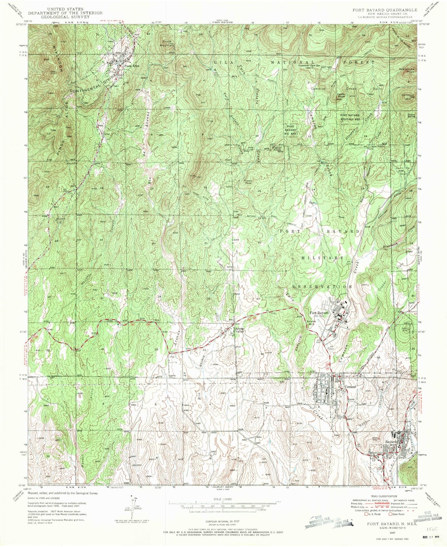
Classic USGS Fort Bayard New Mexico 7.5'x7.5' Topo Map
Couldn't load pickup availability
Historical USGS topographic quad map of Fort Bayard in the state of New Mexico. Typical map scale is 1:24,000, but may vary for certain years, if available. Print size: 24" x 27"
This quadrangle is in the following counties: Grant.
The map contains contour lines, roads, rivers, towns, and lakes. Printed on high-quality waterproof paper with UV fade-resistant inks, and shipped rolled.
Contains the following named places: Comanche Springs Reservoir, Fort Bayard Administration Site, Fort Bayard Reservoir, Seruis Corral, Fort Bayard State Hospital, Silver City District Ranger Office, Badlands Corral, Barrel Spring, Big Tree, Comanche Springs, Fort Bayard National Cemetery, Fort Bayard Medical Center, Sawmill Wagon Road Trail, Whiskey Creek Airport, Wood Haul Wagon Road Trail, Bayard Shopping Center, Seventh Day Adventist Church, First Baptist Church, Valley Community Church UCC, The Church of Jesus Christ of Latter Day Saints, Our Lady of Fatima Parish, Bayard United Methodist Church, Apostolic Church, Fort Bayard Hospital Springs, Silver Christian Center, Ansones Creek, Arenas Valley, Avalanche Peak, Bayard, Beartooth Creek, Cameron Creek Basin, Castle Knob, Century Hill, Cross Mountain, East Stephens Creek, Fort Bayard, Pinos Altos Mountain, Rapp Canyon, Signal Knob, Snake Hill, Atlantic Creek, Whiskey Creek, Snell Mid School, Cobre High School, Kept Woman Mine, Lion Mine, Lion Number 2 Mine, Little Key, Manhattan Mine, Manhattan and Pleasant View, Mountain Key Mine, Oro Grande, Pacific Mine, Pipe Stem, Silver Cell Mine, Texas Mine, Three Brothers Mine, Arizona Mine, Atlantic Mine, Betty-Jo, Deep Down Mine, G 216 Water Well, G 197 Water Well, 00356 Water Well, 00364 Water Well, 00351 Water Well, 00368 Water Well, 00214 Water Well, 00202 Water Well, 00208 Water Well, 00191 Water Well, 00188 Water Well, 00190 Water Well, 00187 Water Well, 00179 Water Well, 00171 Water Well, 00021 Water Well, 00181 Water Well, 00183 Water Well, 00382 Water Well, 00328 Water Well, 00381 Water Well, 00387 Water Well, 00241 Water Well, 00189 Water Well, 10012 Water Well, 00196 Water Well, 00360 Water Well, 00380 Water Well, 00358 Water Well, 00327 Water Well, 10022 Water Well, 00388 Water Well, Fort Bayard (historical), Gospel Line Church, Church of Christ, Gospel Line Church, Santa Clara Parish, Santa Clara, Pinos Altos, Stephens Creek, Bayard Spanish Baptist Church, The Bible Church, Rural Bookmobile Southwest Library, Fort Bayard Medical Center Library, Bayard Public Library, Fort Bayard 1866-1900 Historical Marker, Pinos Altos Weather Station, Fort Bayard Weather Station, Bayard Historical Marker, Fort Bayard National Cemetery Historical Marker, Gold Avenue Methodist Episcopal Church Historic Site, Bayard Elementary School, Central Elementary School, Pinos Altos Historic District, Fort Bayard Post Office (historical), Bayard Post Office, Arenas Valley Post Office, KNFT-AM (Bayard), KNFT-FM (Bayard), KSCQ-FM (Silver City), KWNM-TV (Silver City), Fort Bayard Military Reservation (historical), Santa Clara Division, Cameron Tank, Central, Yellowdog Gulch, City of Bayard, Village of Santa Clara, Arenas Valley Census Designated Place, Pinos Altos Census Designated Place, Rosedale Census Designated Place, Pinos Altos Volunteer Fire Rescue, Santa Clara Volunteer Fire and Rescue, Whiskey Creek Volunteer Fire Department, Bayard Fire Department, Fort Bayard Volunteer Fire Department, Santa Clara Police Department, Bayard Police Department, Santa Clara Post Office, Comanche Springs Reservoir, Fort Bayard Administration Site, Fort Bayard Reservoir, Seruis Corral, Fort Bayard State Hospital, Silver City District Ranger Office, Badlands Corral, Barrel Spring, Big Tree, Comanche Springs, Fort Bayard National Cemetery, Fort Bayard Medical Center, Sawmill Wagon Road Trail, Whiskey Creek Airport, Wood Haul Wagon Road Trail, Bayard Shopping Center, Seventh Day Adventist Church, First Baptist Church, Valley Community Church UCC, The Church of Jesus Christ of Latter Day Saints, Our Lady of Fatima Parish, Bayard United Methodist Church, Apostolic Church, Fort Bayard Hospital Springs, Silver Christian Center, Ansones Creek, Arenas Valley, Avalanche Peak, Bayard, Beartooth Creek, Cameron Creek Basin, Castle Knob, Century Hill, Cross Mountain, East Stephens Creek, Fort Bayard, Pinos Altos Mountain, Rapp Canyon, Signal Knob, Snake Hill, Atlantic Creek, Whiskey Creek, Snell Mid School, Cobre High School, Kept Woman Mine, Lion Mine, Lion Number 2 Mine, Little Key, Manhattan Mine, Manhattan and Pleasant View, Mountain Key Mine, Oro Grande, Pacific Mine, Pipe Stem, Silver Cell Mine, Texas Mine, Three Brothers Mine, Arizona Mine, Atlantic Mine, Betty-Jo, Deep Down Mine, G 216 Water Well, G 197 Water Well, 00356 Water Well, 00364 Water Well, 00351 Water Well, 00368 Water Well, 00214 Water Well, 00202 Water Well, 00208 Water Well, 00191 Water Well, 00188 Water Well, 00190 Water Well, 00187 Water Well, 00179 Water Well, 00171 Water Well, 00021 Water Well, 00181 Water Well, 00183 Water Well, 00382 Water Well, 00328 Water Well, 00381 Water Well, 00387 Water Well, 00241 Water Well, 00189 Water Well, 10012 Water Well, 00196 Water Well, 00360 Water Well, 00380 Water Well, 00358 Water Well, 00327 Water Well, 10022 Water Well, 00388 Water Well, Fort Bayard (historical), Gospel Line Church, Church of Christ


