
MyTopo
Classic USGS Fort Belvoir Virginia 7.5'x7.5' Topo Map
Couldn't load pickup availability
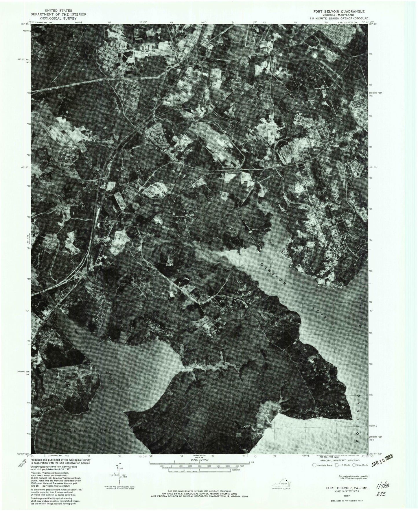
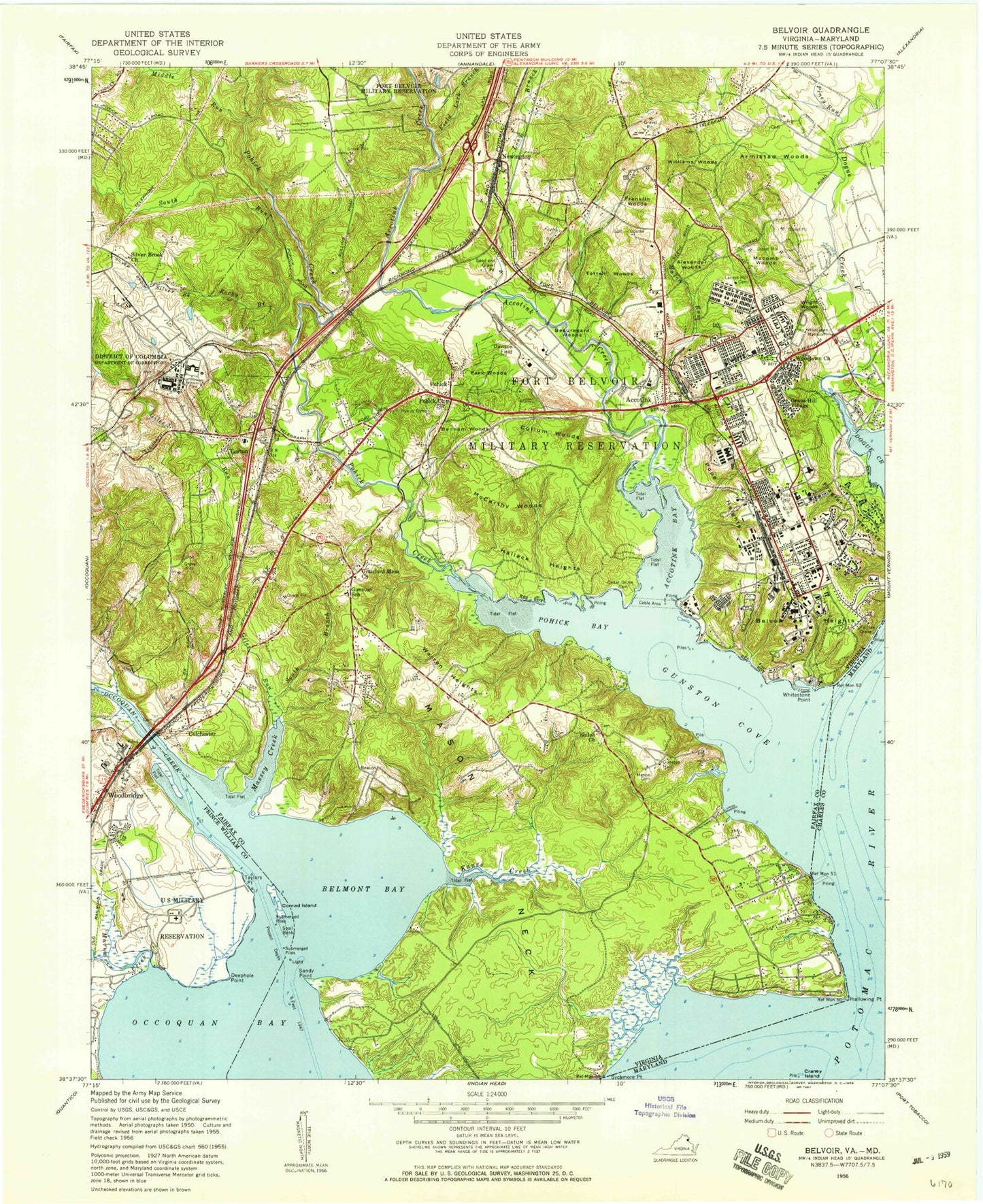
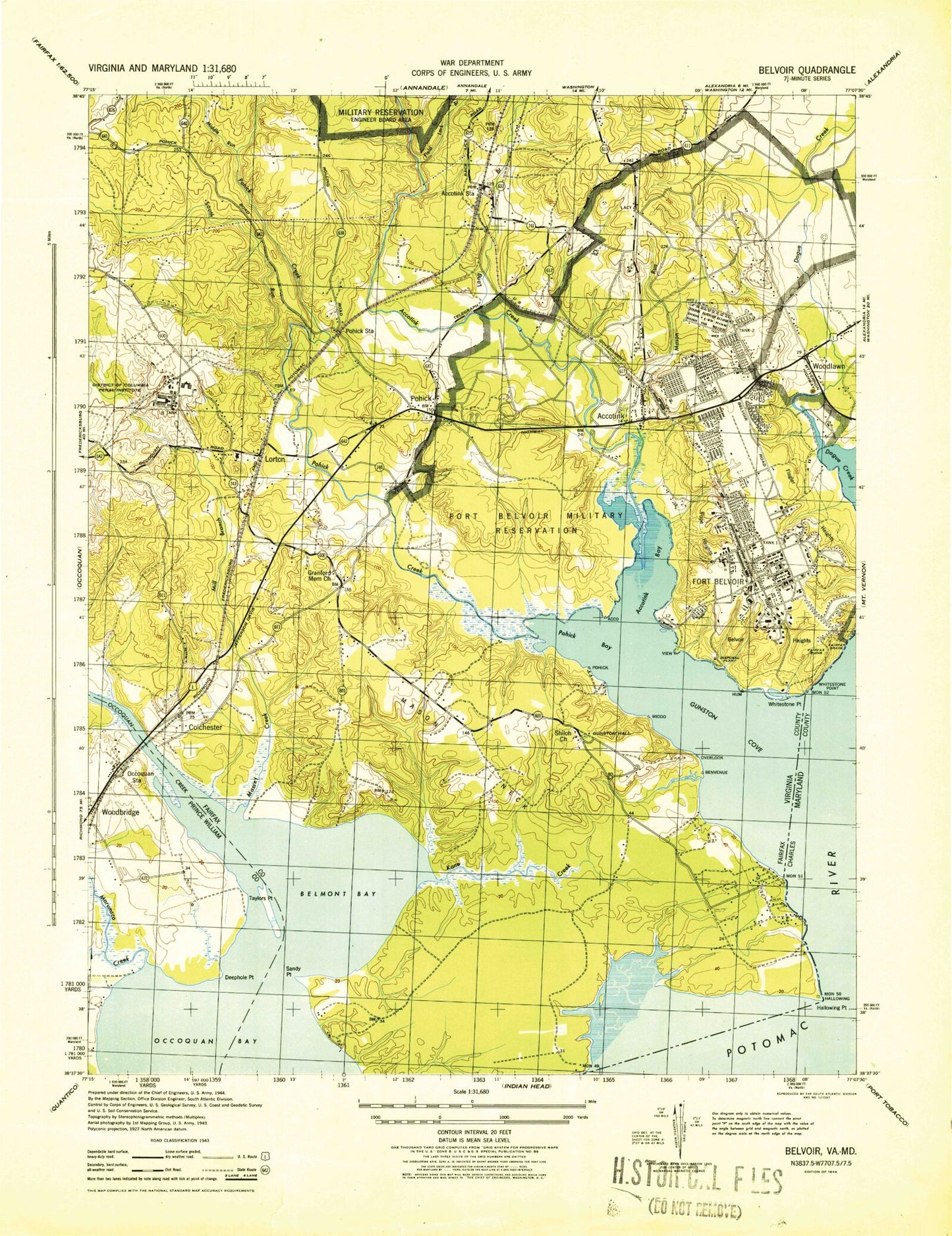
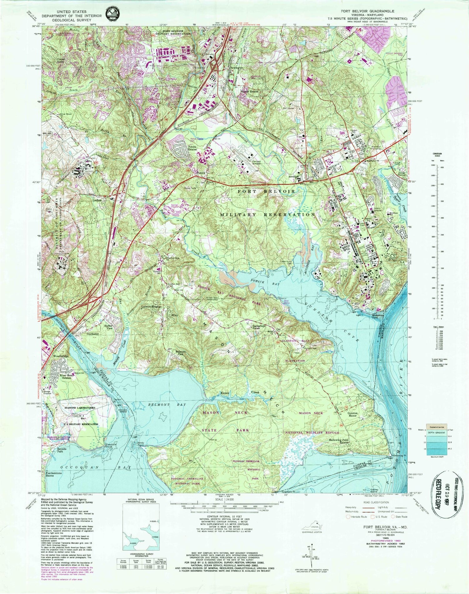
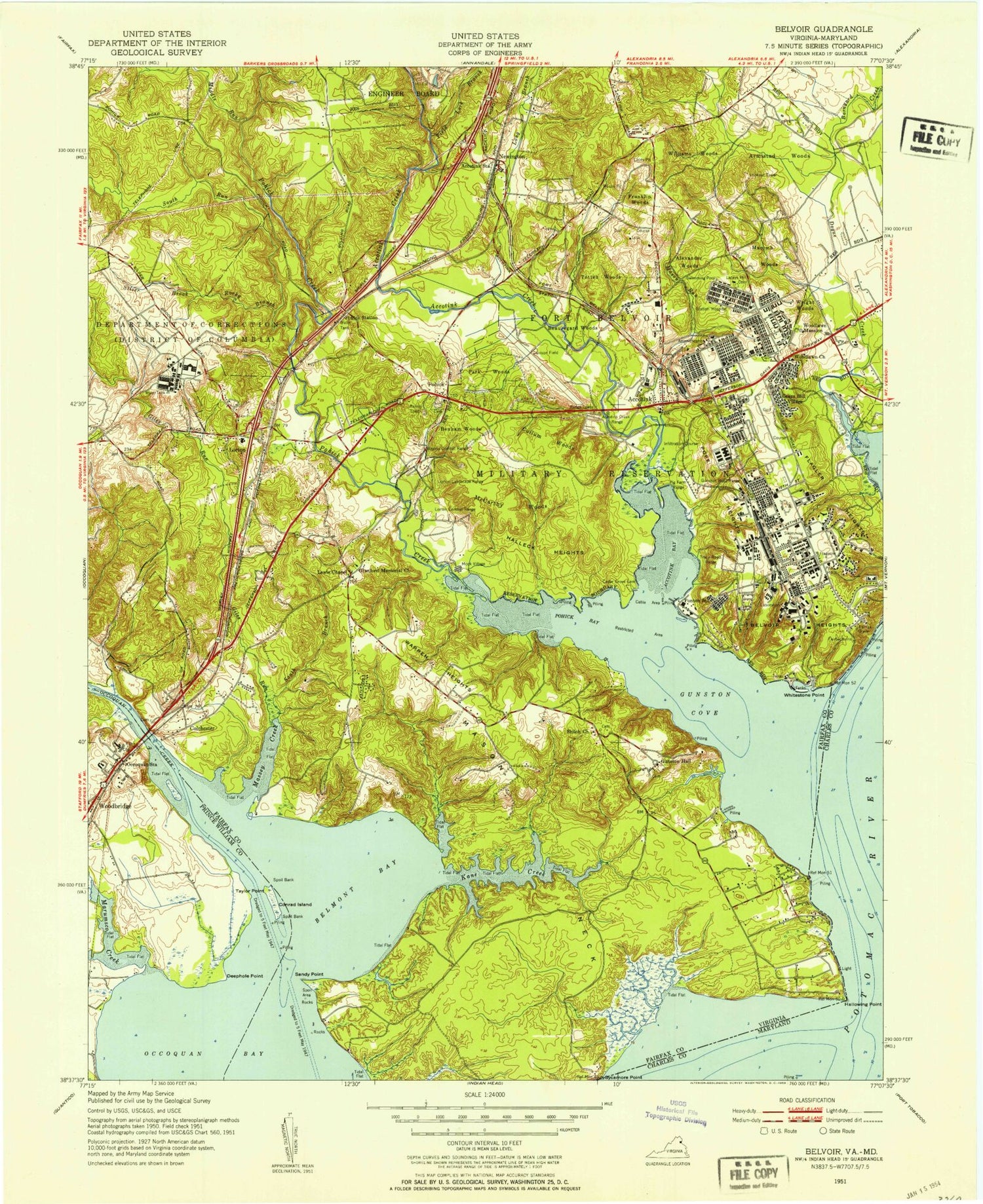
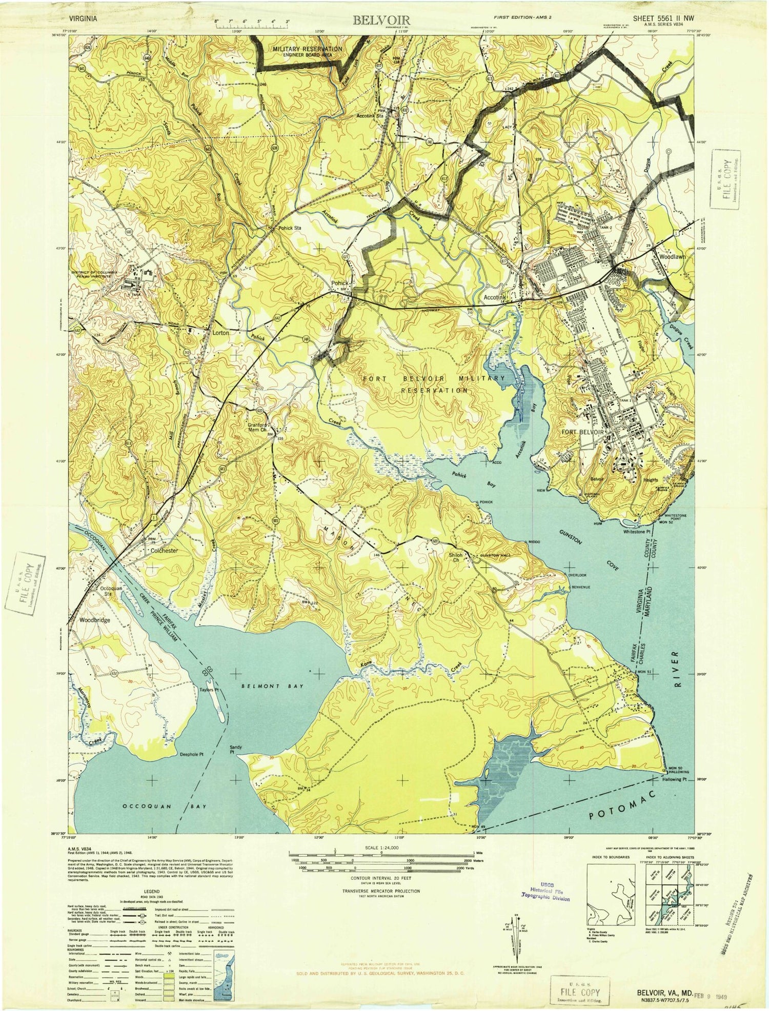
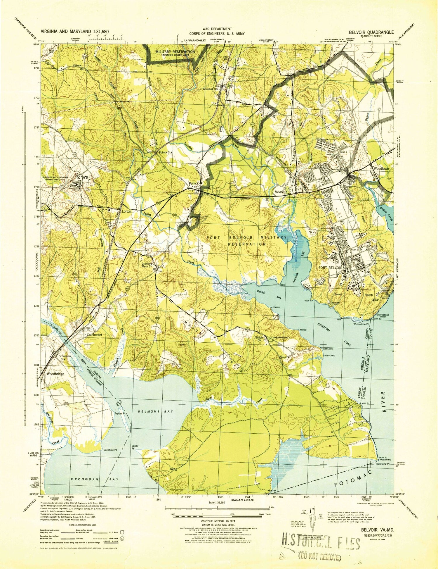
Historical USGS topographic quad map of Fort Belvoir in the states of Virginia, Maryland. Typical map scale is 1:24,000, but may vary for certain years, if available. Print size: 24" x 27"
This quadrangle is in the following counties: Charles, Fairfax, Prince William.
The map contains contour lines, roads, rivers, towns, and lakes. Printed on high-quality waterproof paper with UV fade-resistant inks, and shipped rolled.
Contains the following named places: Accotink Bay, Barden Elementary School, Belmont Bay, Cedar Grove Cemetery, Cheney School, Conrad Island, Cranford Memorial Church, DeWitt Hospital, Deephole Point, Field Lark Branch, Giles Run, Gunston Cove, Gunston Hall, Gunston Hall Church, Gunston Elementary School, Kanes Creek, Long Branch, Markham School, Marumsco Creek, Mason Neck, Mason Run, Massey Creek, Middle Run, Occoquan River, Piney Run, Pohick Bay, Pohick Church, Pohick Creek, Pullen Field, Remey Tomb, Rocky Branch, Sandy Point, Shiloh Church, Silver Brook, Silver Brook Church, South Branch Massey Creek, South Run, Springfield Farms, Sycamore Point, Taylors Point, Whitestone Point, Wilson Scout Reservation, Woodlawn Church, Mason Neck National Wildlife Refuge, Woodlawn Plantation, Accotink Creek, Hilltop Dam, Hilltop Pond, Accotink, Bayside Park, Belmont Park, Chapel Acres, Colchester, Featherstone Shores, Gunston Heights, Gunston Manor, Hallowing Point Estates, Harbor View, Hunter Estates, Lorton, Newington, Pohick, Pohick Estates, River Bend Estates, Wiley, Woodbridge, Belmont Elementary School, Bridgewood Shopping Center, Diamond Laboratories, Gordon Plaza Shopping Center, Marumsco Creek Community Center, Marumsco National Wildlife Refuge, Occoquan Station (historical), Riverbend Park, Veterans Memorial Park, All Saints Chapel, Belvoir Chapel, Belvoir Neck, Fairfax Grave, Fort Humphries (historical), Frenchmans Point, Fullerton Industrial Park, Gunston Hall Plantation, Gunston Hall School (historical), Hayfield Elementary School, Humphrey Engineering Center, Interstate Industrial Park, Lebanon School (historical), Lorton Station Elementary School, Lorton Post Office, Lorton Reformatory, Lorton Valley School (historical), Mason Neck State Park, Newington Park, Newington Post Office, Occoquan Church (historical), Pohick Bay Regional Park, Pohick Episcopal Church Cemetery, Pohick Estates Park, Pohick Industrial Park, Pohick Neck, Potters Hill School (historical), Saint Martins Chapel, Saratoga Shopping Center, South Run Stream Valley Park, United States Army Engineer Museum, Vogan Dental Clinic, Woodlawn, Woodlawn Mansion, Camp A A Humphreys (historical), Mount Vernon District, Saratoga Elementary School, Newington Forest Elementary School, Fort Belvoir Primary School, Raceway Farms, Newberry Station, Village of Mount Air, Springfield Oaks, Terre Grande, Rollingwood, Virginia 95 Industrial Park, Newington Industrial Park, Allen Industrial Park, Hilltop Industrial Park, Newington Commerce Center, Gateway 95 Business Park, Alban Industrial Center, Kingstowne Library, Lorton Library, Pope-Leighey House, Accotink United Methodist Church Cemetery, Accotink United Methodist Church, Fairfax County Fire and Rescue Department Station 19, Fairfax County Fire and Rescue Department Station 20 Gunston, Fairfax County Fire and Rescue Department Station 37 Kingstowne, Eleanor U Kennedy Shelter, Nike Site W-64C (historical), Fairfax County Fire and Rescue Apparatus Shop South, Fort Belvoir Fire Department Station 466, Fort Belvoir Fire Department Station 463, Fort Belvoir Fire Department Station 465, Fort Belvoir Fire Department, Fort Belvoir Census Designated Place, Newington Census Designated Place, Lorton Census Designated Place, Calvary Korean Baptist Church, Faith Fellowship, First Baptist Church of Lorton, Gunston Bible Church, Harvester Presbyterian Church, Sacramento Shopping Center, Woodlawn Shopping Center, Gunston Plaza Shopping Center, Lockport Industrial Park, Lorton South Commercial Center, Lorton Valley Industrial Park, Noman M Cole Junior Pollution Control Plant, Norman M Cole Junior Pollution Control Plant, Pear Tree Village Shopping Center, Saratoga Center School, South County High School, Fort Belvoir, Fort Belvoir Golf Club, Fort Belvoir South Golf Course (historical), Hilltop Golf Club, Ospreys Golf Club, Pohick Bay Regional Park Golf Course, Mason Neck Census Designated Place, Newington Forest Census Designated Place, Saratoga Census Designated Place, Laurel Hill Census Designated Place, Laurel Hill, Davison Army Airfield, Fort Belvoir Community Hospital, Fort Belvoir Community Hospital, Gunston Point, Occoquan Bay National Wildlife Refuge, Fort Belvoir Post Office, North Post Post Office, Chichester Family Cemetery, Shiloh Baptist Church Cemetery, Remey Tomb, Woodlawn Baptist Church Cemetery, Cranford United Methodist Church Cemetery, Millan - Potter Family Cemetery, Silverbrook United Methodist Church Cemetery, Triplett Family Cemetery, Craney Island, Hallowing Point, Mechanicsville Volunteer Rescue Squad Company 29, Accotink Bay, Barden Elementary School, Belmont Bay, Cedar Grove Cemetery, Cheney School, Conrad Island, Cranford Memorial Church, DeWitt Hospital, Deephole Point, Field Lark Branch, Giles Run, Gunston Cove, Gunston Hall, Gunston Hall Church, Gunston Elementary School, Kanes Creek, Long Branch, Markham School, Marumsco Creek, Mason Neck, Mason Run, Massey Creek, Middle Run, Occoquan River, Piney Run, Pohick Bay, Pohick Church, Pohick Creek, Pullen Field, Remey Tomb, Rocky Branch, Sandy Point, Shiloh Church, Silver Brook, Silver Brook Church, South Branch Massey Creek, South Run, Springfield Farms, Sycamore Point, Taylors Point, Whitestone Point, Wilson Scout Reservation, Woodlawn Church, Mason Neck National Wildlife Refuge, Woodlawn Plantation, Accotink Creek