MyTopo
Classic USGS Fort Benning Georgia 7.5'x7.5' Topo Map
Couldn't load pickup availability
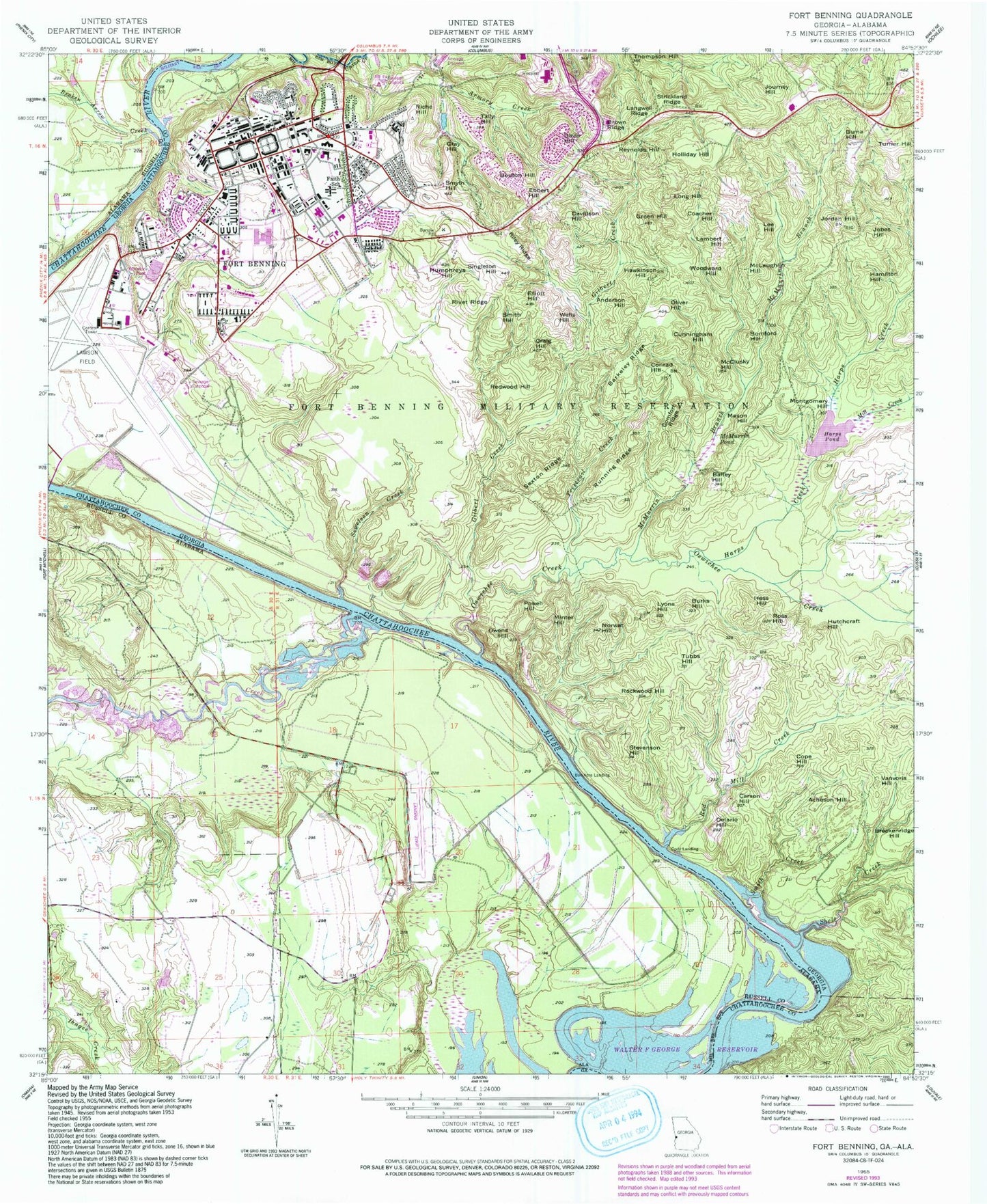
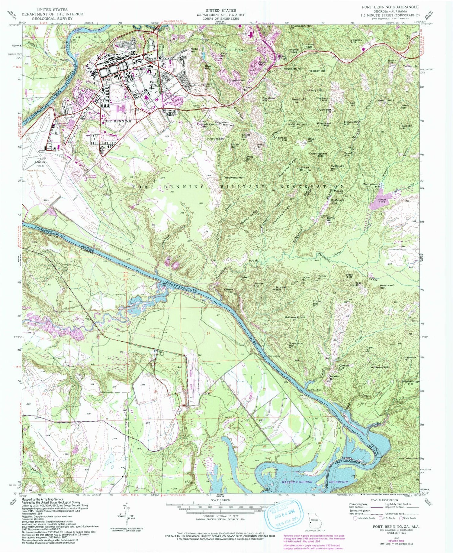
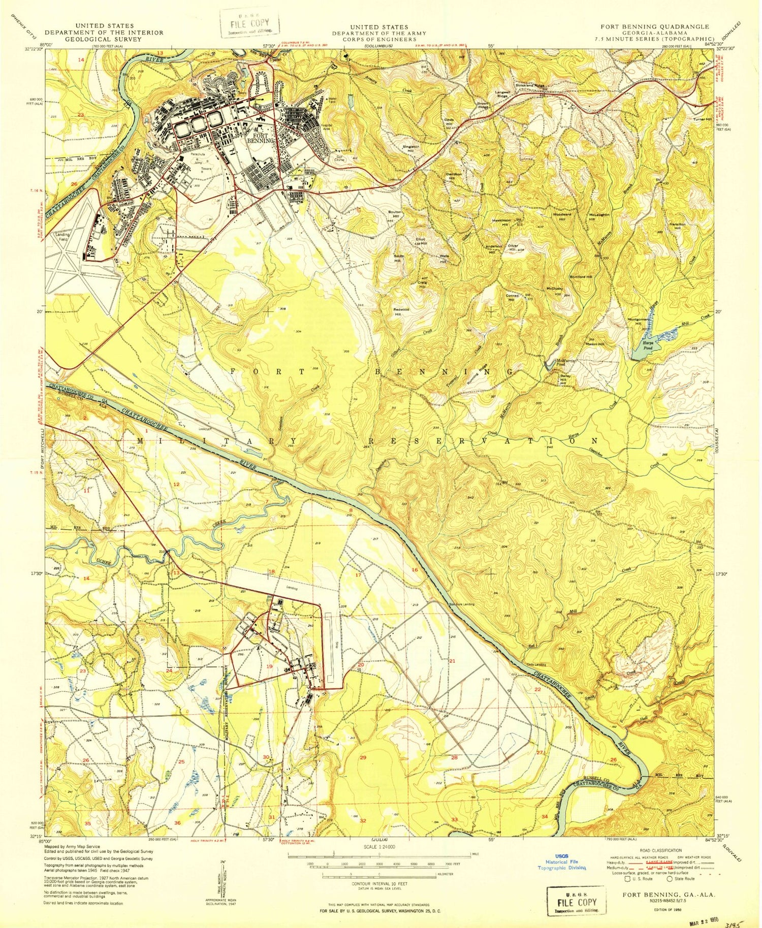
Historical USGS topographic quad map of Fort Benning in the states of Georgia, Alabama. Typical map scale is 1:24,000, but may vary for certain years, if available. Print size: 24" x 27"
This quadrangle is in the following counties: Chattahoochee, Muscogee, Russell.
The map contains contour lines, roads, rivers, towns, and lakes. Printed on high-quality waterproof paper with UV fade-resistant inks, and shipped rolled.
Contains the following named places: Bailey Hill, Barkeley Ridge, Brown Ridge, Burks Hill, Carson Hill, Comfort Ridge, Cope Hill, Craig Hill, Delario Hill, Elliott Hill, Gilbert Creek, Green Hill, Harps Creek, Harps Pond, Humphreys Hill, Jordan Hill, Langwell Ridge, McClusky Hill, McMurrin Branch, McMurrin Pond, Mill Creek, Montgomery Hill, Norwat Hill, Oliver Hill, Oswichee Creek, Owens Hill, Red Mill Creek, Riley Ridge, Rockwood Hill, Ross Hill, Running Ridge, Sewelson Creek, Sexton Ridge, Shell Creek, Singleton Hill, Smith Creek, Smyth Hill, Stevenson Hill, Strickland Ridge, Thompson Hill, Trestrail Creek, Tubbs Hill, Acheson Hill, Anderson Hill, Bomford Hill, Bouton Hill, Breckenridge Hill, Buma Hill, Coacher Hill, Cody Landing, Conrad Hill, Cunningham Hill, Davidson Hill, Davis Hill, Ebbert Hill, Gray Hill, Hamilton Hill, Hawkinson Hill, Hess Hill, Holliday Hill, Hutchcraft Hill, Jobes Hill, Journey Hill, Lambert Hill, Lee Hill, Long Hill, Lyons Hill, Mason Hill, McLaughlin Hill, Minter Hill, Powell Hill, Redwood Hill, Reynolds Hill, Riche Hill, Rivet Hill, Smith Hill, Tally Hill, Turner Hill, Vanvoris Hill, Wells Hill, Woodward Hill, Hards Pond Dam, Bradley Landing, Chambers Landing, Cottage Mills (historical), Edward White School, Fort Benning Mall Shopping Center, Fort Benning Post Office, Good Hope Church (historical), Herbert J Dexter School, Kasihta (historical), McDaniel Manor, Patch Kindergarten, Richard G Wilson School, Russ Pond, Shack (historical), Woolfolk (historical), Bon Acre Landing, Faith School, Fort Benning, Fort Benning South Census Designated Place (historical), Lawson Army Airfield (Fort Benning), Fort Benning Military Police Department, Yuchi (historical), Kawita Talahassi (historical), Broken Arrow Creek, Uchee Creek, Apalatchukla (historical), Chiaha (historical), Uchi (historical), Bon Acre Landing, Osotchi (historical), Yuchi Town Site