MyTopo
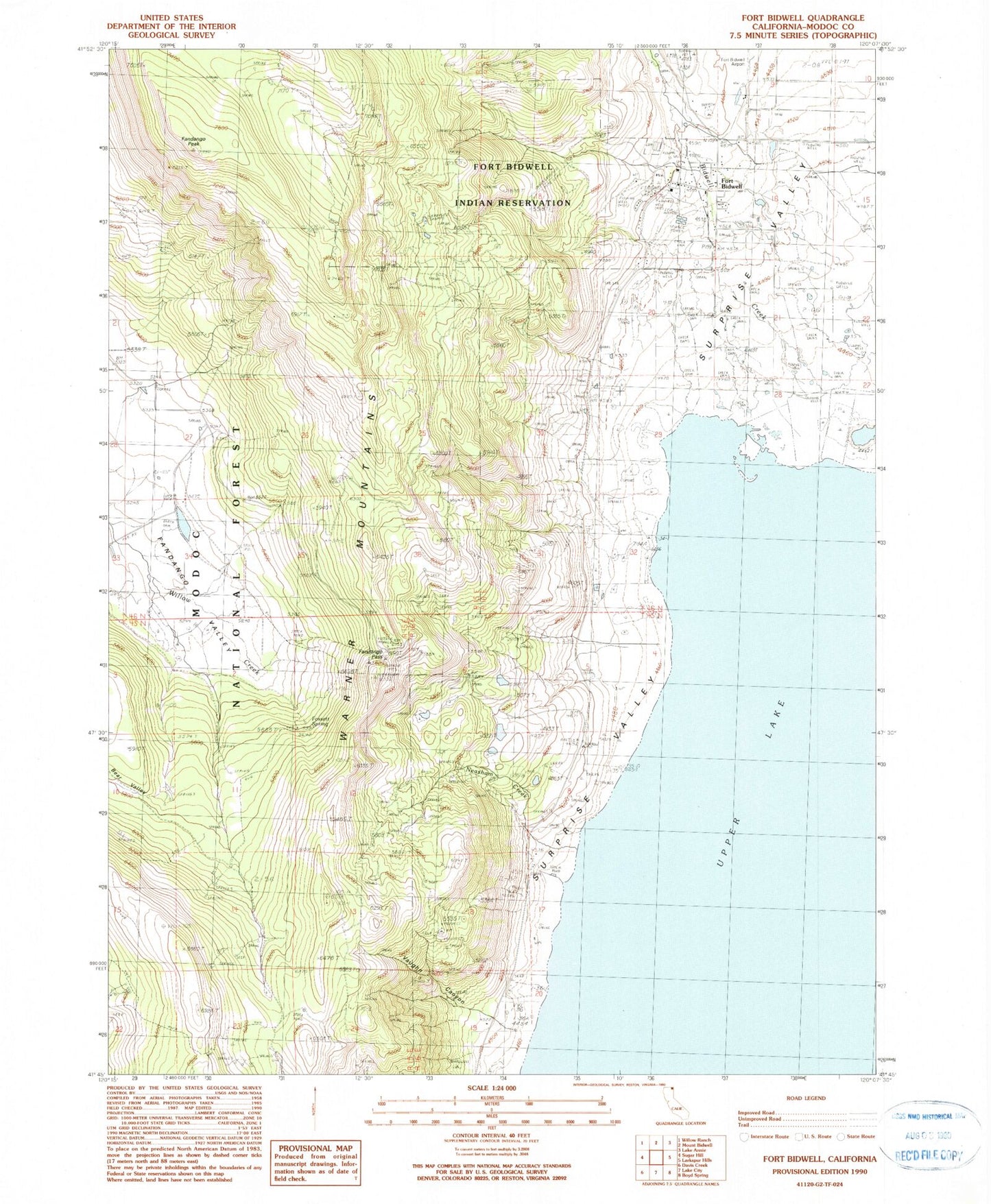
Classic USGS Fort Bidwell California 7.5'x7.5' Topo Map
Couldn't load pickup availability
Historical USGS topographic quad map of Fort Bidwell in the state of California. Map scale may vary for some years, but is generally around 1:24,000. Print size is approximately 24" x 27"
This quadrangle is in the following counties: Modoc.
The map contains contour lines, roads, rivers, towns, and lakes. Printed on high-quality waterproof paper with UV fade-resistant inks, and shipped rolled.
Contains the following named places: Bear Valley, Bidwell Creek, Fandango Pass, Fandango Peak, Fort Bidwell, Fort Bidwell Cemetery, Fort Bidwell Census Designated Place, Fort Bidwell Fire Department, Fort Bidwell Post Office, Fort Bidwell Reservation, Fossett Spring, Hot Spring, Mount Bidwell School, Neasham Creek, Soldier Creek, Upper Lake, Vaughn Canyon, Venning Creek