MyTopo
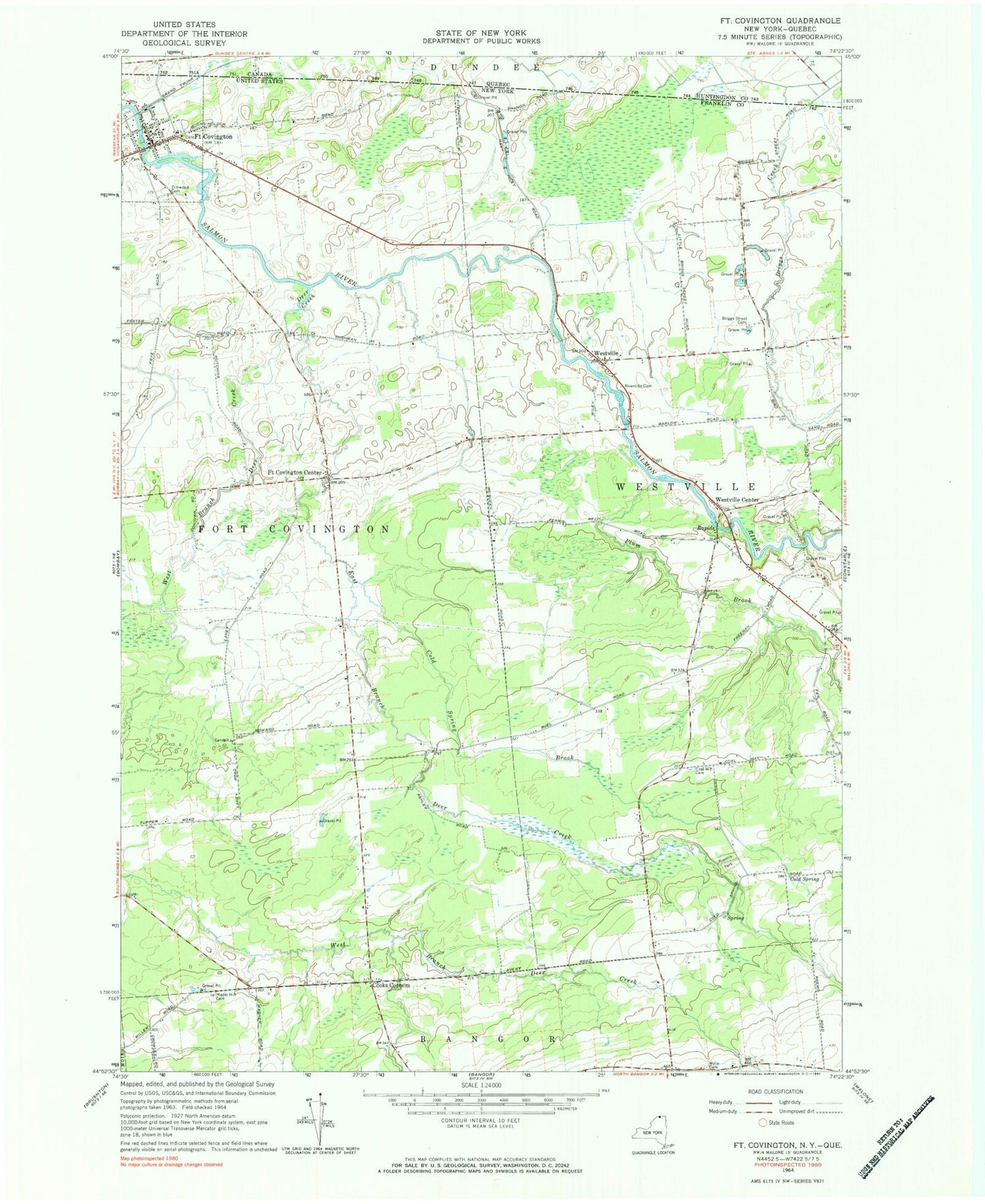
Classic USGS Fort Covington New York 7.5'x7.5' Topo Map
Couldn't load pickup availability
Historical USGS topographic quad map of Fort Covington in the state of New York. Map scale may vary for some years, but is generally around 1:24,000. Print size is approximately 24" x 27"
This quadrangle is in the following counties: Franklin.
The map contains contour lines, roads, rivers, towns, and lakes. Printed on high-quality waterproof paper with UV fade-resistant inks, and shipped rolled.
Contains the following named places: Briggs Street Cemetery, Coal Hill Cemetery, Cold Spring, Cold Spring Brook, Cooks Corners, Cooks Corners Wesleyan Church, Deer Creek, East Branch Deer Creek, Elmwood Cemetery, Fort Covington, Fort Covington Center, Fort Covington Fire and Rescue Department, Kiwanis Park, Maple Hill Cemetery, Pine Ridge Park Campsite, Plum Brook, Riverside Cemetery, School Number 11, School Number 2, School Number 4, School Number 5, School Number 8, School Number 9, Town of Fort Covington, Town of Westville, West Branch Deer Creek, Westville, Westville Center, Westville Volunteer Fire Department, Wylie Cemetery, ZIP Code: 12937