
MyTopo
Classic USGS Fort Deposit Alabama 7.5'x7.5' Topo Map
Couldn't load pickup availability
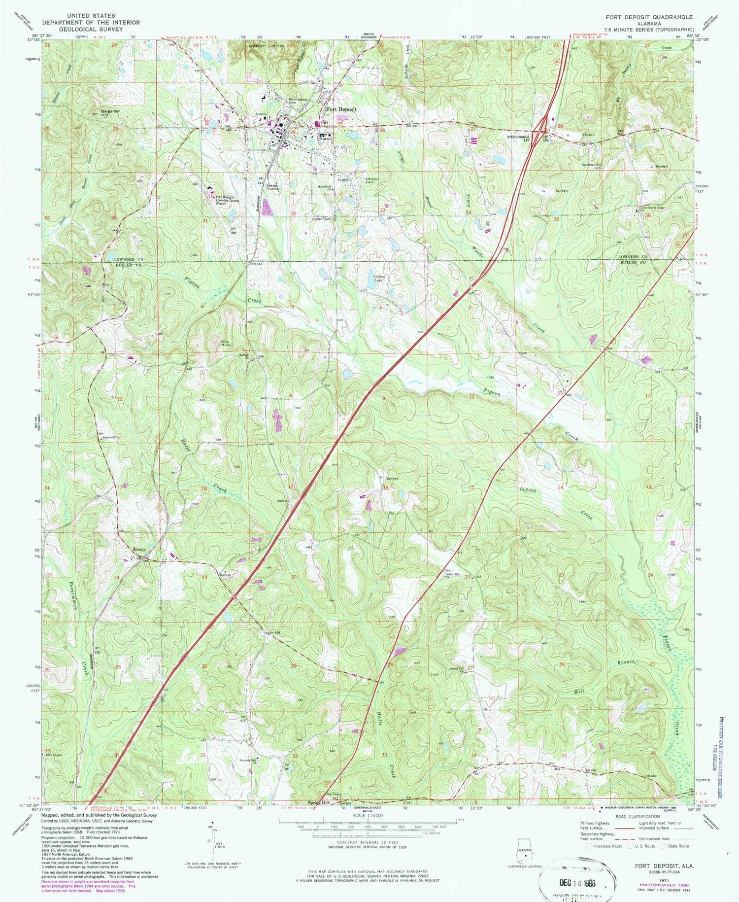
Historical USGS topographic quad map of Fort Deposit in the state of Alabama. Map scale may vary for some years, but is generally around 1:24,000. Print size is approximately 24" x 27"
This quadrangle is in the following counties: Butler, Lowndes.
The map contains contour lines, roads, rivers, towns, and lakes. Printed on high-quality waterproof paper with UV fade-resistant inks, and shipped rolled.
Contains the following named places: Allen Chapel, Antioch East Cemetery, Antioch East Church, Avinger Branch, Barganier, Barganier Hill, Bethel Baptist Church, Bethlehem Christian Church, Fort Deposit, Fort Deposit Academy, Fort Deposit Elementary School, Fort Deposit Methodist Church, Fort Deposit Police Department, Fort Deposit Post Office, Fort Deposit Primitive Baptist Church, Fort Deposit Town Hall, Fort Deposit Volunteer Fire Department, Fort Deposit-Lowndes County Airport, Golson Lake, Golson Pond Dam, Honeycutt Institute, Hopewell Church, Indian Creek, Indian Hill Church, Jordan Cemetery, Little Sandy Ridge Presbyterian Church, Lowndes County High School, Macedonia Baptist Church, Mill Branch, Moriah Cemetery, Moriah Primitive Baptist Church, Myrtlewood Cemetery, New Hope Church, Piney Woods Creek, Searcy, Searcy Volunteer Fire Department, Spring Hill Methodist Church, Springhill Cemetery, Summer Hill Cemetery, Town of Fort Deposit, ZIP Code: 36032


