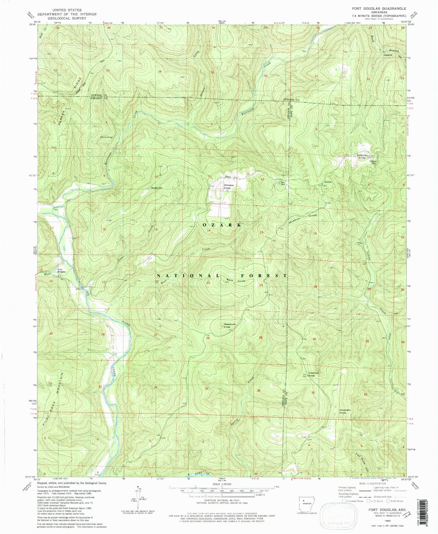
MyTopo
Classic USGS Fort Douglas Arkansas 7.5'x7.5' Topo Map
Couldn't load pickup availability
Historical USGS topographic quad map of Fort Douglas in the state of Arkansas. Typical map scale is 1:24,000, but may vary for certain years, if available. Print size: 24" x 27"
This quadrangle is in the following counties: Johnson, Newton, Pope.
The map contains contour lines, roads, rivers, towns, and lakes. Printed on high-quality waterproof paper with UV fade-resistant inks, and shipped rolled.
Contains the following named places: Hurricane Creek Natural Bridge, Self Cemetery, Wheeler Cemetery, Coleman Cemetery, Bertha, Lick Creek, Township of Pilot Rock (historical), Bald Knob, Bear Creek, Beech Grove School, Big Lick School, Coleman Knob, Dillen, Fort Douglas, Freeman Knob, Greasy Creek, Haw Creek, Hurricane Creek, McMinn Knob, Meadows Knob, Sugar Creek, Umphers Knob, Wheeler Knob, Hurricane Creek Wilderness, Bertha, Buzzard Roost Rocks Natural Arch, Big Piney Creek Wild and Scenic River, Hurricane Creek Wild and Scenic River