MyTopo
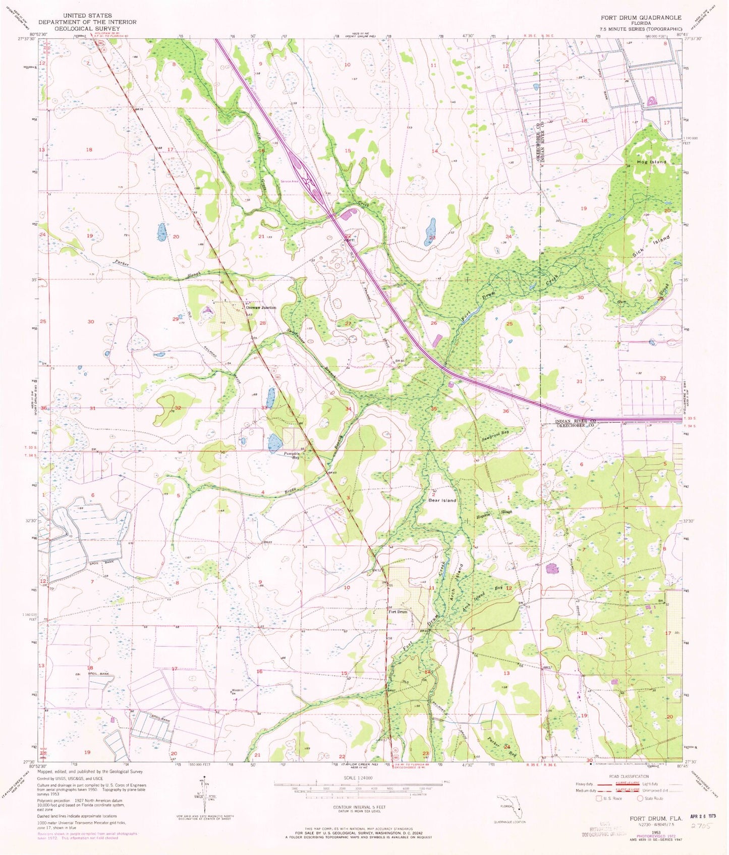
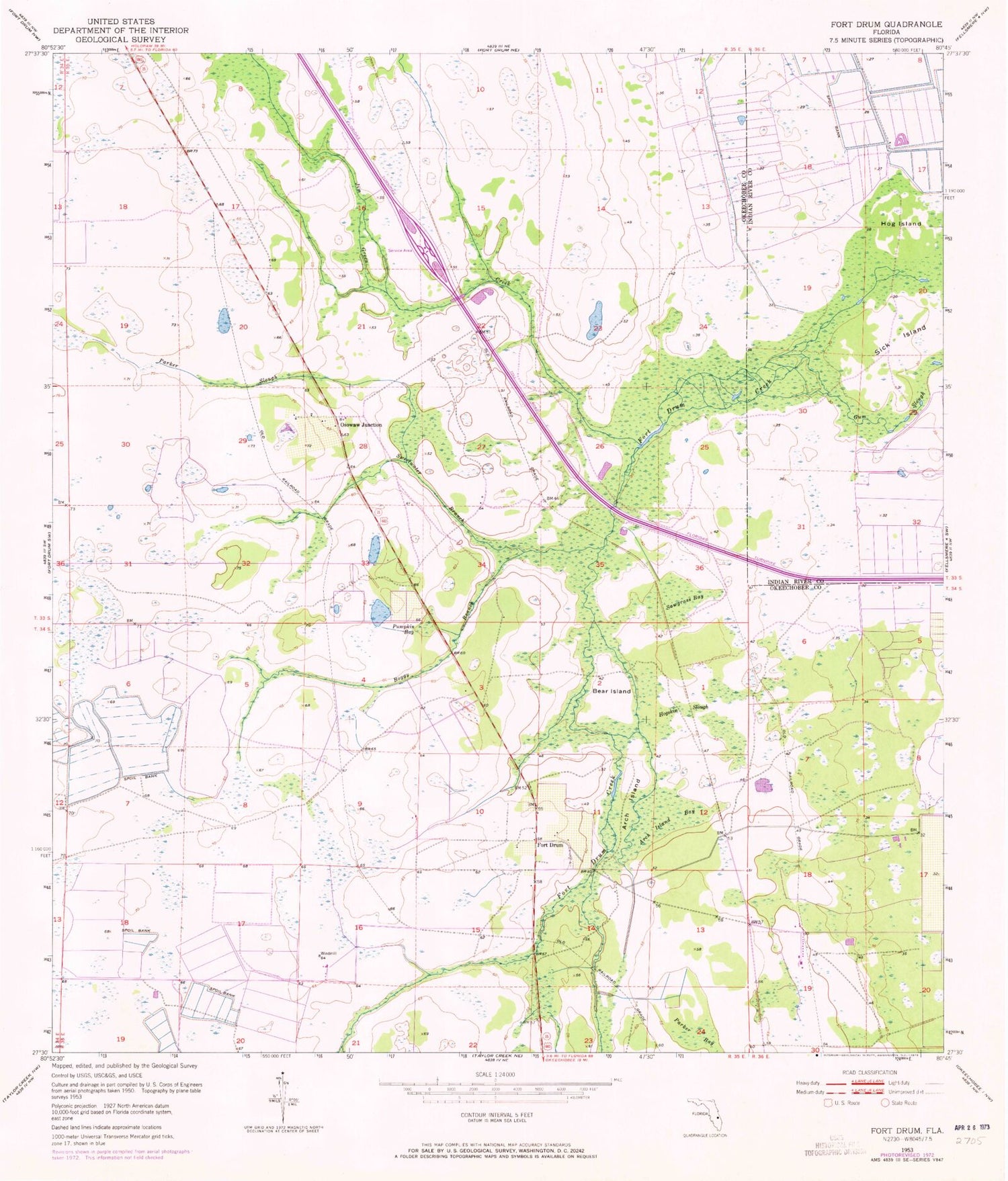
Classic USGS Fort Drum Florida 7.5'x7.5' Topo Map
Couldn't load pickup availability
Historical USGS topographic quad map of Fort Drum in the state of Florida. Map scale may vary for some years, but is generally around 1:24,000. Print size is approximately 24" x 27"
This quadrangle is in the following counties: Indian River, Okeechobee.
The map contains contour lines, roads, rivers, towns, and lakes. Printed on high-quality waterproof paper with UV fade-resistant inks, and shipped rolled.
Contains the following named places: Arch Island, Arch Island Bay, Bear Island, Boggy Branch, Fort Drum, Fort Drum Creek, Gum Slough, Hog Island, Hogskin Slough, Indian Hammock Airport, Jim Green Creek, Lake Montaza Airport, Okeechobee County Fire Rescue Station 3 Fort Drum, Osowaw Junction, Parker Bay, Parker Slough, Pumpkin Bay, Recreation Corporation Airport, Sawgrass Bay, Sick Island, Sweetwater Branch