
MyTopo
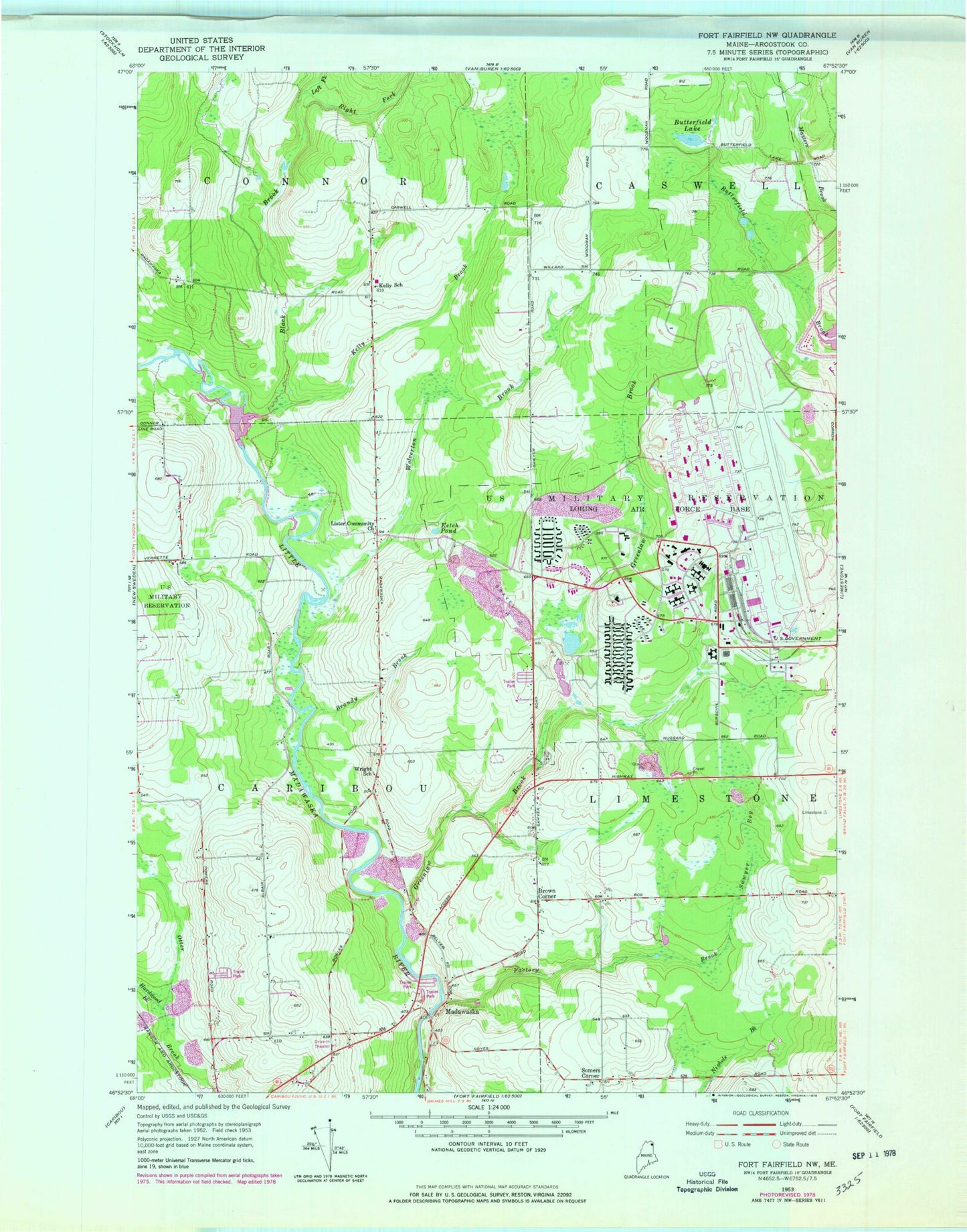
Classic USGS Fort Fairfield NW Maine 7.5'x7.5' Topo Map
Couldn't load pickup availability
Historical USGS topographic quad map of Fort Fairfield NW in the state of Maine. Map scale may vary for some years, but is generally around 1:24,000. Print size is approximately 24" x 27"
This quadrangle is in the following counties: Aroostook.
The map contains contour lines, roads, rivers, towns, and lakes. Printed on high-quality waterproof paper with UV fade-resistant inks, and shipped rolled.
Contains the following named places: Aroostook Band of Micmac Trust Land, Black Brook, Brandy Brook, Brown Corner, Butterfield Lake, Factory Brook, Greenlaw Brook, Hardwood Brook, Kelly Brook, Kelly School, Ketch Pond, Left Fork Black Brook, Lister Community Church, Little Madawaska Dam, Little Madawaska Reservoir, Loring AFB Census Designated Place, Loring Air Force Base, Loring International Airport, Loring Job Corps Center School, Madawaska, Malabeam Lake, Malabeam Lake Dam, Masters Brook, Right Fork Black Brook, Somers Corner, Wolverton Brook, Wright School