
MyTopo
Classic USGS Fort Fairfield Maine 7.5'x7.5' Topo Map
Couldn't load pickup availability
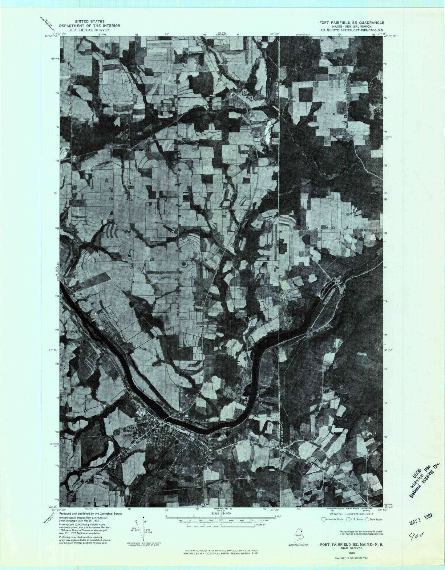
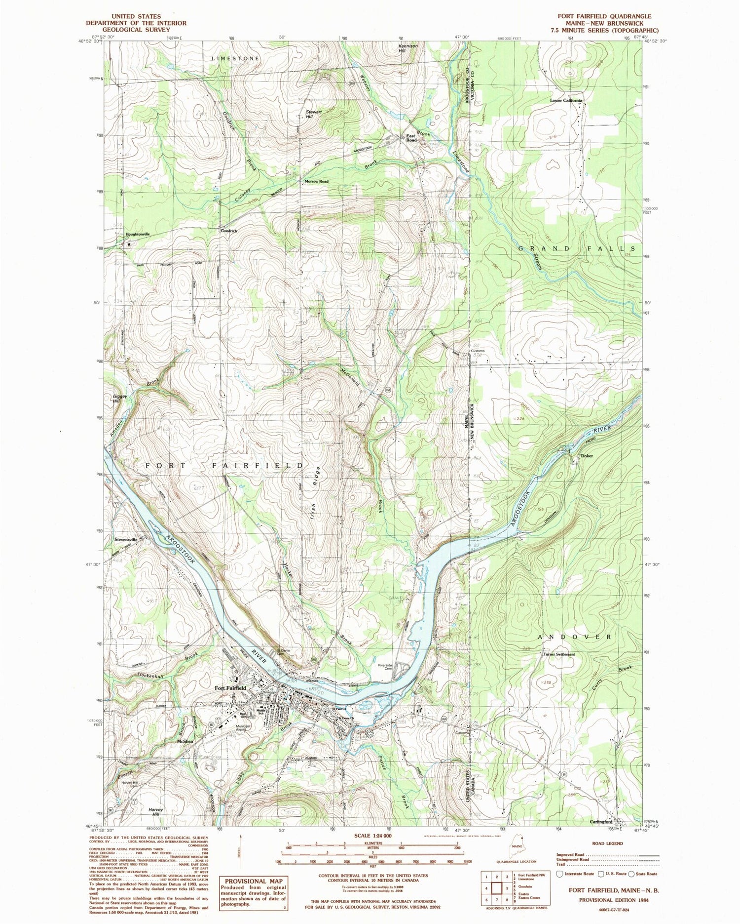
Historical USGS topographic quad map of Fort Fairfield in the state of Maine. Map scale may vary for some years, but is generally around 1:24,000. Print size is approximately 24" x 27"
This quadrangle is in the following counties: Aroostook.
The map contains contour lines, roads, rivers, towns, and lakes. Printed on high-quality waterproof paper with UV fade-resistant inks, and shipped rolled.
Contains the following named places: Amsden Brook, Bethel Baptist Church, Coloney Brook, Dirigere Christian Academy Fort Fairfield, East Road, Everett Brook, Fort Fairfield, Fort Fairfield Airport, Fort Fairfield Census Designated Place, Fort Fairfield Elementary School, Fort Fairfield Fire Department, Fort Fairfield High School, Fort Fairfield Middle / High School, Fort Fairfield Municipal Building, Fort Fairfield Police Department, Fort Fairfield Post Office, Fort Fairfield Public Library, Frontier Heritage History Museum, Giggey Hill, Goodrich, Goodrich Brook, Hacker Brook, Harvey Hill, Harvey Hill Cemetery, Hockenhull Brook, Houghton Burial Ground, Houghtonville, Irish Ridge, Libby Brook, Libby Brook Dam, Libby Brook Pond, McDonald Brook, McShea, Morrow Road, Nadeau Pond, Pattee Brook, Proposed New Mill Dam, Riverside Cemetery, Saint Denis Catholic Cemetery, Saint Denis Church, Saint Paul Church, Stevensville, Stewart Hill, The Aroostook Medical Center Fort Fairfield Health Center, Town of Fort Fairfield, United Parish Church, United Pentecostal Church, Village Square Shopping Center, Webster Brook, Wesleyan Church, ZIP Code: 04742