MyTopo
Classic USGS Fort Gaines NE Georgia 7.5'x7.5' Topo Map
Couldn't load pickup availability
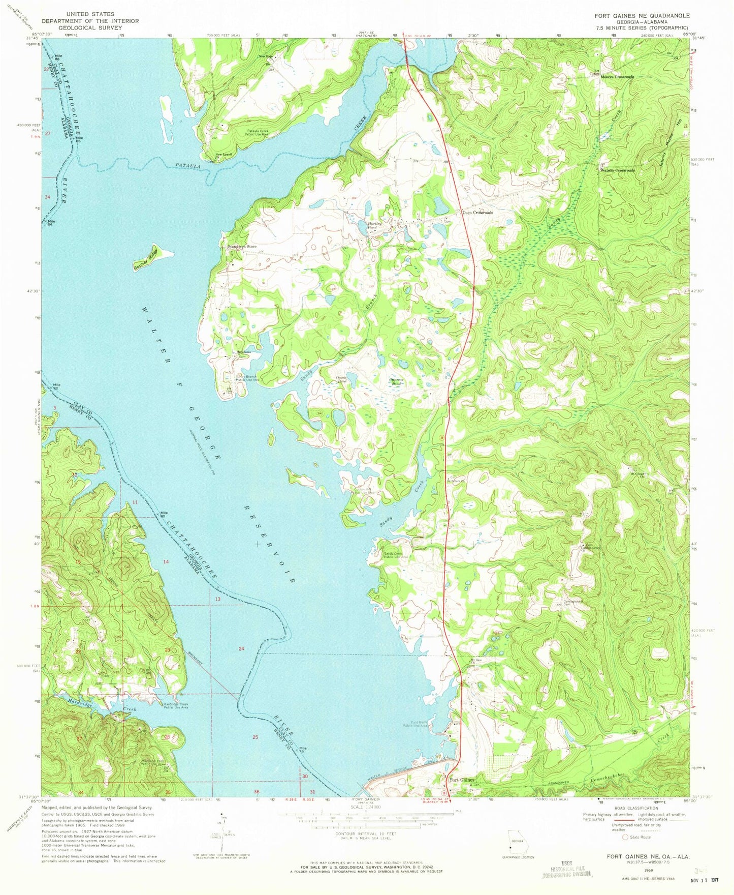
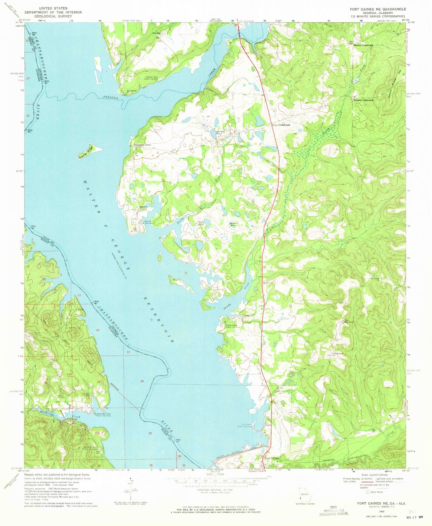
Historical USGS topographic quad map of Fort Gaines NE in the states of Georgia, Alabama. Map scale may vary for some years, but is generally around 1:24,000. Print size is approximately 24" x 27"
This quadrangle is in the following counties: Clay, Henry.
The map contains contour lines, roads, rivers, towns, and lakes. Printed on high-quality waterproof paper with UV fade-resistant inks, and shipped rolled.
Contains the following named places: Campground Cemetery, Cannon Grove Church, Clay County Volunteer Fire Department Station 2, Cotton Hill Public Use Area, Credille Mill, Cypress Pond, Days Crossroads, East Bank Public Use Area, Emanuel Church, Fairview School, Fort Gaines Division, George T Bagby State Park, Hardridge Creek, Hardridge Creek Public Use Area, Hartley Pond, Highland Park Public Use Area, Johnny Moore Hill, Macedonia Church, Moores Crossroads, Mount Gilead Church, Mount Gilead Church Cemetery, Mount Zion Church, New Hope Church, New Lowell Cemetery, New Lowell Church, Ocean Pond, Oketeyeconne, Old Camp Ground Church, Otho Branch, Pataula Creek, Pataula Creek Public Use Area, Saint Peters Church, Sandy Branch, Sandy Branch Public Use Area, Sandy Creek, Sandy Creek Public Use Area, Screamer Volunteer Fire Department Station 2, Standleys Store, Walter F George Reservoir, Watson Crossroads