MyTopo
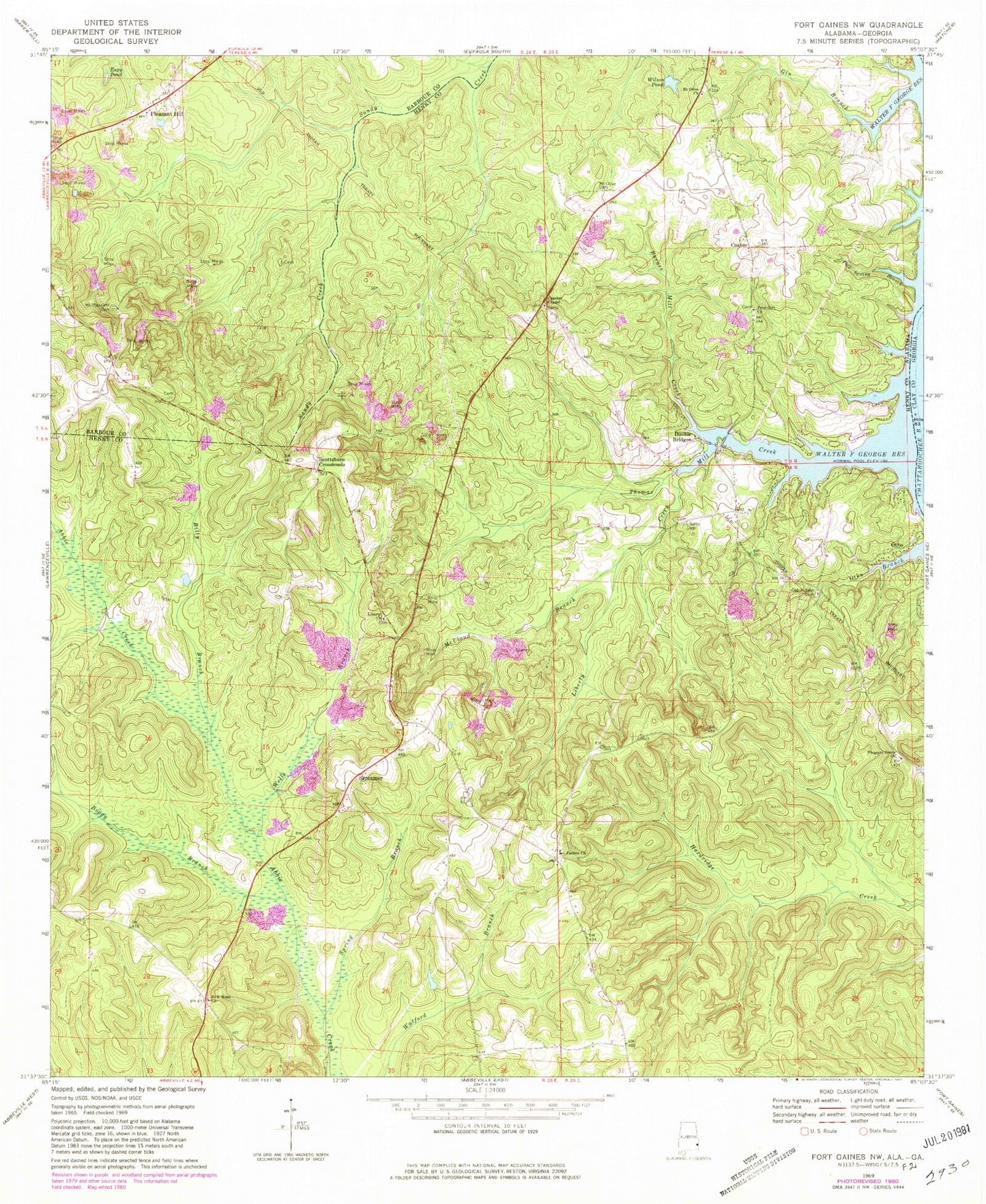
Classic USGS Fort Gaines NW Alabama 7.5'x7.5' Topo Map
Couldn't load pickup availability
Historical USGS topographic quad map of Fort Gaines NW in the state of Alabama. Map scale may vary for some years, but is generally around 1:24,000. Print size is approximately 24" x 27"
This quadrangle is in the following counties: Barbour, Clay, Henry.
The map contains contour lines, roads, rivers, towns, and lakes. Printed on high-quality waterproof paper with UV fade-resistant inks, and shipped rolled.
Contains the following named places: Barnes Mill Creek, Billy Branch, Boggy Branch, Chester Chapel Cemetery, Chester Chapel Freewill Baptist Church, Coates, Double Bridges, Espy Number 51 Mine, Espy Pond, Free Gift Church, Gin Branch, Griffin Mine, Hillardsville, Judson Cemetery, Judson Missionary Baptist Church, Liberty Cemetery, Liberty Creek, Liberty Methodist Church, Lucas Number 1 Mine, Lucas Number 2 Mine, Mathison Mine, McCloud Branch, Mount Olive Cemetery, Mount Olive Church, Mount Pleasant Cemetery, Mount Pleasant Church, New Hope Missionary Baptist Church, Old Judson Cemetery, Otho, Pleasant Grove Church, Pleasant Hill, Pleasant Hill Baptist Church, Pleasant Hill Cemetery, Polk Spring Branch, Scottsboro Crossroads, Scottsboro School, Screamer, Screamer Volunteer Fire Department Station 1, Spring Branch, Thomas Mill Creek, Thomas Mill Creek Park, Wells Branch, Wilson Pond, Woods Mill