MyTopo
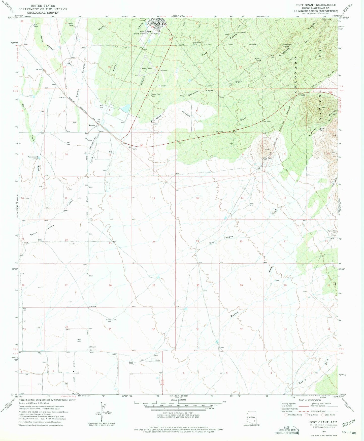
Classic USGS Fort Grant Arizona 7.5'x7.5' Topo Map
Couldn't load pickup availability
Historical USGS topographic quad map of Fort Grant in the state of Arizona. Map scale may vary for some years, but is generally around 1:24,000. Print size is approximately 24" x 27"
This quadrangle is in the following counties: Graham.
The map contains contour lines, roads, rivers, towns, and lakes. Printed on high-quality waterproof paper with UV fade-resistant inks, and shipped rolled.
Contains the following named places: Angel Field, Arizona Department of Corrections - Fort Grant Unit, Big Creek, Bonita, Bonita Elementary School, Boone Well, Estes Ranch, Fort Grant, Fort Grant State Industrial School, Gold Gulch, Gold Gulch Corral, Goudy Canyon Wash, Grant Creek, Grapevine Canyon, Grapevine Canyon Wash, Grapevine Spring, Hog Canyon, Hog Canyon Wash, Jesus Canyon Wash, Martin Wash, Martin Well, Mills Ranch, Mothers Canyon, Pitchfork Canyon, Pitchfork Canyon Wash, South Taylor Wash, Tumbleweed Tank