
MyTopo
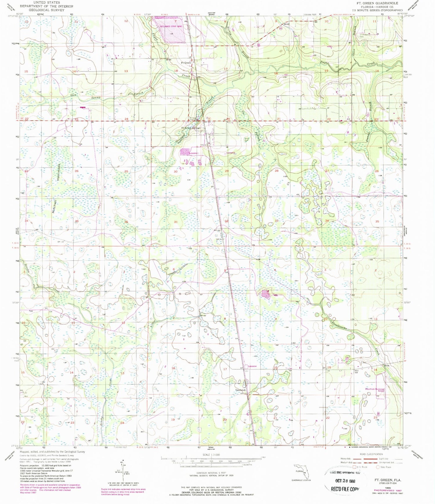
Classic USGS Fort Green Florida 7.5'x7.5' Topo Map
Couldn't load pickup availability
Historical USGS topographic quad map of Fort Green in the state of Florida. Map scale may vary for some years, but is generally around 1:24,000. Print size is approximately 24" x 27"
This quadrangle is in the following counties: Hardee.
The map contains contour lines, roads, rivers, towns, and lakes. Printed on high-quality waterproof paper with UV fade-resistant inks, and shipped rolled.
Contains the following named places: Bowling Green Division, Doe Branch, Fort Green, Fort Green Post Office, Fort Green Springs, Fort Green Springs Census Designated Place, Gum Swamp Branch, Hickey Branch, Lettis Creek, Mitchell Hammock, Olive Branch, Olive Branch Cemetery, Plunder Branch, Shirttail Branch, Vandolah, Wauchula Municipal Airport


