MyTopo
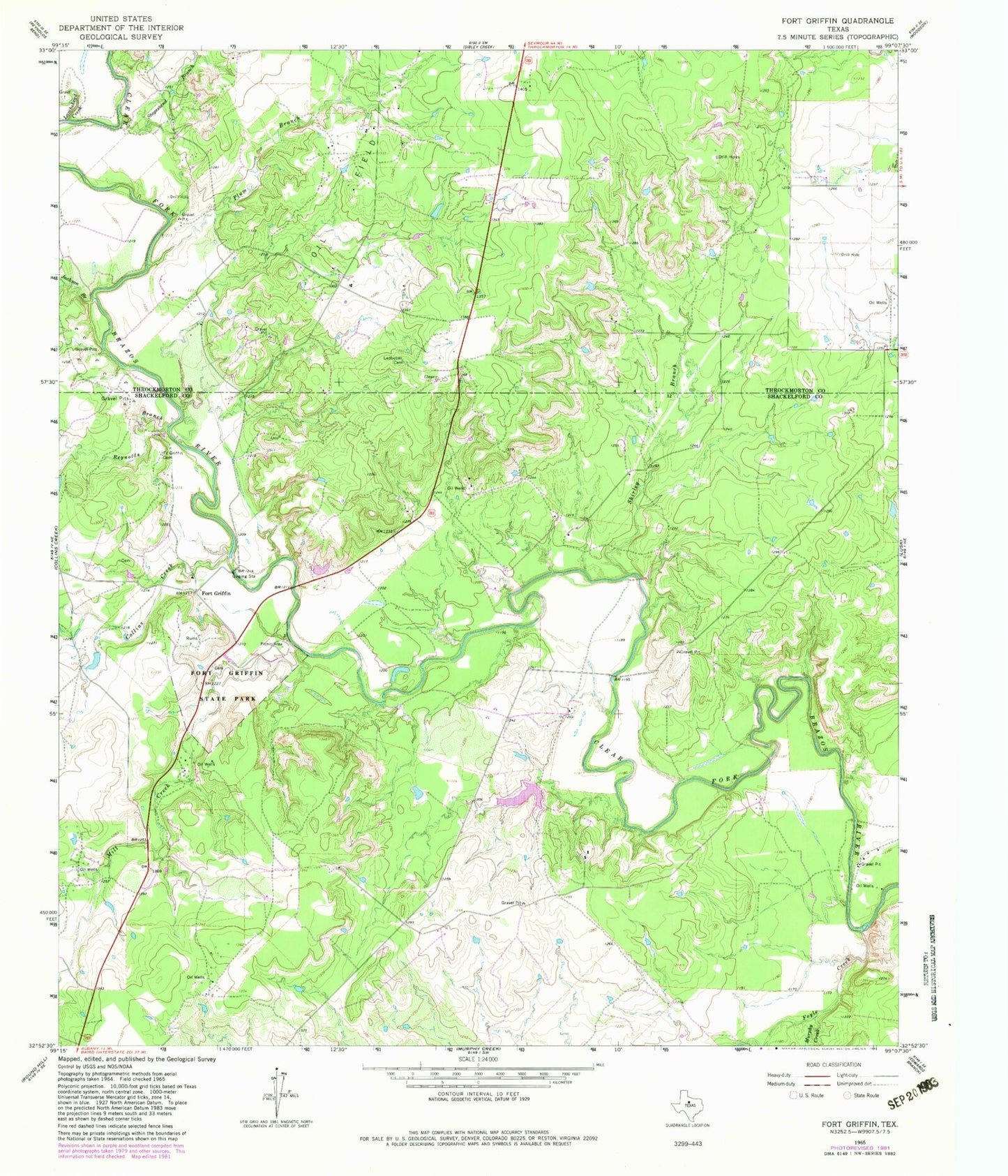
Classic USGS Fort Griffin Texas 7.5'x7.5' Topo Map
Couldn't load pickup availability
Historical USGS topographic quad map of Fort Griffin in the state of Texas. Map scale may vary for some years, but is generally around 1:24,000. Print size is approximately 24" x 27"
This quadrangle is in the following counties: Shackelford, Throckmorton.
The map contains contour lines, roads, rivers, towns, and lakes. Printed on high-quality waterproof paper with UV fade-resistant inks, and shipped rolled.
Contains the following named places: Collins Creek, Fort Griffin, Fort Griffin Brazos River Bridge, Fort Griffin Cemetery, Fort Griffin State Historical Park, Fort Griffin State Historical Park Trail, Fort Griffin State Park, Foyle Creek, Jackson Branch, Lambshead Creek, Ledbetter Cemetery, McCowan Lake, McCowan Lake Dam, Mill Creek, Murphy Creek, Plum Branch, Reynolds Branch, Shirley Branch, Stagestand Branch, State Highway 23 Bridge, Taylor Lake, Taylor Lake Dam